Lake Missoula was a prehistoric proglacial lake in western Montana that existed periodically at the end of the last ice age between 15,000 and 13,000 years ago. The lake measured about 7,770 square kilometres (3,000 sq mi) and contained about 2,100 cubic kilometres (500 cu mi) of water, half the volume of Lake Michigan.
Wave-cut strandlines cut into the slope at left in photo. These cuts record former high-water lines, or shorelines. Gullies above the highway are the result of modern-day erosion. (NPS Photo)
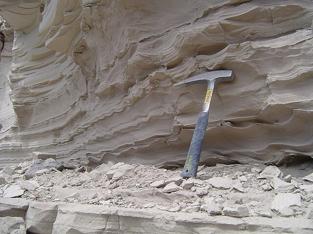
Sediment deposited by the lake with a hammer for scale.
In geology, a proglacial lake is a lake formed either by the damming action of a moraine during the retreat of a melting glacier, a glacial ice dam, or by meltwater trapped against an ice sheet due to isostatic depression of the crust around the ice. At the end of the last ice age about 10,000 years ago, large proglacial lakes were a widespread feature in the northern hemisphere.
Argentinian proglacial lakes: Lago Viedma (middle), Lago Argentino (left) and Lago San Martin (right). Retreating glaciers are visible at the top.
Tarn—a proglacial lake impounded by the terminal moraine of the retreating Schoolroom Glacier in Grand Teton National Park, Wyoming
Lake Blåvatnet in Lyngen Alps, Norway located below Lenangsbreene glaciers and surrounded by several moraines formed during Younger Dryas and early Holocene
The Hubbard Glacier closed off the Russell Fjord from Disenchantment Bay in 2002 to cause the waters behind the glacier to rise 61 feet (19 m) over 10 weeks in a proglacial lake until they broke through.