The Gorizia Hills is a hilly microregion in western Slovenia and northeastern Italy. It lies on the right bank of the Soča (Isonzo) River, north of the Italian town of Gorizia, after which it is named. The region covers around 120 km2 (46 sq mi) and has about 7,000 inhabitants, mostly ethnic Slovenes, with a small number of Friulian speakers in its westernmost part.
The village of Hum in the Municipality of Brda, in the Slovene part of the Gorizia Hills
Gorizia, colloquially stara Gorica 'old Gorizia' to distinguish it from Nova Gorica, is a town and comune (municipality) in northeastern Italy, in the autonomous region of Friuli-Venezia Giulia. It is located at the foot of the Julian Alps, bordering Slovenia. It is the capital of the Regional decentralization entity of Gorizia and is a local center of tourism, industry, and commerce. Since 1947, a twin town of Nova Gorica has developed on the other side of the modern-day Italy–Slovenia border. The region was subject to territorial dispute between Italy and Yugoslavia after World War II: after the new boundaries were established in 1947 and the old town was left to Italy, Nova Gorica was built on the Yugoslav side. The two towns constitute a conurbation, which also includes the Slovenian municipality of Šempeter-Vrtojba. Since May 2011, these three towns have been joined in a common trans-border metropolitan zone, administered by a joint administration board.

The old part of Gorizia seen from the castle in August 2008
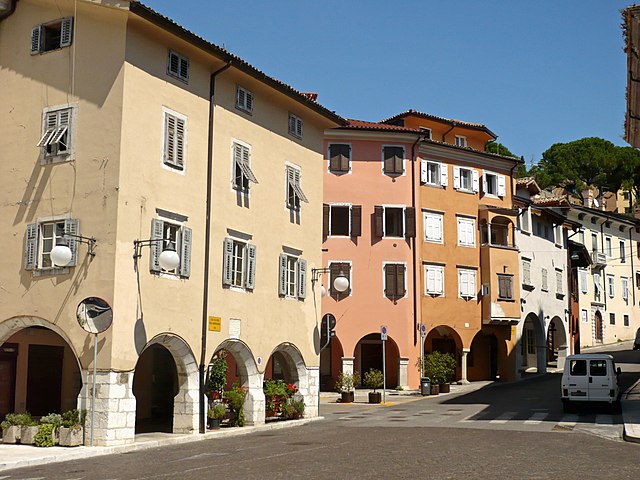
The medieval center of Gorizia
The Leopold Gate, built in the late 17th century in honor of Leopold I, Holy Roman Emperor
The Strassoldo Palace, residence of the Bourbon family in exile


