Guanahaní was the Taíno name of an island in the Bahamas that was the first land in the New World sighted and visited by Christopher Columbus' first voyage, on 12 October 1492. It is a bean-shaped island that Columbus called San Salvador. Guanahaní has traditionally been identified with Watlings Island, which was officially renamed San Salvador Island in 1925 as a result, but modern scholars are divided on the accuracy of this identification and several alternative candidates in and around the southern Bahamas have been proposed as well.
This page from Alain Manesson Mallet's five-volume world atlas shows the islet of Guanahani, the site of Columbus' first landing in 1492
The Bahamas, officially the Commonwealth of The Bahamas, is a country in North America. It is an island country within the Lucayan Archipelago of the West Indies in the Atlantic Ocean. It contains 97% of the Lucayan Archipelago's land area and 88% of its population. The archipelagic state consists of more than 3,000 islands, cays, and islets in the Atlantic Ocean, and is located north of Cuba and northwest of the island of Hispaniola and the Turks and Caicos Islands, southeast of the U.S. state of Florida, and east of the Florida Keys. The capital is Nassau on the island of New Providence. The Royal Bahamas Defence Force describes The Bahamas' territory as encompassing 470,000 km2 (180,000 sq mi) of ocean space.
A depiction of Columbus' first landing, claiming possession of the New World for the Crown of Castile in caravels; the Niña and the Pinta, on Watling Island, an island of the Bahamas that the natives called Guanahani and that he named San Salvador, on 12 October 1492.
Continental Marines land at New Providence during the Battle of Nassau in 1776
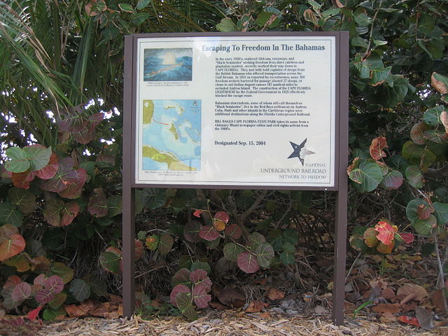
Sign at Bill Baggs Cape Florida State Park commemorating hundreds of African-American slaves who escaped to freedom in the early 1820s in The Bahamas
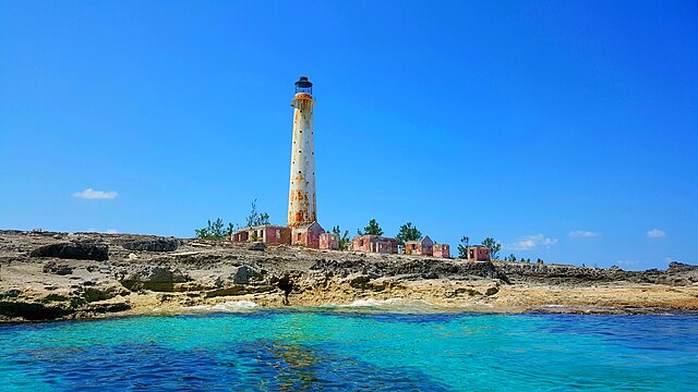
The lighthouse in Great Isaac Cay.