Gudbrandsdalen
Videos
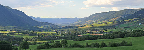
Gudbrandsdalen is a valley and traditional district in the Norwegian county of Innlandet. The valley is oriented in a north-westerly direction from Lillehammer and the lake of Mjøsa, extending 230 kilometers (140 mi) toward the Romsdalen valley. The river Gudbrandsdalslågen (Lågen) flows through the valley, starting from the lake Lesjaskogsvatnet and ending at the lake Mjøsa. The Otta river which flows through Otta valley is a major tributary to the main river Lågen. The valleys of the tributary rivers such as Otta and Gausa (Gausdal) are usually regarded as part of Gudbrandsdalen. The total area of the valley is calculated from the areas of the related municipalities. Gudbrandsdalen is the main valley in a web of smaller valleys. On the western side there are long adjacent valleys: Ottadalen stretches 100 kilometers (62 mi) from Otta village, Gausdal some 50 kilometers (31 mi) from Lillehammer and Heidal some 40 kilometers (25 mi) from Sjoa. Gudbrandsdalen runs between the major mountain ranges of Norway including Jotunheimen and Dovrefjell–Rondane.
Dovre, in the northern part of the valley

Depiction of King Olaf II speaking to peasants at the thing, Hundorp. Halfdan Egedius, 1899.

Otta town at the confluence of Otta and Lågen rivers, Rondane summits above.

Patchwork farmland created by draining the shallow lake at Lesja east of the church.
Glomma
Videos
The Glomma, or Glåma, is Norway's longest and most voluminous river. With a total length of 621 kilometres, it has a drainage basin that covers fully 13% of Norway's surface area, all in the southern part of the country.

The Glomma at the Solbergfoss Hydroelectric Power Station

The Glomma at Elverum, during winter

The Vorma, a major tributary, flows into the Glomma just north of Årnes