Hamina is a town and a municipality of Finland. It is located approximately 145 km (90 mi) east of the country's capital Helsinki, in the Kymenlaakso region, and formerly the province of Southern Finland. The municipality's population is 19,534 and covers an area of 1,155.14 square kilometres (446.00 sq mi), of which 545.66 km2 (210.68 sq mi)
is water. The population density is
32.03 inhabitants per square kilometre (83.0/sq mi). The population of the central town is approximately 10,000. The municipal language of Hamina is Finnish.
Clockwise from top-left: St. Mary's Church, the Reserve Officer School, the countryside of Husula neighbourhood, a view from the Sailor Pavilion towards Tervasaari and the historical Town Hall.
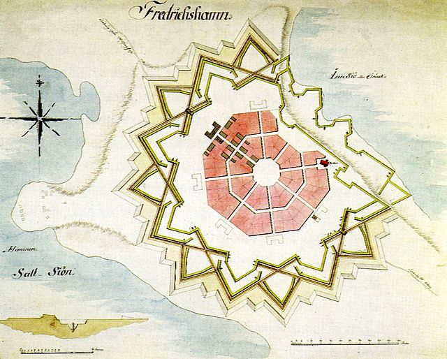
Plan of the Fredrikshamn fortress town (1723) by Axel Löwen
The orthodox church of Peter and Paul
Central bastion of the fortress
Kymenlaakso is a region in Finland. It borders the regions of Uusimaa, Päijät-Häme, South Savo and South Karelia and Russia. Its name means literally The Valley of River Kymi. Kymijoki is one of the biggest rivers in Finland with a drainage basin with 11% of the area of Finland. The city of Kotka with 51,000 inhabitants is located at the delta of River Kymi and has the most important import harbour in Finland. Other cities are Kouvola further in the inland which has after a municipal merger 81,000 inhabitants and the old bastion town Hamina.
The Kymi River in Kotka


