High Rhine
Videos
The High Rhine is the name used for the part of the Rhine that flows westbound from Lake Constance to Basel. The High Rhine begins at the outflow of the Rhine from the Untersee in Stein am Rhein and turns into the Upper Rhine in Basel. In contrast to the Alpine Rhine and Upper Rhine, the High Rhine flows mostly to the west.
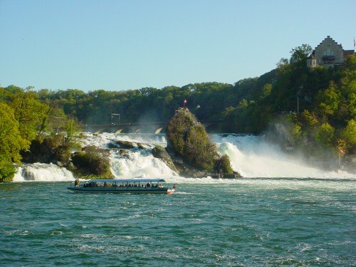
The Rhine Falls at Neuhausen am Rheinfall

The High Rhine at Rheinau

In Ellikon am Rhein
Lake Constance
Videos
Lake Constance refers to three bodies of water on the Rhine at the northern foot of the Alps: Upper Lake Constance (Obersee), Lower Lake Constance (Untersee), and a connecting stretch of the Rhine, called the Lake Rhine (Seerhein). These waterbodies lie within the Lake Constance Basin in the Alpine Foreland through which the Rhine flows.
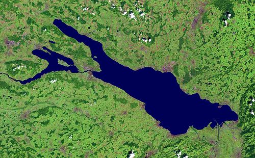
Satellite image

Saints Columbanus and Gallus on Lake Constance, from a 15th-century manuscript

Complete lake from the Winterstaude

Lake Constance with the Island of Lindau seen from the Pfänder in 2007