1.
Lake County, Illinois
–
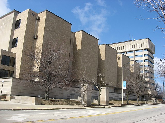
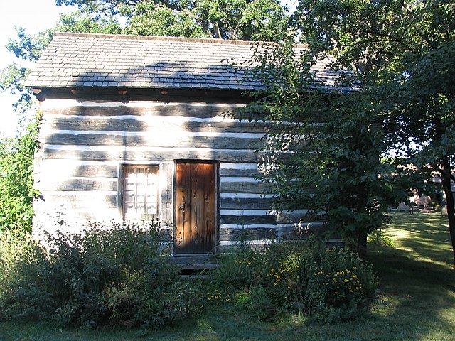
Lake County is a county in the northeastern corner of the U. S. state of Illinois. According to the 2010 census, it has a population of 703,462, originally part of McHenry County, the townships composing Lake County were carved out into a separate county in 1839. Lake County is one of the counties of the Chicago-Naperville-Elgin. It is located along the shore of Lake Michigan, according to the 2000 census, Lake County is the 31st richest county by per capita income. The lakefront communities of Lake Forest, Lake Bluff, and Highland Park are part of the affluent North Shore area, naval Station Great Lakes is located in the city of North Chicago in Lake County. It is the United States Navys Headquarters Command for training, the county, which was primarily unsettled prairie and was still home to its native Potawatomi Indians, was created by the Illinois State Legislature in 1839. At that time, Libertyville, then known as Independence Grove, was the first county seat, in 1841, however, the countys residents voted to move the county government to Little Fort, now Waukegan, where the commissioners had purchased a section of land from the state. Lake Countys first courthouse was built on part of land in 1844. The countys first courthouse was used solely for court sessions and the jail, when fire damaged the courthouse on October 19,1875, the county records were saved because they were in the adjacent building. After the fire, proposals were made to move the county seat to Highland Park, the county commissioners, however, decided to rebuild in Waukegan. The east half of the building was reconstructed at a cost of $45,000, in 1895, the first jail building was added to the government complex and a west addition was added to the courthouse in 1922. By 1938, county commissioners saw a need for additional space and this courthouse, however, was demolished in 1967 to make room for a new high-rise administration building, which was completed with the addition of the jail in 1969 and courts in 1970. The justice center, which houses the county jail, work release program, sheriffs administration offices, Lake County government services extend throughout the countys 470 square miles. The historic Half Day Inn, a tavern/restaurant, was constructed in 1843, according to the U. S. Census Bureau, the county has a total area of 1,368 square miles, of which 444 square miles is land and 935 square miles is water. It is the second-largest county in Illinois by total area, most of the water is in Lake Michigan. These facilities include traditional nature preserves, such as the Ryerson Conservation Area, as well as courses and historic homes. Several local environmental groups operate in Lake County, such as Conserve Lake County and Citizens for Conservation, volunteer opportunities also exist with the Lake County Forest Preserve District. The population density was 1,585.6 inhabitants per square mile, there were 260,310 housing units at an average density of 586.7 per square mile
2.
2010 United States Census
–
The 2010 United States Census, is the twenty-third and currently most recent United States national census. National Census Day, the day used for the census, was April 1,2010. As part of a drive to increase the accuracy,635,000 temporary enumerators were hired. The population of the United States was counted as 308,745,538, as required by the United States Constitution, the U. S. census has been conducted every 10 years since 1790. The 2000 U. S. Census was the previous census completed, participation in the U. S. Census is required by law in Title 13 of the United States Code. On January 25,2010, Census Bureau Director Robert Groves personally inaugurated the 2010 Census enumeration by counting World War II veteran Clifton Jackson, more than 120 million census forms were delivered by the U. S. Post Office beginning March 15,2010, the number of forms mailed out or hand-delivered by the Census Bureau was approximately 134 million on April 1,2010. The 2010 Census national mail participation rate was 74%, from April through July 2010, census takers visited households that did not return a form, an operation called non-response follow-up. In December 2010, the Census Bureau delivered population information to the president for apportionment, personally identifiable information will be available in 2082. The Census Bureau did not use a form for the 2010 Census. In several previous censuses, one in six households received this long form, the 2010 Census used only a short form asking ten basic questions, How many people were living or staying in this house, apartment, or mobile home on April 1,2010. Were there any additional people staying here on April 1,2010 that you did not include in Question 1, mark all that apply, Is this house, apartment, or mobile home – What is your telephone number. What is Person 1s age and Person 1s date of birth, is Person 1 of Hispanic, Latino, or Spanish origin. Does Person 1 sometimes live or stay somewhere else, the form included space to repeat some or all of these questions for up to twelve residents total. In contrast to the 2000 census, an Internet response option was not offered, detailed socioeconomic information collected during past censuses will continue to be collected through the American Community Survey. The survey provides data about communities in the United States on a 1-year or 3-year cycle, depending on the size of the community, rather than once every 10 years. A small percentage of the population on a basis will receive the survey each year. In June 2009, the U. S. Census Bureau announced that it would count same-sex married couples, however, the final form did not contain a separate same-sex married couple option
3.
Central Time Zone
–
The North American Central Time Zone is a time zone in parts of Canada, the United States, Mexico, Central America, some Caribbean Islands, and part of the Eastern Pacific Ocean. Central Standard Time is six hours behind Coordinated Universal Time, during summer most of the zone uses daylight saving time, and changes to Central Daylight Time which is five hours behind UTC. The province of Manitoba is the province or territory in Canada that observes Central Time in all areas. Also, most of the province of Saskatchewan is on Central Standard Time year-round, major exceptions include Lloydminster, a city situated on the boundary between Alberta and Saskatchewan. The city charter stipulates that it shall observe Mountain Time and DST, putting the community on the time as all of Alberta, including the major cities of Calgary. As a result, during the summer, clocks in the province match those in Alberta. The Central Time Zone is the second most populous in the US after the Eastern Time Zone, lanett and Valley observe Eastern Time historically because they were textile mill towns and the original home office of their mills was in West Point, Georgia. Some eastern counties observe Central Time because they are close to the border of the Middle Tennessee counties surrounding the Nashville metropolitan area. Louisiana Michigan, All of Michigan observes Eastern Time except the four Upper Peninsula counties that border Wisconsin, other westernmost counties from this area such as Ontonagon observe Eastern Time. South Dakota, Eastern half as divided by the Missouri river adjacent to the state capital, note, the metropolitan area of Pierre is Central, including Fort Pierre. Wisconsin Most of Mexico—roughly the eastern three-fourths—lies in the Central Time Zone, except for six northwestern states, the federal entities of Mexico that observe Central Time, Belize, Costa Rica, El Salvador, Guatemala, Honduras, and Nicaragua all use Central Standard Time year-round. The Galápagos Islands in Ecuador uses Central Standard Time all year-round, Daylight saving time is in effect in much of the Central time zone between mid-March and early November. The modified time is called Central Daylight Time and is UTC−5, in Canada, Saskatchewan does not observe a time change. One reason that Saskatchewan does not take part in a change is that, geographically. The province elected to move onto permanent daylight saving by being part of the Central Time Zone, Mexico decided not to go along with this change and observes their horario de verano from the first Sunday in April to the last Sunday in October. In December 2009, the Mexican Congress allowed ten border cities, eight of which are in states that observe Central Time, to adopt the U. S. daylight time schedule effective in 2010
4.
Daylight saving time
–
Daylight saving time is the practice of advancing clocks during summer months by one hour so that evening daylight lasts an hour longer, while sacrificing normal sunrise times. Typically, regions that use Daylight Savings Time adjust clocks forward one hour close to the start of spring, American inventor and politician Benjamin Franklin proposed a form of daylight time in 1784. New Zealander George Hudson proposed the idea of saving in 1895. The German Empire and Austria-Hungary organized the first nationwide implementation, starting on April 30,1916, many countries have used it at various times since then, particularly since the energy crisis of the 1970s. The practice has both advocates and critics, DST clock shifts sometimes complicate timekeeping and can disrupt travel, billing, record keeping, medical devices, heavy equipment, and sleep patterns. Computer software often adjusts clocks automatically, but policy changes by various jurisdictions of DST dates, industrialized societies generally follow a clock-based schedule for daily activities that do not change throughout the course of the year. The time of day that individuals begin and end work or school, North and south of the tropics daylight lasts longer in summer and shorter in winter, with the effect becoming greater as one moves away from the tropics. However, they will have one hour of daylight at the start of each day. Supporters have also argued that DST decreases energy consumption by reducing the need for lighting and heating, DST is also of little use for locations near the equator, because these regions see only a small variation in daylight in the course of the year. After ancient times, equal-length civil hours eventually supplanted unequal, so civil time no longer varies by season, unequal hours are still used in a few traditional settings, such as some monasteries of Mount Athos and all Jewish ceremonies. This 1784 satire proposed taxing window shutters, rationing candles, and waking the public by ringing church bells, despite common misconception, Franklin did not actually propose DST, 18th-century Europe did not even keep precise schedules. However, this changed as rail transport and communication networks came to require a standardization of time unknown in Franklins day. Modern DST was first proposed by the New Zealand entomologist George Hudson, whose shift work job gave him time to collect insects. An avid golfer, he also disliked cutting short his round at dusk and his solution was to advance the clock during the summer months, a proposal he published two years later. The proposal was taken up by the Liberal Member of Parliament Robert Pearce, a select committee was set up to examine the issue, but Pearces bill did not become law, and several other bills failed in the following years. Willett lobbied for the proposal in the UK until his death in 1915, william Sword Frost, mayor of Orillia, Ontario, introduced daylight saving time in the municipality during his tenure from 1911 to 1912. Starting on April 30,1916, the German Empire and its World War I ally Austria-Hungary were the first to use DST as a way to conserve coal during wartime, Britain, most of its allies, and many European neutrals soon followed suit. Russia and a few other countries waited until the year
5.
UTC-5
–
UTC−05,00 is a time offset that subtracts five hours from Coordinated Universal Time. In North America, it is observed in the Eastern Time Zone during standard time, the western Caribbean uses it year round. The southwestern and northwestern portions of Indiana Mexico – Central Zone Central, in most of Mexico, daylight time starts a few weeks after the United States. Communities on the U. S. border that observe Central Time follow the U. S. daylight time schedule
6.
ZIP Code
–
ZIP Codes are a system of postal codes used by the United States Postal Service since 1963. The term ZIP, an acronym for Zone Improvement Plan, was chosen to suggest that the travels more efficiently, and therefore more quickly. The basic format consists of five numerical digits, an extended ZIP+4 code, introduced in 1983, includes the five digits of the ZIP Code, a hyphen, and four additional digits that determine a more specific location within a given ZIP Code. The term ZIP Code was originally registered as a servicemark by the U. S. Postal Service, USPS style for ZIP is all caps and the c in code is also capitalized, although style sheets for some publications use sentence case or lowercase. The early history and context of postal codes began with postal district/zone numbers, the United States Post Office Department implemented postal zones for numerous large cities in 1943. For example, Mr. John Smith 3256 Epiphenomenal Avenue Minneapolis 16, by the early 1960s a more organized system was needed, and on July 1,1963, non-mandatory five-digit ZIP Codes were introduced nationwide. Three months later, on October 1,1963, the U. S, an earlier list in June had proposed capitalized abbreviations ranging from two to five letters. The abbreviations have remained unchanged, with one exception, according to the historian of the U. S. Robert Moon, an employee of the post office, is considered the father of the ZIP Code, he submitted his proposal in 1944 while working as a postal inspector. The post office gives credit to Moon only for the first three digits of the ZIP Code, which describe the sectional center facility or sec center, an SCF is a central mail processing facility with those three digits. The SCF sorts mail to all post offices with those first three digits in their ZIP Codes, the mail is sorted according to the final two digits of the ZIP Code and sent to the corresponding post offices in the early morning. Sectional centers do not deliver mail and are not open to the public, Mail picked up at post offices is sent to their own SCF in the afternoon, where the mail is sorted overnight. The United States Post Office used a character, which it called Mr. ZIP. He was often depicted with a such as USE ZIP CODE in the selvage of panes of stamps or on labels contained in, or the covers of. In 1983, the U. S. Postal Service introduced an expanded ZIP Code system that it called ZIP+4, often called plus-four codes, add-on codes, or add ons. But initial attempts to promote use of the new format met with public resistance. For Post Office Boxes, the rule is that each box has its own ZIP+4 code. However, there is no rule, so the ZIP+4 Code must be looked up individually for each box. It is common to use add-on code 9998 for mail addressed to the postmaster,9999 for general delivery, for a unique ZIP Code, the add-on code is typically 0001
7.
United States
–
Forty-eight of the fifty states and the federal district are contiguous and located in North America between Canada and Mexico. The state of Alaska is in the northwest corner of North America, bordered by Canada to the east, the state of Hawaii is an archipelago in the mid-Pacific Ocean. The U. S. territories are scattered about the Pacific Ocean, the geography, climate and wildlife of the country are extremely diverse. At 3.8 million square miles and with over 324 million people, the United States is the worlds third- or fourth-largest country by area, third-largest by land area. It is one of the worlds most ethnically diverse and multicultural nations, paleo-Indians migrated from Asia to the North American mainland at least 15,000 years ago. European colonization began in the 16th century, the United States emerged from 13 British colonies along the East Coast. Numerous disputes between Great Britain and the following the Seven Years War led to the American Revolution. On July 4,1776, during the course of the American Revolutionary War, the war ended in 1783 with recognition of the independence of the United States by Great Britain, representing the first successful war of independence against a European power. The current constitution was adopted in 1788, after the Articles of Confederation, the first ten amendments, collectively named the Bill of Rights, were ratified in 1791 and designed to guarantee many fundamental civil liberties. During the second half of the 19th century, the American Civil War led to the end of slavery in the country. By the end of century, the United States extended into the Pacific Ocean. The Spanish–American War and World War I confirmed the status as a global military power. The end of the Cold War and the dissolution of the Soviet Union in 1991 left the United States as the sole superpower. The U. S. is a member of the United Nations, World Bank, International Monetary Fund, Organization of American States. The United States is a developed country, with the worlds largest economy by nominal GDP. It ranks highly in several measures of performance, including average wage, human development, per capita GDP. While the U. S. economy is considered post-industrial, characterized by the dominance of services and knowledge economy, the United States is a prominent political and cultural force internationally, and a leader in scientific research and technological innovations. In 1507, the German cartographer Martin Waldseemüller produced a map on which he named the lands of the Western Hemisphere America after the Italian explorer and cartographer Amerigo Vespucci
8.
Chicago
–
Chicago, officially the City of Chicago, is the third-most populous city in the United States. With over 2.7 million residents, it is the most populous city in the state of Illinois, and it is the county seat of Cook County. In 2012, Chicago was listed as a global city by the Globalization and World Cities Research Network. Chicago has the third-largest gross metropolitan product in the United States—about $640 billion according to 2015 estimates, the city has one of the worlds largest and most diversified economies with no single industry employing more than 14% of the workforce. In 2016, Chicago hosted over 54 million domestic and international visitors, landmarks in the city include Millennium Park, Navy Pier, the Magnificent Mile, Art Institute of Chicago, Museum Campus, the Willis Tower, Museum of Science and Industry, and Lincoln Park Zoo. Chicagos culture includes the arts, novels, film, theater, especially improvisational comedy. Chicago also has sports teams in each of the major professional leagues. The city has many nicknames, the best-known being the Windy City, the name Chicago is derived from a French rendering of the Native American word shikaakwa, known to botanists as Allium tricoccum, from the Miami-Illinois language. The first known reference to the site of the current city of Chicago as Checagou was by Robert de LaSalle around 1679 in a memoir, henri Joutel, in his journal of 1688, noted that the wild garlic, called chicagoua, grew abundantly in the area. In the mid-18th century, the area was inhabited by a Native American tribe known as the Potawatomi, the first known non-indigenous permanent settler in Chicago was Jean Baptiste Point du Sable. Du Sable was of African and French descent and arrived in the 1780s and he is commonly known as the Founder of Chicago. In 1803, the United States Army built Fort Dearborn, which was destroyed in 1812 in the Battle of Fort Dearborn, the Ottawa, Ojibwe, and Potawatomi tribes had ceded additional land to the United States in the 1816 Treaty of St. Louis. The Potawatomi were forcibly removed from their land after the Treaty of Chicago in 1833, on August 12,1833, the Town of Chicago was organized with a population of about 200. Within seven years it grew to more than 4,000 people, on June 15,1835, the first public land sales began with Edmund Dick Taylor as U. S. The City of Chicago was incorporated on Saturday, March 4,1837, as the site of the Chicago Portage, the city became an important transportation hub between the eastern and western United States. Chicagos first railway, Galena and Chicago Union Railroad, and the Illinois, the canal allowed steamboats and sailing ships on the Great Lakes to connect to the Mississippi River. A flourishing economy brought residents from rural communities and immigrants from abroad, manufacturing and retail and finance sectors became dominant, influencing the American economy. The Chicago Board of Trade listed the first ever standardized exchange traded forward contracts and these issues also helped propel another Illinoisan, Abraham Lincoln, to the national stage
9.
North Shore (Chicago)
–
The North Shore consists of many affluent suburbs north of Chicago, Illinois, bordering the shores of Lake Michigan. These communities fall within suburban Cook County and Lake County, the North Shores membership is often a topic of debate, and is sometimes expanded to include other affluent Chicago suburbs which do not border Lake Michigan. Other suburbs such as Glenview, Northbrook, Deerfield, Highwood, Skokie, and Northfield are often considered to be a part of the North Shore, europeans settled the area sparsely after an 1833 treaty with local Native Americans. Electric rail lines were run from Chicago, parallel to steam commuter lines. The North Shore today is noteworthy for being one of the few remaining agglomerations of streetcar suburbs in the United States, the major Jewish suburban communities include Evanston, Skokie, Glencoe and Highland Park. Jews, however, were barred from Kenilworth and Lake Forest, the number of Jews in the north suburbs increased to 40% by the early 1960s. It is notable, too, that at point in time most of these north suburbs were almost entirely white. One informal 1967 poll by mostly white residents of the North Shore seeking to open housing suggested that of 2,000 real estate listings. Source, Today the North Shore remains one of the most affluent, seven of its communities are in the top quintile of U. S. household income, and five of those are in the top 5 percent. From Evanston to Lake Bluff, only Highwood falls below the national median, the North Shore is also the home of the Ravinia Festival, a historic outdoor music theater in Highland Park, Illinois. Early histories of Chicago do not use the term North Shore and it began to come into use in the early 1880s and by 1889, with the creation of the North Shore Improvement Association, the name was officially established. In 1890 Joseph Sears used the term several times in a brochure that was written to promote the community of Kenilworth. This railway ran along Lake Michigans western shore between Chicago and Milwaukee, the line was popularly referred to, including in the railroads own brochures and timetables, as the North Shore Line. After 1924 the Skokie Valley line of the CNS&M opened land further west to the North Shore, meanwhile, in 1906, the Sanitary District of Chicago platted the North Shore Channel of the sanitary canal from the Chicago River, through Evanston and Wilmette to Lake Michigan. While the CNS&M ran from Chicago all the way to Milwaukee, chicagos North Shore Convention & Visitors Bureaus markets the City of Evanston and the Villages of Skokie, Glenview, Northbrook and Winnetka. This geographic area favored by marketeers extends from Chicago’s northern boundary into southern Lake County, mostly the Central Suburban League public high schools cater to the North Shore. The Central Suburban League is an IHSA-recognized high school extracurricular conference comprising 12 public schools located in the suburbs of Chicago. Comprising 12 relatively large high schools, it is among the high school conferences in Illinois
10.
Chicago metropolitan area
–
The Chicago metropolitan area, or Chicagoland, is the metropolitan area associated with the city of Chicago, Illinois, and its suburbs. With an estimated population of 9.4 million people, it is the third largest metropolitan area in the United States, Chicagoland is the area that is closely linked to the city through geographic, social, economic, and cultural ties. The Chicago metropolitan area is one of the world’s largest and most diversified economies, with more than four million employees, the region is home to more than 400 major corporate headquarters, including 31 in the Fortune 500. The Chicago Metropolitan Statistical Area was originally designated by the United States Census Bureau in 1950 and it comprised the Illinois counties of Cook, DuPage, Kane, Lake and Will, along with Lake County in Indiana. As surrounding counties saw an increase in their population densities and the number of their residents employed within Cook County, the Chicago MSA, now defined as the Chicago-Naperville-Elgin, IL-IN-WI Metropolitan Statistical Area, is the third largest MSA by population in the United States. The 2015 census estimate for the MSA was 9,427,676 and this loss of population has been attributed to taxes, political issues, and other factors. A breakdown of the 2009 estimated populations of the three Metropolitan Divisions of the MSA are as follows, The OMB also defines a larger region as a Combined Statistical Area. The Chicago-Naperville, IL-IN-WI Combined Statistical Area combines the areas of Chicago, Michigan City. This area represents the extent of the market pool for the entire region. The CSA has a population of 9,928,312, the Chicago urban agglomeration, according to the United Nations World Urbanization Prospects report, lists a population of 9,545,000. The term “urban agglomeration” refers to the contained within the contours of a contiguous territory inhabited at urban density levels. It usually incorporates the population in a city plus that in the surrounding area, Chicagoland is an informal name for the Chicago metropolitan area. The term Chicagoland has no definition, and the region is often considered to include areas beyond the corresponding MSA. Colonel Robert R. McCormick, editor and publisher of the Chicago Tribune, mcCormicks conception of Chicagoland stretched all the way to nearby parts of four states. The first usage was in the Tribunes July 27,1926 front page headline, Chicagolands Shrines, A Tour of Discoveries and he stated that Chicagoland comprised everything in a 200-mile radius in every direction and reported on many different places in the area. The Tribune was the dominant newspaper in a vast area stretching to the west of the city, today, the Chicago Tribunes usage includes the city of Chicago, the rest of Cook County, eight nearby Illinois counties, and the two Indiana counties of Lake and Porter. Illinois Department of Tourism literature uses Chicagoland for suburbs in Cook, Lake, DuPage, Kane, the Chicagoland Chamber of Commerce defines it as all of Cook, DuPage, Kane, Lake, McHenry, and Will counties. For example, many residents who live in some of the more distant satellite counties nonetheless refer to themselves as being from Chicago or Chicagoans
11.
Walter S. Gurnee
–
Walter Smith Gurnee served as Mayor of Chicago for the Democratic Party. The town of Gurnee, Illinois is named for him, Gurnee was born in Haverstraw, New York and arrived in Chicago after spending time in Michigan. Once in Chicago, he established a tannery, which, by 1844 and he was a founding member of the Chicago Board of Trade. Prior to becoming the mayor of Chicago, Gurnee was the partner of Gurnee & Matteson. Gurnee did well enough in business, and in his tannery. Gurnee campaigned for the mayoralty on the issue of ownership of the citys water supply. Once in office, he fought against the merger of the Illinois Central and Michigan Central railroads, village of Gurnee, IL history page 1st Inaugural speech at Chicago Public Library 2nd Inaugural speech at Chicago Public Library
12.
Willits House
–
The Ward W. Willits House is a building designed by architect Frank Lloyd Wright. Designed in 1901, the Willits house is considered the first of the great Prairie houses, built in the Chicago suburb of Highland Park, Illinois, the house presents a symmetrical facade to the street. One of the interesting points about the house is Wrights ability to seamlessly combine architecture with nature. The plan is a cruciate with four wings extending out from a central fireplace, in addition to stained-glass windows and wooden screens that divide rooms, Wright also designed most of the furniture in the house. The Willits House is Wrights first true Prairie-style house, as such and this house was designed for Ward Winfield Willits in 1901, who was then vice-president of Adams and Westlake Company, a brass foundry of which he was later made president. Orlando Giannini, who was employed by Willits at the time, the Willits House is the first house in true Prairie style and marks the full development of Wrights wood frame and stucco system of construction. Although the Willits House has two stories, it is a complex shape, consisting of a rectangular central space with a rectangular wing projecting from each side of that space. This is a design feature for most prairie-style houses, in addition to low roofs. Wright used a plan with the interior space flowing around a central chimney core and extending outward onto covered verandas. The plan of the house is a style, as seen with the four wings extending from the fireplace in the central core. Wing two contains the living room with high windows and a walled terrace. The dining room, extended by a porch, comprises the third wing. The first floor contains the room that faces the street, the dining room, kitchen, pantry, servants quarters, reception, porte cochere, veranda. The first floor contains several fireplaces that are clustered together. An entrance-stair hall, living room, dining room and kitchen rotate around the central fireplace, the plan of the house begins to open up and the rooms are linking much more strongly outward. The house is contained and architecture that moved outwards was one of the main features. Moving to the floor of the house, it contains five bedrooms, a sewing room. Instead of continuing the west bedroom the full width of the wing, the Willits House was seen as an entertainment-style home
13.
Ravinia Festival
–
The Ravinia Festival is the oldest outdoor music festival in the United States, with a series of outdoor concerts and performances held every summer from June to September. In Ravinia Parks first summer of 1905, it hosted the New York Philharmonic, and it has been the summer home of the Chicago Symphony Orchestra since 1936. Located in Highland Park, Illinois, the festival operates on the grounds of the 36 acre Ravinia Park, the Ravinia neighborhood, once an incorporated village before annexation in 1899, is known as Ravinia, and retained its own post office until autumn 2010. The business district on Roger Williams Ave. within walking distance from the Ravinia Festival grounds, includes neighborhood service businesses, Ravinia takes its name from the ravines found nearby along the shoreline of Lake Michigan. The Pavilion, a 3, 400-seat venue where the major music events and concerts. The Martin Theatre, an 850-seat indoor hall often used for music, semi-staged opera performances, Martinis at the Martin cabaret series. Bennett Gordon Hall, the 450-seat home of Ravinias Steans Music Institute, the $10 BGH Classics Series, Ravinias Steans Music Institute is the Ravinia Festivals pre-professional summer conservatory program. Three programs comprise the Institutes summer season, the program for jazz, the program for piano and strings, in 1904, the A. C. Frost Company created Ravinia as an amusement park intended to lure riders to the fledgling Chicago and Milwaukee Electric Railroad. The amusement park boasted a baseball diamond, electric fountain and refectory or casino building with dining rooms, the prairie-style Martin Theatre is the only building on the grounds that dates back to that original construction. When the parks existence became jeopardized following the bankruptcy, local residents formed a corporation in 1911 to purchase. Music was a summer activity from then on, except for a brief hiatus during the Depression. Over 100 years later, Ravinia Festival is the oldest outdoor music festival in North America and is lauded for presenting world-class music. The festival attracts about 600,000 listeners to some 120 to 150 events that all genres from classical music to jazz to music theater over each three-month summer season. B. For most attendees Ravinia is experienced on the 36 acre parkland, most attendees choose to bring complete picnics and dinners to shows, with various lawn chairs, coolers full of food, blankets, candles, and lawn accessories in tow. Ravinia is one of the few venues in the country to allow full meals to be brought in and consumed at concerts. Accordingly, most grocery stores and specialty restaurants in and around the Highland Park area offer ready-to-eat Ravinia picnics for purchase, once at the park, visitors can eat, listen to music and visit the Ravinia Gift Shop. The park is served by the Metra commuter railroad station Ravinia Park outside the front gate with special stops before, visitors get dropped off and picked up right at the front gate. The Music Performance initiative allows professional musicians to work as mentors within the classroom, focusing on specific instruments to demonstrate standards for playing classical and these role models strive to develop students’ self-esteem and increase their access to the cultural riches of the music world
14.
Chicago Symphony Orchestra
–
The Chicago Symphony Orchestra, based in Chicago, was formed by Theodore Thomas in 1891. The Symphony makes its home at Orchestra Hall in Chicago and plays a season at the Ravinia Festival. The music director is Riccardo Muti, who began his tenure in 2010, the CSO is one of five American orchestras commonly referred to as the Big Five. Since Thomas, the orchestra has had ten music directors, including Rafael Kubelík, Fritz Reiner, Sir Georg Solti, from 2010 to the present, the incumbent conductor is Riccardo Muti. In 1890 Charles Norman Fay, a Chicago businessman, invited Theodore Thomas to establish an orchestra in Chicago, under the name Chicago Orchestra, the orchestra played its first concert October 16,1891 at the Auditorium Theater. It is one of the oldest orchestras in the United States, along with the New York Philharmonic, the Boston Symphony Orchestra, Orchestra Hall, now a component of the Symphony Center complex, was designed by Chicago architect Daniel H. Burnham and completed in 1904. Maestro Thomas served as director for thirteen years until his death shortly after the orchestras newly built residence was dedicated December 14,1904. The orchestra was renamed Theodore Thomas Orchestra in 1905 and today, in 1905, Frederick Stock became music director, a post he held until his death in 1942. The orchestra was renamed the Chicago Symphony Orchestra in 1913, subsequent music directors have included Désiré Defauw, Artur Rodziński, Rafael Kubelík, Fritz Reiner, Jean Martinon, Georg Solti, and Daniel Barenboim. His contract has been renewed for five years, through the 2020 season. Many of these guests have also recorded with the orchestra, carlos Kleiber made his only symphonic guest appearances in America with the CSO, in October 1978 and June 1983. The three principal guest conductors of the orchestra have been Carlo Maria Giulini, Claudio Abbado, the CSO holds an annual fundraiser, originally known as the Chicago Symphony Marathon, more recently as Radiothon and Symphonython, in conjunction with Chicago radio station WFMT. As part of the event, from 1986 through 2008, the released tracks from their broadcast archives on double LP/CD collections. The Chicago Symphony Orchestra maintains a home at Ravinia in Highland Park. The CSO helped to inaugurate the first season of the Ravinia Festival in August 1936 and has been in residence at the Festival every summer since, as of 2005, James Conlon holds the title of Ravinia music director. The Chicago Symphony has amassed an extensive discography, recordings by the CSO have earned 62 Grammy Awards from the National Academy of Recording Arts and Sciences. These include several Classical Album of the Year awards, awards in Best Classical Performance in vocal soloist, choral, instrumental, engineering and orchestral categories. On May 1,1916, Frederick Stock and the orchestra recorded the Wedding March from Felix Mendelssohns music to A Midsummer Nights Dream for what was known as the Columbia Graphophone Company
15.
National Register of Historic Places
–
The National Register of Historic Places is the United States federal governments official list of districts, sites, buildings, structures, and objects deemed worthy of preservation. The passage of the National Historic Preservation Act in 1966 established the National Register, of the more than one million properties on the National Register,80,000 are listed individually. The remainder are contributing resources within historic districts, each year approximately 30,000 properties are added to the National Register as part of districts or by individual listings. For most of its history the National Register has been administered by the National Park Service and its goals are to help property owners and interest groups, such as the National Trust for Historic Preservation, coordinate, identify, and protect historic sites in the United States. While National Register listings are mostly symbolic, their recognition of significance provides some financial incentive to owners of listed properties, protection of the property is not guaranteed. During the nomination process, the property is evaluated in terms of the four criteria for inclusion on the National Register of Historic Places, the application of those criteria has been the subject of criticism by academics of history and preservation, as well as the public and politicians. Occasionally, historic sites outside the proper, but associated with the United States are also listed. Properties can be nominated in a variety of forms, including individual properties, historic districts, the Register categorizes general listings into one of five types of properties, district, site, structure, building, or object. National Register Historic Districts are defined geographical areas consisting of contributing and non-contributing properties, some properties are added automatically to the National Register when they become administered by the National Park Service. These include National Historic Landmarks, National Historic Sites, National Historical Parks, National Military Parks/Battlefields, National Memorials, on October 15,1966, the Historic Preservation Act created the National Register of Historic Places and the corresponding State Historic Preservation Offices. Initially, the National Register consisted of the National Historic Landmarks designated before the Registers creation, approval of the act, which was amended in 1980 and 1992, represented the first time the United States had a broad-based historic preservation policy. To administer the newly created National Register of Historic Places, the National Park Service of the U. S. Department of the Interior, hartzog, Jr. established an administrative division named the Office of Archeology and Historic Preservation. Hartzog charged OAHP with creating the National Register program mandated by the 1966 law, ernest Connally was the Offices first director. Within OAHP new divisions were created to deal with the National Register, the first official Keeper of the Register was William J. Murtagh, an architectural historian. During the Registers earliest years in the late 1960s and early 1970s, organization was lax and SHPOs were small, understaffed, and underfunded. A few years later in 1979, the NPS history programs affiliated with both the U. S. National Parks system and the National Register were categorized formally into two Assistant Directorates. Established were the Assistant Directorate for Archeology and Historic Preservation and the Assistant Directorate for Park Historic Preservation, from 1978 until 1981, the main agency for the National Register was the Heritage Conservation and Recreation Service of the United States Department of the Interior. In February 1983, the two assistant directorates were merged to promote efficiency and recognize the interdependency of their programs, jerry L. Rogers was selected to direct this newly merged associate directorate
16.
Frank Lloyd Wright
–
Frank Lloyd Wright was an American architect, interior designer, writer, and educator, who designed more than 1,000 structures,532 of which were completed. Wright believed in designing structures that were in harmony with humanity and its environment and this philosophy was best exemplified by Fallingwater, which has been called the best all-time work of American architecture. Wright was a leader of the Prairie School movement of architecture and developed the concept of the Usonian home and his creative period spanned more than 70 years. In addition to his houses, Wright designed original and innovative offices, churches, schools, skyscrapers, hotels, museums and he often designed interior elements for these buildings as well, including furniture and stained glass. Wright wrote 20 books and many articles and was a lecturer in the United States. His colorful personal life made headlines, most notably for the 1914 fire. Wright was recognized in 1991 by the American Institute of Architects as the greatest American architect of all time, Frank Lloyd Wright was born Frank Lincoln Wright in the farming town of Richland Center, Wisconsin, United States, in 1867. His father, William Carey Wright, was an orator, music teacher, occasional lawyer, William Wright met and married Anna Lloyd Jones, a county school teacher, the previous year when he was employed as the superintendent of schools for Richland County. Originally from Massachusetts, William Wright had been a Baptist minister, Anna was a member of the large, prosperous and well-known Lloyd Jones family of Unitarians, who had emigrated from Wales to Spring Green, Wisconsin. One of Annas brothers was Jenkin Lloyd Jones, who would become an important figure in the spread of the Unitarian faith in the Western United States, both of Wrights parents were strong-willed individuals with idiosyncratic interests that they passed on to him. According to his biography, his mother declared when she was expecting that her first child would grow up to build beautiful buildings and she decorated his nursery with engravings of English cathedrals torn from a periodical to encourage the infants ambition. In 1870 the family moved to Weymouth, Massachusetts, where William ministered to a small congregation, in 1876, Anna visited the Centennial Exhibition in Philadelphia where she saw an exhibit of educational blocks created by Friedrich Wilhelm August Fröbel. The blocks, known as Froebel Gifts, were the foundation of his innovative kindergarten curriculum, Anna, a trained teacher, was excited by the program and bought a set with which young Wright spent much time playing. The blocks in the set were geometrically shaped and could be assembled in various combinations to form three-dimensional compositions, the Wright family struggled financially in Weymouth and returned to Spring Green, Wisconsin, where the supportive Lloyd Jones clan could help William find employment. They settled in Madison, where William taught music lessons and served as the secretary to the newly formed Unitarian society, although William was a distant parent, he shared his love of music, especially the works of Johann Sebastian Bach, with his children. Soon after Wright turned 14, his parents separated, Anna had been unhappy for some time with Williams inability to provide for his family and asked him to leave. The divorce was finalized in 1885 after William sued Anna for lack of physical affection, William left Wisconsin after the divorce and Wright claimed he never saw his father again. At this time he changed his name from Lincoln to Lloyd in honor of his mothers family
17.
John S. Van Bergen
–
John Shellette Van Bergen was an American architect born in Oak Park, Illinois. Van Bergen started his career as an apprentice draftsman in 1907. In 1909 he went to work for Frank Lloyd Wright at his studio in Oak Park, at Wrights studio he did working drawings for and supervised the Robie House and the Mrs. Thomas Gale House. Van Bergen designed prairie style homes in the Chicago area, mostly in the suburbs of Oak Park and his home designs are recognized as excellent examples of Prairie style architecture and several are listed as local landmarks. A few of his homes are listed on the U. S. National Register of Historic Places, John S. Van Bergen was born October 2,1885 to William and Ella Van Bergen, one of four children. At the time the Van Bergen family resided in a home on Euclid Avenue in Oak Park, the Van Bergen’s then moved into the present day 500 block of Fair Oaks when a young John Van Bergen began to show an interest in architecture. This further influenced the young Van Bergen, Van Bergens mother was friends with Wrights mother, Anna, and Van Bergens third grade teacher was Wrights sister, Maginel. In 1901 John Van Bergen began high school at the old Oak Park and River Forest High School, during high school Van Bergen produced his earliest known drawing, a map of the high school district commissioned by the district superintendent. The map was dated June 24,1904, after high school Van Bergen spent time in Hollywood, California. When he returned from California he soon found an architectural apprenticeship, John Van Bergen began his career as an apprentice draftsman working with Walter Burley Griffin in 1907. Van Bergens father has been friends with Griffins father for many years, late in his life Van Bergen recalled Griffin as not only a skillfully trained architect but also a great teacher for me. He had no end of patience for a poor draftsman. Walter took great pains in explaining things to me - pains that no other architect ever took, Van Bergen remained with Griffin as his only apprentice until October 1908. In 1909 he left Chicago Technical College and began working with architect Frank Lloyd Wright and he joined Wright before he was a licensed architect and went to work in his studio. Van Bergen was the last architect added to Wrights studio and while there he was put in charge of finishing many Frank Lloyd Wright projects, working for Wright he did working drawings and was supervisor for the Robie House and the Mrs. Thomas Gale House. Van Bergen designed many Prairie style residences in and around Chicago, especially in the suburbs of Oak Park, of the architects closely associated with Wright, Van Bergen and Francis Conroy Sullivan were the two least known. Van Bergens work was very much cast in a manner to that of Wrights early Prairie work. When Wright left for Europe in late 1909 Van Bergen, along with Isabel Roberts, remained behind to close Wrights studio and help end the Oak Park, after Van Bergen left Wrights studio he briefly worked for another former Wright employee, William Eugene Drummond
18.
Howard Van Doren Shaw
–
Howard Van Doren Shaw AIA was an American architect. He became one of the architects of his generation in the Chicago. Shaw was considered a leader in the American Craftsman movement, best exemplified in his 1900 remodel of Second Presbyterian Church in Chicago and he designed Marktown, Clayton Marks planned worker community in Northwest Indiana. Howard Van Doren Shaw was born in Chicago, Illinois on May 7,1869 and his father Theodore was a successful dry goods businessman and was part of the planning committee for the Worlds Columbian Exposition. His mother Sarah was a painter and a member of the Bohemian Club. Howard had one brother, Theodore, Jr and his family resided at 2124 Calumet Avenue, then a part of the Prairie Avenue district, the heart of the social fabric of the city. Prairie Avenue was also the site of Chicagos most modern residential architecture, howard Shaw met Frances Wells, his future wife, in the districts Bouniques dancing school. Wells was the daughter of Moses D. Wells, wholesaler of boots, Shaw studied at the Harvard School for Boys in Hyde Park Township. He was accepted to Yale University, graduating with a bachelor of arts in 1890, while at Yale, Shaw was the lead editor of The Yale Record, the worlds oldest humor magazine. He was admitted to the Massachusetts Institute of Technology later that year, MIT was one of the few architectural schools in the country at that time, closely following the rules set forth by the École des Beaux-Arts. Shaw completed the program in one year. Shaw would use the elements of Georgian, Tudor, and neoclassical design he learned from MIT in most of his later works, after returning to Chicago in June 1891, he joined the Jenney & Mundie firm. William Le Baron Jenney was emerging as a designer, creating the first skyscrapers. His firm was already gaining a reputation as a ground for new architects, such as Daniel Burnham. Shaw worked directly with emerging architects James Gamble Rogers, Alfred Hoyt Granger, Shaw received his first commission from his wifes parents, who desired a new house in Lakeville, Connecticut. After the completion of the Wells house, he traveled to Europe to study the endemic architecture and he visited Spain, southern France, Italy, Austria-Hungary, Germany, and England. Shaw spent two months in England before returning to Chicago and he rejoined Jenney & Mundie in early 1893, and on April 20, he married Francis Wells. Chicago architecture was receiving new recognition thanks to the success of the White City at the Worlds Columbian Exposition, Shaw worked on one last commission for the firm, the Snitzler house, in 1894
19.
Robert Seyfarth
–
Robert Seyfarth was an American architect based in Chicago, Illinois. He spent the years of his professional career working for the noted Prairie School architect George Washington Maher. A member of the influential Chicago Architectural Club, Seyfarth was a product of the Chicago School of Architecture, the ideals this architecture sought to express were the very ones the most inventive Chicago architects were trying to embody in their own work - order, harmony, and repose. As a result, the conception of architecture was anything. “Architects and critics engaged in debates concerning the definition of modern architecture. This discourse reflected the development of diverse ideologies and forms that ranged from Beaux-Arts classicism to streamlining. Delano argued that if a project was “handled with freedom and. answered the needs of our present day clients, it will be really expressive of our own time”. Seyfarth opted to take his career down this divergent path, and his grandfather William Seyfarth had come to the United States in 1848 from Schloss Tonndorf in what is now the state of Thuringia, Germany, with the intention of opening a tavern in Chicago. William purchased a building that was standing at the south-west corner of Grove Street and Western Avenue and opened his business. The location was a good one - it was on what was called the Wabash Road a days journey from Chicago. At about the time he purchased a stone quarry about a mile south-west of the settlement and operated it concurrently with the inn. He was a member of the board when Blue Island built its first brick schoolhouse in 1856. William and Louise had five sons, including Edward, who was the father of the architect, Edward Seyfarth was active in community affairs on many levels. He served as treasurer from 1880–1886 and as village trustee from 1886–1889. Charles A. Seyfarth was one of the members of the Blue Island Elks in 1916. Andreas had called. a quiet, though one among the prettiest little suburban towns in the West and it was in this atmosphere that Seyfarth grew up, attended primary school, married his first wife Nell Martin, and built their first home. The club, which was founded in 1877, was a group of the citys most influential leaders that included Marshall Field, George Pullman, Edson Keith, Cyrus McCormick and George Armour. Chicago Manual Training School was a secondary school and was designed to graduate its students three years from the time they entered
20.
Jens Jensen (landscape architect)
–
Jens Jensen was a Danish-American landscape architect. Jens Jensen was born near Dybbøl, Denmark, on September 13,1860, for the first nineteen years of his life he lived on his familys farm, which cultivated his love for the natural environment. When he was four years old, during the Second War of Schleswig in 1864, Jensen watched the Prussians invade his town and this invasion, which annexed the land into Prussia, left a deep influence on how Jensen viewed the world of man. He attended the Tune Agricultural School outside Copenhagen, afterwards undertaking mandatory service in the Prussian Army, during those three years, he sketched parks in the English and French character in Berlin and other German cities. By 1884, his service over, Jensen was engaged to Anne Marie Hansen. Coupled with his wish to escape the farm, this led to his decision to immigrate to the United States that year. Initially Jensen worked in Florida, and then at Luther College in Decorah, Iowa, before moving to Chicago and he was soon promoted to a foreman. During this time he was allowed to design and plant a garden of exotic flowers, when the garden withered and died, he traveled into the surrounding prairie and transplanted native wildflowers. Jensen transplanted the wildflowers into a corner of Union Park, creating what became the American Garden in 1888, working his way through the park system, Jensen was appointed superintendent of the 200 acre Humboldt Park in 1895. By the late 1890s, the West Park Commission was entrenched in corruption, after refusing to participate in political graft, Jensen was ousted by a dishonest park board in 1900. He was eventually reinstated and by 1905 he was superintendent of the entire West Park System in Chicago. His design work for the city can be seen at Garfield Park, Humboldt Park, Douglas Park, in the 1910s, Jensen played a role in building support for the preservation of part of the Indiana Dunes sand dune ecosystem, also near Chicago. Shaw designed Marktown, Clayton Marks planned worker community in Northwest Indiana, in 1920 he retired from the park system and started his own landscape architecture practice. He worked on estates and municipal parks throughout the U. S. He was commissioned by Eleanor and Edsel Ford for four residences, other projects included the Morse Dell Plain House and Garden at Hammond, Indiana and the William Whitaker Landscape and House at Crown Point, Indiana. Jensen did the plan and designed the estates gardens. The Gaukler Point gardens and residence are now a historical landscape and house museum. He also designed the gardens for Edsel and Eleanors summer estate Skylands in Bar Harbor on Mount Desert Island in Maine, Jensen did design work for their two other Michigan residences, one being Haven Hill, between 1922 and 1935
21.
Lake Michigan
–
Lake Michigan is one of the five Great Lakes of North America and the only one located entirely within the United States. The other four Great Lakes are shared by the U. S. and it is the second-largest of the Great Lakes by volume and the third-largest by surface area, after Lake Superior and Lake Huron. Lake Michigan is shared, from west to east, by the U. S. states of Wisconsin, Illinois, Indiana, ports along its shores include Chicago, Milwaukee, Green Bay, Wisconsin, Gary, Indiana, and Benton Harbor, Michigan. The word Michigan originally referred to the lake itself, and is believed to come from the Ojibwa word mishigami meaning great water, some of the earliest human inhabitants of the Lake Michigan region were the Hopewell Indians. Their culture declined after 800 AD, and for the few hundred years. The French explorer Jean Nicolet is believed to have been the first European to reach Lake Michigan, in the earliest European maps of the region, the name of Lake Illinois has been found in addition to that of Michigan, named for the Illinois Confederation of tribes. Lake Michigan is joined via the narrow, open-water Straits of Mackinac with Lake Huron, the Straits of Mackinac were an important Native American and fur trade route. The eastern end of the Straits was controlled by Fort Mackinac on Mackinac Island, French coureurs des bois and voyageurs established small ports and trading communities, such as Green Bay, on the lake during the late 17th and early 18th centuries. In the 19th century, Lake Michigan played a role in the development of Chicago. The first person to reach the bottom of Lake Michigan was J. Val Klump. Klump reached the bottom via submersible as part of a 1985 research expedition, in 2007, a row of stones paralleling an ancient shoreline was discovered by Mark Holley, professor of underwater archeology at Northwestern Michigan College. This formation lies 40 feet below the surface of the lake, One of the stones is said to have a carving resembling a mastodon. So far the formation has not been authenticated, Lake Michigan is the only one of the Great Lakes wholly within the borders of the United States, the others are shared with Canada. It lies in the known as the American Midwest. Lake Michigan has an area of 22,404 sq. mi, making it the largest lake entirely within one country by surface area. It is the half of Lake Michigan–Huron, which is the largest body of fresh water in the world. It is 307 miles long by 118 miles wide with a shoreline 1,640 miles long, the lakes average depth is 46 fathoms 3 feet, while its greatest depth is 153 fathoms 5 feet. It contains a volume of 1,180 cubic miles of water, Green Bay in the northwest is its largest bay
22.
1890 United States Census
–
The Eleventh United States Census was taken beginning June 2,1890. The data was tabulated by machine for the first time, the data reported that the distribution of the population had resulted in the disappearance of the American frontier. Data was entered on a machine readable medium, punched cards, the total population of 62,947,714, the family, or rough, count, was announced after only six weeks of processing. The public reaction to this tabulation was disbelief, as it was believed that the right answer was at least 75,000,000. The United States census of 1890 showed a total of 248,253 Native Americans living in America, down from 400,764 Native Americans identified in the census of 1850. The 1890 census announced that the region of the United States no longer existed. Up to and including the 1880 census, the country had a frontier of settlement, by 1890, isolated bodies of settlement had broken into the unsettled area to the extent that there was hardly a frontier line. This prompted Frederick Jackson Turner to develop his Frontier Thesis, the original data for the 1890 Census is no longer available. Almost all the schedules were damaged in a fire in the basement of the Commerce Building in Washington. Some 25% of the materials were presumed destroyed and another 50% damaged by smoke, the damage to the records led to an outcry for a permanent National Archives. The Librarian was asked by the Bureau to identify any records which should be retained for historical purposes, congress authorized destruction of that list of records on February 21,1933, and the surviving original 1890 census records were destroyed by government order by 1934 or 1935. The other censuses for which information has been lost are the 1800 and 1810 enumerations. Mayo-Smith, Richmond, The Eleventh Census of the United States
23.
1910 United States Census
–
The 1910 Census switched from a portrait page orientation to a landscape orientation. The column titles in the form are as follows, LOCATION. Number of dwelling house in order of visitation, Number of family in order of visitation. NAME of each person whose place of abode on April 15,1910, was in this family, enter surname first, then the given name and middle initial, if any. Include every person living on April 15,1910, omit children born since April 15,1910. Relationship of this person to the head of the family, whether single, married, widowed, or divorced. Number of years of present marriage, Mother of how many children, Number born. Mother of how children, Number now living. Place of birth of each person and parents of each person enumerated, if born in the United States, give the state or territory. If of foreign birth, give the country, place of birth of this Person. Place of birth of Father of this person, place of birth of Mother of this person. Year of immigration to the United States, whether able to speak English, or, if not, give language spoken. Trade or profession of, or particular kind of work done by person, as spinner, salesman, laborer. General nature of industry, business, or establishment in which this works, as cotton mill, dry goods store, farm. Whether as employer, employee, or work on own account, whether out of work on April 15,1910. Number of weeks out of work during year 1909, attended school any time since September 1,1909. Whether a survivor of the Union or Confederate Army or Navy, special Notation, In 1912, New Mexico and Arizona would become the 47th and 48th states admitted to the Union. The 1910 population count for each of these areas was 327,301 and 204,354 respectively
24.
1920 United States Census
–
In 1929, Congress passed the Reapportionment Act of 1929 which provided for a permanent method of reapportionment and fixed the number of Representatives at 435. The original census enumeration sheets were microfilmed by the Census Bureau in the 1940s, the microfilmed census is available in rolls from the National Archives and Records Administration. Several organizations also host images of the census online. Microdata from the 1920 census are available through the Integrated Public Use Microdata Series. Aggregate data for small areas, together with electronic boundary files,1921 U. S Census Report Contains 1920 Census results Historic US Census data 1920 Census,1920 United States Census for Genealogy & Family History Research 1920 Census
25.
1930 United States Census
–
The original census enumeration sheets were microfilmed by the Census Bureau in 1949, after which the original sheets were destroyed. The microfilmed census is located on 2,667 rolls of microfilm, several organizations also host images of the microfilmed census online, and digital indices. Microdata from the 1930 census are available through the Integrated Public Use Microdata Series. Aggregate data for small areas, together with electronic boundary files, can be downloaded from the National Historical Geographic Information System
26.
1940 United States Census
–
The census date of record was April 1,1940. A number of new questions were asked including where people were 5 years before, highest educational grade achieved and this census introduced sampling techniques, one in 20 people were asked additional questions on the census form. Other innovations included a field test of the census in 1939, the 1940 census collected the following information, In addition, a sample of individuals were asked additional questions covering age at first marriage, fertility, and other topics. Full documentation on the 1940 census, including forms and a procedural history, is available from the Integrated Public Use Microdata Series. Following completion of the census, the original sheets were microfilmed. As required by Title 13 of the U. S. Code, non-personally identifiable information Microdata from the 1940 census is freely available through the Integrated Public Use Microdata Series. Also, aggregate data for small areas, together with electronic boundary files, on April 2, 2012—72 years after the census was taken—microfilmed images of the 1940 census enumeration sheets were released to the public by the National Archives and Records Administration. The records are indexed only by enumeration district upon initial release, several organizations are compiling indices, why the huge interest in the 1940 Census. 1940 Census Questions Hosted at CensusFinder. com
27.
1950 United States Census
–
Full documentation on the 1950 census, including census forms and a procedural history, is available from the Integrated Public Use Microdata Series. Microdata from the 1950 census are available through the Integrated Public Use Microdata Series. Aggregate data for small areas, together with electronic boundary files, personally identifiable information will be available in 2022. Historic US Census data 1951 U. S Census Report Contains 1950 Census results
28.
1970 United States Census
–
Microdata from the 1970 census are freely available through the Integrated Public Use Microdata Series. Aggregate data for small areas, together with electronic boundary files and these data were originally created and disseminated by DUALabs. Personally identifiable information will be available in 2042, california took over as the most populous state, New York had previously been ranked number one. While the entire country increased to more than 204 million persons, four states lost population with West Virginia leading the list, down 8, historic US Census data 1971 U. S Census Report, with estimated 1970 Census results 1970 Census of Population
29.
1980 United States Census
–
Approximately 16 percent of households received a long form of the 1980 census, which contained over 100 questions. Full documentation on the 1980 census, including forms and a procedural history, is available from the Integrated Public Use Microdata Series. Microdata from the 1980 census are available through the Integrated Public Use Microdata Series. Aggregate data for small areas, together with electronic boundary files, personally identifiable information will be available in 2052. Between the 1980 census and the 1990 census, the United States population increased by approximately 22,164,837 or 9. 8%, historic US Census data 1981 U. S Census Report Contains 1980 Census results
30.
1990 United States Census
–
Approximately 16 percent of households received a long form of the 1990 census, which contained over 100 questions. Full documentation on the 1990 census, including forms and a procedural history, is available from the Integrated Public Use Microdata Series. It was the first census to designate Native Hawaiian and Other Pacific Islander as a group separate from Asians. To increase black participation in the 1990 United States Census, the bureau recruited Bill Cosby, Magic Johnson, Alfre Woodard, the Integrated Public Use Microdata Series. Aggregate data for small areas, together with electronic boundary files, personally identifiable information will be available in 2062. The results of the 1990 census determined the number of seats that each state receives in the United States House of Representatives starting with the 1992 elections, consequently, this affected the number of votes each state has in the Electoral College for the 1992 presidential election. Because of population changes, twenty-one states had changes in their number of seats, eight states gained at least one seat, and thirteen states lost at least one seat. The final result involved 19 seats being switched
31.
2000 United States Census
–
This was the twenty-second federal census and was at the time the largest civilly administered peacetime effort in the United States. Approximately 16 percent of households received a form of the 2000 census. Full documentation on the 2000 census, including forms and a procedural history, is available from the Integrated Public Use Microdata Series. Microdata from the 2000 census is available through the Integrated Public Use Microdata Series. Aggregate data for small areas, together with electronic boundary files, personally identifiable information will be available in 2072. The U. S. resident population includes the number of people in the 50 states. The Bureau also enumerated the residents of the U. S. territory of Puerto Rico, its population was 3,808,610, the 2000 Census was the first time survey options for multiracial Americans were provided. S. Households had access to computers, 42% have Internet access, regionally, the South and West experienced the bulk of the nations population increase,14,790,890 and 10,411,850, respectively. This meant that the center of U. S. population moved to Phelps County. The Northeast grew by 2,785,149, the Midwest by 4,724,144, the results of the census are used to determine how many congressional districts each state is apportioned. Congress defines the formula, in accordance with Title 2 of the U. S. Code, each member of the House represents a population of about 647,000. The populations of the District of Columbia and Puerto Rico are excluded from the apportionment population because they do not have voting seats in the U. S, since the first census in 1790, the decennial count has been the basis for the United States representative form of government. Article I, Section II specifies that The Number of Representatives shall not exceed one for every thirty Thousand, in 1790, each member of the House represented about 34,000 residents. Since then, the House more than quadrupled in size, today, each member represents about 20 times as many constituents. This recommendation was followed by the Secretary of Commerce, after the census was tabulated, Utah challenged the results in two different ways. Utah was extremely close to gaining a fourth seat, falling 857 people short. The margin was later shortened to 80 people, after the government discovered that it overcounted the population of North Carolina by 2,673 residents. Utah claimed that individuals traveling abroad as religious missionaries should be counted as residents, almost half of all Mormon missionaries, more than 11,000 individuals, were from Utah, only 102 came from North Carolina
32.
White Americans
–
White Americans are Americans who are considered or reported as White. The United States Census Bureau defines White people as those having origins in any of the peoples of Europe. Like all official U. S. racial categories, White has a not Hispanic or Latino and a Hispanic or Latino component, the term Caucasian is often used interchangeably with White, although the terms are not synonymous. Whites constitute the majority, with a total of about 246,660,710, non-Hispanic Whites totaled about 197,870,516, or 62. 06% of the U. S. population. Definitions of who is White have changed throughout the history of the United States, the term White American can encompass many different ethnic groups. Although the United States Census purports to reflect a social definition of race, the 2000 U. S. census states that racial categories generally reflect a social definition of race recognized in this country. They do not conform to any biological, anthropological or genetic criteria, the Census Bureau defines White people as follows, White refers to a person having origins in any of the original peoples of Europe, the Middle East or North Africa. It includes people who indicated their race as White or reported entries such as Irish, German, Italian, Lebanese, Arab, Moroccan or Caucasian. In U. S. Hispanic and Latino Americans as a make up a racially diverse group. In cases where individuals do not self-identify, the U. S. census parameters for race give each national origin a racial value. Additionally, people who reported Muslim, Jewish, Zoroastrian, or Caucasian as their race in the Some other race section, the US Census considers the write-in response of Caucasian or Aryan to be a synonym for White in their ancestry code listing. In the contemporary United States, essentially anyone of European descent is considered White, the definition of White has changed significantly over the course of American history. Among Europeans those not considered White at some point in American history include Italians, Greeks, Spaniards, Irish, Swedes, Germans, Finns, Russians, early on in the United States, white generally referred to those of British ancestry or northern and northwestern European descent. David R. Roediger argues that the construction of the race in the United States was an effort to mentally distance slave owners from slaves. The process of officially being defined as white by law came about in court disputes over pursuit of citizenship. Scholars such as David Roediger, Paul Gilroy, and others have based some of their work on this notion, moreover, Whites tend to be disproportionately represented in powerful positions, controlling almost all political, economic, and cultural institutions. Whites made up 79. 8% or 75% of the American population in 2008 and this latter number is sometimes recorded as 77. 1% when it includes about 2% of the population who are identified as white in combination with one or more other races. The largest ethnic groups among White Americans were Germans, followed by Irish and English, White Americans are projected to remain the majority, though with their percentage decreasing to 72% of the total population by 2050
33.
Black people
–
As such, the meaning of the expression varies widely both between and within societies, and depends significantly on context. For many other individuals, communities and countries, black is also perceived as a derogatory, outdated, reductive or otherwise unrepresentative label, different societies apply differing criteria regarding who is classified as black, and these social constructs have also changed over time. In a number of countries, societal variables affect classification as much as skin color, in the United Kingdom, black was historically equivalent with person of color, a general term for non-European peoples. In South Africa and Latin America, mixed-race people are not classified as black. In other regions such as Australasia, settlers applied the term black or it was used by local populations with different histories and ancestral backgrounds. The Romans interacted with and later conquered parts of Mauretania, a state that covered modern Morocco, western Algeria. The people of the region were noted in Classical literature as Mauri, numerous communities of dark-skinned peoples are present in North Africa, some dating from prehistoric communities. In the 18th century, the Moroccan Sultan Moulay Ismail the Bloodthirsty raised a corps of 150,000 black slaves, called his Black Guard and he claims that black-looking Arabs, much like black-looking Latin Americans, consider themselves white because they have some distant white ancestry. Egyptian President Anwar Sadat had a mother who was a dark-skinned Nubian Sudanese woman, in response to an advertisement for an acting position, as a young man he said, I am not white but I am not exactly black either. My blackness is tending to reddish, due to the patriarchal nature of Arab society, Arab men, including during the slave trade in North Africa, enslaved more black women than men. They used more black female slaves in domestic service and agriculture than males, the men interpreted the Quran to permit sexual relations between a male master and his female slave outside of marriage, leading to many mixed-race children. When an enslaved woman became pregnant with her Arab masters child, she was considered as umm walad or mother of a child, the child was given rights of inheritance to the fathers property, so mixed-race children could share in any wealth of the father. Because the society was patrilineal, the children took their fathers social status at birth and were born free, some succeeded their fathers as rulers, such as Sultan Ahmad al-Mansur, who ruled Morocco from 1578 to 1608. He was not technically considered as a child of a slave, his mother was Fulani. Such tolerance for black persons, even when technically free, was not so common in Morocco, the long association of sub-Saharan peoples as slaves is shown in the term abd, it is still frequently used in the Arabic-speaking world as a term for black people. In early 1991, non-Arabs of the Zaghawa tribe of Sudan attested that they were victims of an intensifying Arab apartheid campaign, Sudanese Arabs, who controlled the government, were widely referred to as practicing apartheid against Sudans non-Arab citizens. The government was accused of deftly manipulat Arab solidarity to carry out policies of apartheid, American University economist George Ayittey accused the Arab government of Sudan of practicing acts of racism against black citizens. The Arabs monopolized power and excluded blacks – Arab apartheid, many African commentators joined Ayittey in accusing Sudan of practising Arab apartheid
34.
African Americans
–
African Americans are an ethnic group of Americans with total or partial ancestry from any of the Black racial groups of Africa. The term may also be used to only those individuals who are descended from enslaved Africans. As a compound adjective the term is usually hyphenated as African-American, Black and African Americans constitute the third largest racial and ethnic group in the United States. Most African Americans are of West and Central African descent and are descendants of enslaved peoples within the boundaries of the present United States. On average, African Americans are of 73. 2–80. 9% West African, 18–24% European, according to US Census Bureau data, African immigrants generally do not self-identify as African American. The overwhelming majority of African immigrants identify instead with their own respective ethnicities, immigrants from some Caribbean, Central American and South American nations and their descendants may or may not also self-identify with the term. After the founding of the United States, black people continued to be enslaved, believed to be inferior to white people, they were treated as second-class citizens. The Naturalization Act of 1790 limited U. S. citizenship to whites only, in 2008, Barack Obama became the first African American to be elected President of the United States. The first African slaves arrived via Santo Domingo to the San Miguel de Gualdape colony, the ill-fated colony was almost immediately disrupted by a fight over leadership, during which the slaves revolted and fled the colony to seek refuge among local Native Americans. De Ayllón and many of the colonists died shortly afterwards of an epidemic, the settlers and the slaves who had not escaped returned to Haiti, whence they had come. The first recorded Africans in British North America were 20 and odd negroes who came to Jamestown, as English settlers died from harsh conditions, more and more Africans were brought to work as laborers. Typically, young men or women would sign a contract of indenture in exchange for transportation to the New World, the landowner received 50 acres of land from the state for each servant purchased from a ships captain. An indentured servant would work for years without wages. The status of indentured servants in early Virginia and Maryland was similar to slavery, servants could be bought, sold, or leased and they could be physically beaten for disobedience or running away. Africans could legally raise crops and cattle to purchase their freedom and they raised families, married other Africans and sometimes intermarried with Native Americans or English settlers. By the 1640s and 1650s, several African families owned farms around Jamestown and some became wealthy by colonial standards and purchased indentured servants of their own. In 1640, the Virginia General Court recorded the earliest documentation of slavery when they sentenced John Punch. One of Dutch African arrivals, Anthony Johnson, would own one of the first black slaves, John Casor
35.
Native Americans in the United States
–
In the United States, Native Americans are people descended from the Pre-Columbian indigenous population of the land within the countrys modern boundaries. These peoples were composed of distinct tribes, bands, and ethnic groups. Most Native American groups had historically preserved their histories by oral traditions and artwork, at the time of first contact, the indigenous cultures were quite different from those of the proto-industrial and mostly Christian immigrants. Some of the Northeastern and Southwestern cultures in particular were matrilineal, the majority of Indigenous American tribes maintained their hunting grounds and agricultural lands for use of the entire tribe. Europeans at that time had patriarchal cultures and had developed concepts of property rights with respect to land that were extremely different. Assimilation became a consistent policy through American administrations, during the 19th century, the ideology of manifest destiny became integral to the American nationalist movement. Expansion of European-American populations to the west after the American Revolution resulted in increasing pressure on Native American lands and this resulted in the ethnic cleansing of many tribes, with the brutal, forced marches coming to be known as The Trail of Tears. As American expansion reached into the West, settler and miner migrants came into increasing conflict with the Great Basin, Great Plains and these were complex nomadic cultures based on horse culture and seasonal bison hunting. Over time, the United States forced a series of treaties and land cessions by the tribes, in 1924, Native Americans who were not already U. S. citizens were granted citizenship by Congress. Contemporary Native Americans have a relationship with the United States because they may be members of nations, tribes. The terms used to refer to Native Americans have at times been controversial, by comparison, the indigenous peoples of Canada are generally known as First Nations. It is not definitively known how or when the Native Americans first settled the Americas and these early inhabitants, called Paleoamericans, soon diversified into many hundreds of culturally distinct nations and tribes. The archaeological periods used are the classifications of archaeological periods and cultures established in Gordon Willey and Philip Phillips 1958 book Method and they divided the archaeological record in the Americas into five phases, see Archaeology of the Americas. The Clovis culture, a hunting culture, is primarily identified by use of fluted spear points. Artifacts from this culture were first excavated in 1932 near Clovis, the Clovis culture ranged over much of North America and also appeared in South America. The culture is identified by the distinctive Clovis point, a flaked flint spear-point with a notched flute, dating of Clovis materials has been by association with animal bones and by the use of carbon dating methods. Recent reexaminations of Clovis materials using improved carbon-dating methods produced results of 11,050 and 10,800 radiocarbon years B. P, other tribes have stories that recount migrations across long tracts of land and a great river, believed to be the Mississippi River. Genetic and linguistic data connect the people of this continent with ancient northeast Asians
36.
Pacific Islander
–
Pacific Islander is a term used to refer to the peoples of the Pacific Islands. According to the Encyclopædia Britannica, the Pacific islands consist of three regions, The islands scattered across a triangle covering the region of the Pacific Ocean. The triangle is bound by the Hawaiian Islands in the north, New Zealand in the west, the rest of Polynesia includes the Samoan islands, the Cook Islands, French Polynesia, Niue Island, Tokelau and Tuvalu, Tonga, Wallis and Futuna, and Pitcairn Island. The islands of Kiribati, Nauru, the Marianas, the Republic of the Marshall Islands, Palau, the Pacific islands may also refer to any of the other islands in the Pacific Ocean. Ethnolinguistically, those Pacific islanders who reside in Oceania are divided into two different ethnic classifications, Austronesian language peoples Austronesian peoples who speak the Oceanian languages, numbering about 2.3 million, who occupy Polynesia, Micronesia, and most of the smaller islands of Melanesia. The Pacific Island Labourers Act 1901 was enacted to restrict entry of Pacific Islanders to Australia, in 2008 a Pacific Seasonal Worker Pilot Scheme was announced as a three-year pilot scheme. The scheme provides visas for workers from Kiribati, Tonga, Vanuatu, the pilot scheme includes one country each from Melanesia, Polynesia and Micronesia, countries which already send workers to New Zealand under its seasonal labour scheme. Australias pilot scheme also includes Papua New Guinea, in 20137.4 percent of the New Zealand population identified with one or more Pacific ethnic groups, although 62.3 percent of these were born in New Zealand. Those with a Samoan background make up the largest proportion, followed by Cook Islands Maori, Tongan, some smaller island populations such as Niue and Tokelau have the majority of their nationals living in New Zealand. To celebrate the diverse Pacific island cultures, the Auckland region hosts several Pacific island festivals and it includes people who indicate their race as Native Hawaiian, Guamanian or Chamorro, Samoan, and Other Pacific Islander or provide other detailed Pacific Islander responses. The term Pacific Islands American is used for ethnic Pacific islander residents in U. S. states, honolulu, HI, University of Hawaii Press. American History Unbound, Asians and Pacific Islanders, xiv,499 pp. Smelt, R. & Lin, Y. Cultures of the world, New Zealand, tarrytown, NY, Marshall Cavendish Benchmark Thomas, Nicholas, Islanders, The Pacific in the Age of Empire, Yale University Press,2010. Asian Pacific Americans in the U. S. Army Native Hawaiian Pacific Islander Association
37.
Census
–
A census is the procedure of systematically acquiring and recording information about the members of a given population. It is a regularly occurring and official count of a particular population, the term is used mostly in connection with national population and housing censuses, other common censuses include agriculture, business, and traffic censuses. United Nations recommendations also cover census topics to be collected, official definitions, classifications, the word is of Latin origin, during the Roman Republic, the census was a list that kept track of all adult males fit for military service. Current administrative data systems allow for other approaches to enumeration with the level of detail but raise concerns about privacy. A census can be contrasted with sampling in which information is obtained only from a subset of a population, typically main population estimates are updated by such intercensal estimates. Modern census data are used for research, business marketing, and planning. Census counts are necessary to adjust samples to be representative of a population by weighting them as is common in opinion polling, similarly, stratification requires knowledge of the relative sizes of different population strata which can be derived from census enumerations. In some countries, the census provides the official used to apportion the number of elected representatives to regions. In many cases, a carefully chosen random sample can provide accurate information than attempts to get a population census. A census is often construed as the opposite of a sample as its intent is to count everyone in a rather than a fraction. However, population censuses rely on a frame to count the population. This is the way to be sure that everyone has been included as otherwise those not responding would not be followed up on. The fundamental premise of a census is that the population is not known, the use of a sampling frame is counterintuitive as it suggests that the population size is already known. However, a census is also used to collect data on the individuals in the nation. This process of sampling marks the difference between historical census, which was a house to house process or the product of a decree. The sampling frame used by census is almost always an address register, thus it is not known if there is anyone resident or how many people there are in each household. Depending on the mode of enumeration, a form is sent to the householder, as a preliminary to the dispatch of forms, census workers will check any address problems on the ground. While it may seem straightforward to use the postal service file for this purpose, a particular problem is what are termed communal establishments which category includes student residences, religious orders, homes for the elderly, people in prisons etc
38.
Population density
–
Population density is a measurement of population per unit area or unit volume, it is a quantity of type number density. It is frequently applied to living organisms, and most of the time to humans and it is a key geographical term. Population density is population divided by land area or water volume. Low densities may cause a vortex and lead to further reduced fertility. This is called the Allee effect after the scientist who identified it, commonly this may be calculated for a county, city, country, another territory, or the entire world. The worlds population is around 7,000,000,000, therefore, the worldwide human population density is around 7,000,000,000 ÷510,000,000 =13.7 per km2. If only the Earths land area of 150,000,000 km2 is taken into account and this includes all continental and island land area, including Antarctica. If Antarctica is also excluded, then population density rises to over 50 people per km2, thus, this number by itself does not give any helpful measurement of human population density. Several of the most densely populated territories in the world are city-states, microstates, cities with high population densities are, by some, considered to be overpopulated, though this will depend on factors like quality of housing and infrastructure and access to resources. Most of the most densely populated cities are in Southeast Asia, though Cairo, for instance, Milwaukee has a greater population density when just the inner city is measured, and the surrounding suburbs excluded. Arithmetic density, The total number of people / area of land, physiological density, The total population / area of arable land. Agricultural density, The total rural population / area of arable land, residential density, The number of people living in an urban area / area of residential land. Urban density, The number of people inhabiting an urban area / total area of urban land, ecological optimum, The density of population that can be supported by the natural resources. S. States by population density Selected Current and Historic City, Ward & Neighborhood Density