History of New Brunswick
Videos
Page
The history of New Brunswick covers the period from the arrival of the Paleo-Indians thousands of years ago to the present day. Prior to European colonization, the lands encompassing present-day New Brunswick were inhabited for millennia by the several First Nations groups, most notably the Maliseet, Mi'kmaq, and the Passamaquoddy.

A Passamaquoddy story scraped onto a bark

Depiction of the siege of Saint John in 1745, during the Acadian Civil War

A View of the Plundering and Burning of the City of Grimross (present-day Arcadia, New Brunswick) by Thomas Davies in 1758. This is the only contemporaneous image of the St. John River Campaign and the Acadian expulsion.
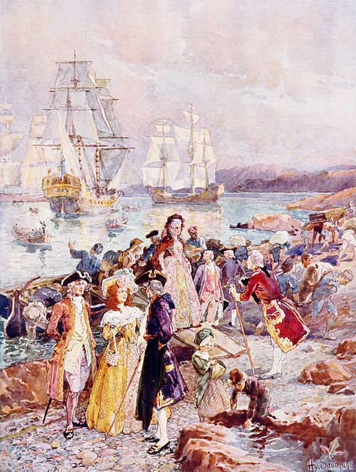
The Coming of the Loyalists by Henry Sandham, depicting the arrival of the loyalists to New Brunswick
St. John River campaign
Videos
Page
The St. John River campaign occurred during the French and Indian War when Colonel Robert Monckton led a force of 1150 British soldiers to destroy the Acadian settlements along the banks of the Saint John River until they reached the largest village of Sainte-Anne des Pays-Bas in February 1759. Monckton was accompanied by Captain George Scott as well as New England Rangers led by Joseph Goreham, Captain Benoni Danks, as well as William Stark and Moses Hazen, both of Rogers' Rangers.

Robert Monckton, British commander in the Saint John River campaign

Boishebert (1753)

St. John River campaign: The construction of Fort Frederick (1758) by Thomas Davies
St. John River campaign: A View of the Plundering and Burning of the City of Grimross (present day Arcadia, New Brunswick) by Thomas Davies in 1758. This is the only contemporaneous image of the expulsion of the Acadians.