History of the ancient Levant
The Levant is the area in Southwest Asia, south of the Taurus Mountains, bounded by the Mediterranean Sea in the west, the Arabian Desert in the south, and Mesopotamia in the east. It stretches roughly 400 mi (640 km) north to south, from the Taurus Mountains to the Sinai desert and Hejaz, and east to west between the Mediterranean Sea and the Khabur river. The term is often used to refer to the following regions or modern states: the Hatay Province of Turkey, Syria, Lebanon, Israel, Palestine, and Jordan. The term sometimes include Cilicia, Cyprus and the Sinai Peninsula.
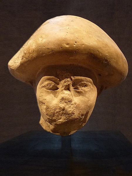
An Asiatic official from Avaris wearing the mushroom-headed hairstyle
The Levant is an approximate historical geographical term referring to a large area in the Eastern Mediterranean region of West Asia and core territory of the political term Middle East. In its narrowest sense, which is in use today in archaeology and other cultural contexts, it is equivalent to Cyprus and a stretch of land bordering the Mediterranean Sea in western Asia: i.e. the historical region of Syria, which includes present-day Israel, Jordan, Lebanon, Syria, the Palestinian territories and most of Turkey southwest of the middle Euphrates. Its overwhelming characteristic is that it represents the land bridge between Africa and Eurasia. In its widest historical sense, the Levant included all of the Eastern Mediterranean with its islands; that is, it included all of the countries along the Eastern Mediterranean shores, extending from Greece in Southern Europe to Cyrenaica, Eastern Libya in Northern Africa.
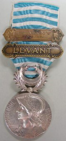
French medal commemorating the Franco-Turkish War in Cilicia, c. 1920
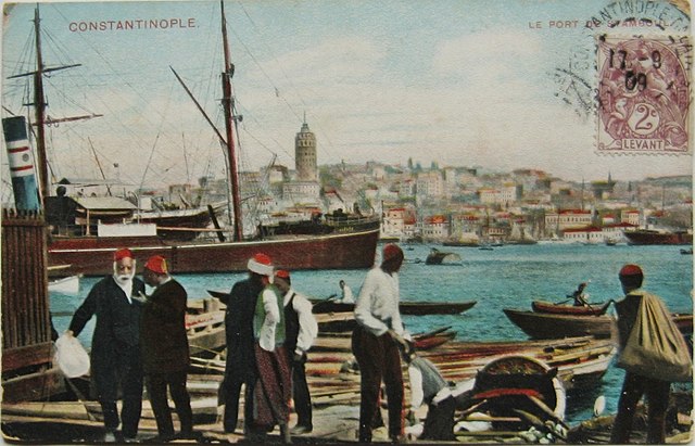
1909 postcard depicting Ottoman Constantinople and bearing a French stamp inscribed "Levant"