Hoover Dam
Videos
The Hoover Dam is a concrete arch-gravity dam in the Black Canyon of the Colorado River, on the boundary between the U.S. states of Nevada and Arizona. Constructed between 1931 and 1936, during the Gr
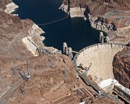
2017 Aerial view Hoover Dam 4774

River view of the future dam site, c. 1904

Sketch of the proposed dam site and reservoir, c. 1921

Workers on a "Jumbo Rig"; used for drilling the Hoover Dam's tunnels
The Mike O'Callaghan–Pat Tillman Memorial Bridge is an arch bridge that spans the Colorado River between the U.S. states of Arizona and Nevada. The bridge is located within the Lake Mead National Recr
Hoover Dam
…tourist attraction, with 7 million tourists a year. The heavily traveled U.S. Route 93 (US 93) ran along the dam's crest until October 2010, when the Hoover Dam Bypass opened. As the United States developed the Southwest, the Colorado River was seen as a potential source of irrigation water. An initial attempt at…

The bridge in front of the Hoover Dam

The Mike O'Callaghan–Pat Tillman Memorial Bridge in front of the Hoover Dam

The completed bridge viewed from the Nevada side in December 2010

View from Hoover Dam