Hudson River Waterfront Walkway
The Hudson River Waterfront Walkway, also known as the Hudson River Walkway, is a promenade along the Hudson Waterfront in New Jersey. The ongoing and incomplete project located on Kill van Kull and the western shore of Upper New York Bay and the Hudson River was implemented as part of a New Jersey state-mandated master plan to connect the municipalities from the Bayonne Bridge to the George Washington Bridge with an urban linear park and provide contiguous unhindered access to the water's edge.
Walkway adjacent to Liberty National Golf Course
Bayonne Bridge at sunset
Plaque marking site of the Black Tom explosion
Flags at half-staff in Liberty State Park
The Hudson Waterfront is an urban area of northeastern New Jersey along the lower reaches of the Hudson River, the Upper New York Bay and the Kill van Kull. Though the term can specifically mean the shoreline, it is often used to mean the contiguous urban area between the Bayonne Bridge and the George Washington Bridge that is approximately 19 miles (31 km) long. Historically, the region has been known as Bergen Neck, the lower peninsula, and Bergen Hill, lower Hudson Palisades. It has sometimes been called the Gold Coast.
Hudson Waterfront
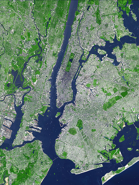
Satellite image showing the inner core of the New York–New Jersey Harbor Estuary and main waterways of Port of New York and New Jersey. The Hudson Waterfront is situated on the peninsula between the Hudson and Hackensack Rivers, and their bays.
Ellis Island and Downtown Jersey City looking north


