Huehuetenango is one of the 22 departments of Guatemala. It is located in the western highlands and shares the borders with the Mexican state of Chiapas in the north and west; with El Quiché in the east, and Totonicapán, Quetzaltenango and San Marcos in the south. The capital is the city of Huehuetenango.
Counterclockwise from top: Zaculeu in the city of Huehuetenango, Cenotes de Candelaria in Nenton, Hoyo Cimarron in La Trinidad Nenton, Catarata de Pajaj in San Pedro Soloma, Lagartero river in Nenton and Laguna Brava in Nenton Huehuetenango
Bridge over the San Juan River near its source which is one of the principal tourist attractions in the department.
San Mateo Ixtatán.
The Maya ruins of Zaculeu, near Huehuetenango city
Chiapas, officially the Free and Sovereign State of Chiapas, is one of the states that make up the 32 federal entities of Mexico. It comprises 124 municipalities as of September 2017 and its capital and largest city is Tuxtla Gutiérrez. Other important population centers in Chiapas include Ocosingo, Tapachula, San Cristóbal de las Casas, Comitán, and Arriaga. Chiapas is the southernmost state in Mexico, and it borders the states of Oaxaca to the west, Veracruz to the northwest, and Tabasco to the north, and the Petén, Quiché, Huehuetenango, and San Marcos departments of Guatemala to the east and southeast. Chiapas has a significant coastline on the Pacific Ocean to the southwest.
Jaguar sculpture from Cintalapa dating between 1000 and 400 BCE on display at the Regional Museum of Anthropology and History of Chiapas.
The Palace at Palenque
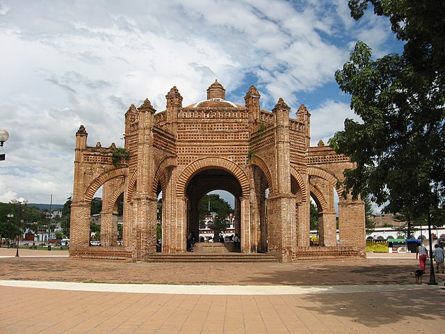
The Royal Crown centered in the main plaza of Chiapa de Corzo built in 1562.
Remnants of frescos at the Saint Mark Cathedral of Tuxtla Gutiérrez


