Hurricane Omar was a powerful tropical cyclone that took an unusual southwest to northeast track through the eastern Caribbean Sea during mid-October 2008. Forming out of a tropical disturbance on October 13, Omar initially moved slowly in the eastern Caribbean Sea. By October 15, Omar began to quickly intensify as deep convection developed around the center of circulation. Later that day, an eye developed and the storm began to accelerate to the northeast. Early on October 16, Omar reached its peak intensity with maximum winds of 130 mph (210 km/h) and a barometric pressure of 958 mbar. Shortly after, the hurricane rapidly weakened to Category 1 intensity. After slightly re-strengthening the next day, Omar weakened to a tropical storm before degenerating into a non-convective low pressure area. The remnants of Omar persisted until October 21, at which time they dissipated to the west of the Azores.
Omar near peak intensity on October 16
Hurricane Omar at its secondary peak with winds of 85 mph (137 km/h)
Damage from Hurricane Omar in Aruba
Hurricane Omar passing through the Leeward Islands on October 16
United States Virgin Islands
The United States Virgin Islands, officially the Virgin Islands of the United States, are a group of Caribbean islands and an unincorporated and organized territory of the United States. The islands are geographically part of the Virgin Islands archipelago and are located in the Leeward Islands of the Lesser Antilles.
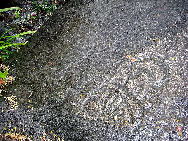
Ancient petroglyphs in the Virgin Islands National Park
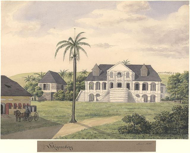
The Høgensborg estate on Sankt Croix, 1833
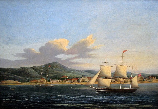
Frederiksstad on Saint Croix, 1848
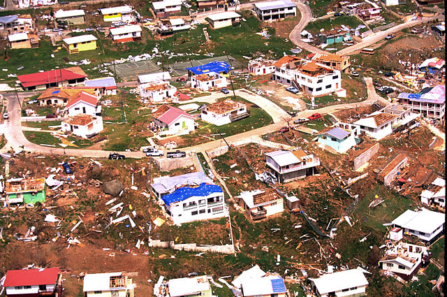
The aftermath of Hurricane Marilyn on the island of St. Thomas, 1995. In recent decades the U.S. Virgin Islands have been devastated by a series of hurricanes.