Hurricane Wilma was the most intense tropical cyclone ever recorded in the Atlantic basin, and the second-most intense tropical cyclone recorded in the Western Hemisphere, after Hurricane Patricia in 2015. Part of the record-breaking 2005 Atlantic hurricane season, which included three of the ten most intense Atlantic hurricanes in terms of barometric pressure, Wilma was the twenty-second storm, thirteenth hurricane, sixth major hurricane, fourth Category 5 hurricane, and the second-most destructive hurricane of the 2005 season. Its origins came from a tropical depression that formed in the Caribbean Sea near Jamaica on October 15, headed westward, and intensified into a tropical storm two days later, which abruptly turned southward and was named Wilma. Wilma continued to strengthen, and eventually became a hurricane on October 18. Shortly thereafter, explosive intensification occurred, and in only 24 hours, Wilma became a Category 5 hurricane with wind speeds of 185 mph (298 km/h).
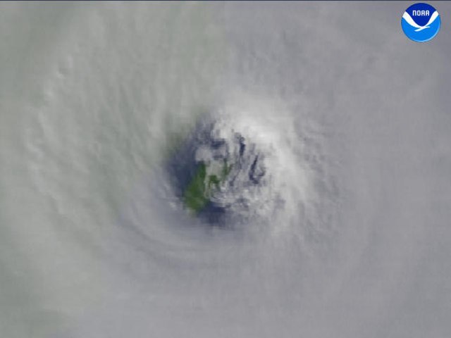
The island of Cozumel is shown through the eye of Hurricane Wilma in this composite image. NOAA.
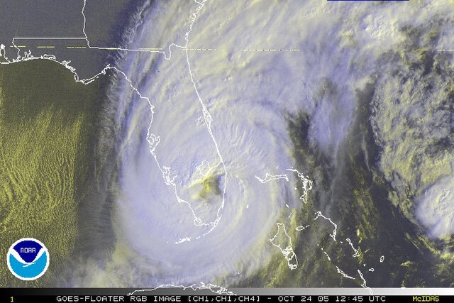
The eye of Wilma over Florida, shortly after landfall. Tropical Depression Alpha can be seen to the right.
Storm surge from Wilma on Key Haven, island suburb of Key West, Florida
Heavy façade damage to a building in Fort Lauderdale
An Atlantic hurricane is a type of tropical cyclone that forms in the Atlantic Ocean primarily between June and November. The terms "hurricane", "typhoon", and "cyclone" can be used interchangeably to describe this weather phenomenon. These storms are rotating, organized systems of clouds and thunderstorms that originate over tropical or subtropical waters and have closed low-level circulation, not to be confused with tornadoes. They form over low pressure systems. In the North Atlantic, central North Pacific, and eastern North Pacific, the term "hurricane" is mainly used, whereas "typhoon" is more commonly used for storms originating in the western North Pacific. The term "cyclone" is used in the South Pacific and Indian Ocean.
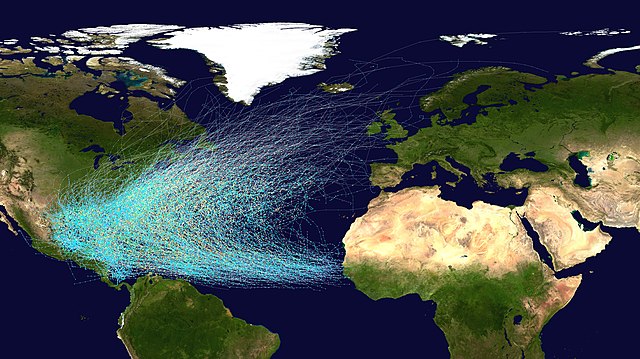
Tracks of North Atlantic tropical cyclones from 1851 to 2019
The subtropical ridge (in the Pacific) shows up as a large area of black (dryness) on this water vapor satellite image from September 2000
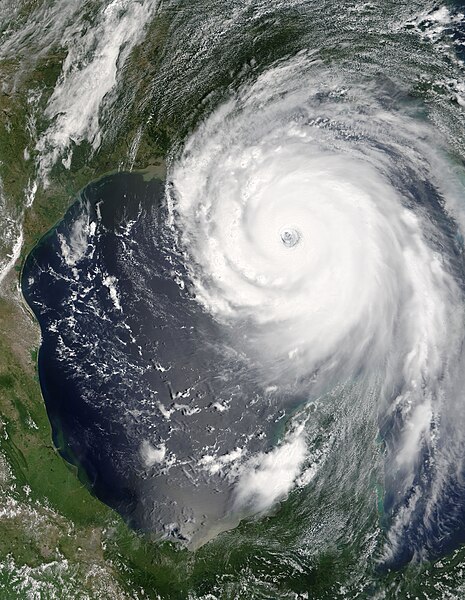
Hurricane Katrina was the costliest and one of the five deadliest hurricanes in the history of the United States.