Husborne Crawley is a small village and civil parish in Bedfordshire, England, located close to Junction 13 of the M1 motorway. The village touches the borders of the Woburn Abbey estate on one side, and the village of Aspley Guise on the other. The meaning of the Husborne element of the towns name is "warrior stream" and the Crawley element means "crow clearing". It appears as Hussheburn Crawele, in 1421.
St. James' Church
A graph showing the total Husborne Crawley Population from 1801 to 2011, as reported by the Vision of Britain website and Census information.
Image: Occupation Chart for Husbourne Crawley 1881
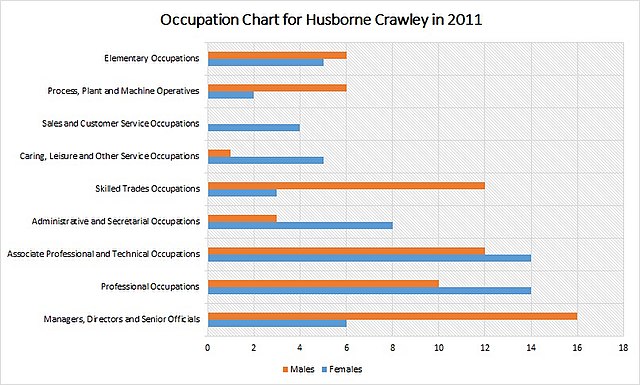
Image: Occupation Chart for Husbourne Crawley 2011
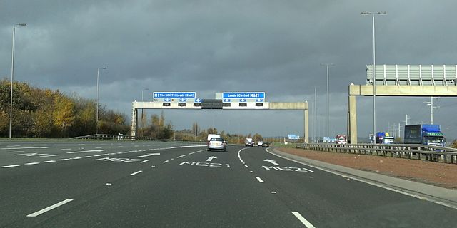
The M1 motorway connects London to Leeds, where it joins the A1(M) near Aberford, to connect to Newcastle. It was the first inter-urban motorway to be completed in the UK; the first motorway in the country was the Preston Bypass, which later became part of the M6.
Looking north towards junction 37 on one of the few stretches that remain three-lane
Looking north from B579 bridge at Chalton. Former cement works at Sundon to the right (May 1958)
Looking north from a similar position south of Toddington services (July 1959)
The M1 and M621 interchange on the northbound carriageways at Leeds