The Iapygia quadrangle is one of a series of 30 quadrangle maps of Mars used by the United States Geological Survey (USGS) Astrogeology Research Program. The Iapygia quadrangle is also referred to as MC-21. It was named after the heel of the boot of Italy. That name was given by the Greeks It is part of a region of Italy named Apulia. The name Iapygia was approved in 1958.
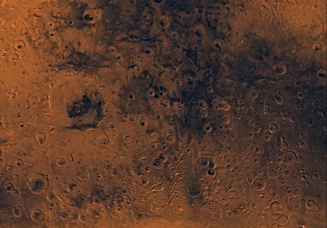
Image of the Iapygia Quadrangle (MC-21). Most of the region contains heavily cratered and dissected highlands. The west-central part contains Huygens crater. The southern one-third includes the northern rim of the Hellas basin.
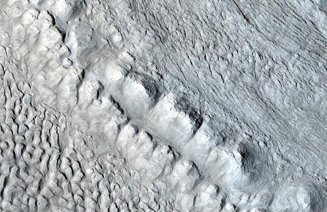
Wide view of dike near the crater Huygens, as seen by HiRISE
Close view of dike near the crater Huygens, as seen by HiRISE
Dike near the crater Huygens shows up as narrow dark line running from upper left to lower right, as seen by THEMIS.
Terra Sabaea is a large area on Mars. Its coordinates are 2°N 42°E and it covers 4,700 kilometres (2,900 mi) at its broadest extent. It was named in 1979 after a classic albedo feature on the planet. Terra Sabaea is fairly large and parts of it are found in five quadrangles: Arabia quadrangle, Syrtis Major quadrangle, Iapygia quadrangle, Ismenius Lacus quadrangle, and Sinus Sabaeus quadrangle.
Romer Lake's Elephant Foot Glacier in the Earth's Arctic, as seen by Landsat 8. This picture shows several glaciers that have the same shape as many features on Mars that are believed to also be glaciers.
Mesa in Ismenius Lacus quadrangle, as seen by CTX. Mesa has several glaciers eroding it. One of the glaciers is seen in greater detail in the next two images from HiRISE.
Enlargement of area in rectangle of the previous image. On Earth the ridge would be called the terminal moraine of an alpine glacier. Picture taken with HiRISE under the HiWish program.
Remains of glaciers, as seen by HiRISE under the HiWish program.