Indian subcontinent
Videos
The Indian subcontinent is a physiographical region in Southern Asia, mostly situated on the Indian Plate, projecting southwards into the Indian Ocean from the Himalayas. Geopolitically, it spans major landmasses from the countries of Bangladesh, Bhutan, India, the Maldives, Nepal, Pakistan, and Sri Lanka. The neighboring geographical regions around the subcontinent include the Tibetan Plateau to the north, the Indochinese Peninsula to the east, the Iranian Plateau to the west, and the Indian Ocean to the south. Although the terms "Indian subcontinent" and "South Asia" are often used interchangeably to denote the region, the geopolitical term of South Asia frequently includes Afghanistan, which is not part of the subcontinent.
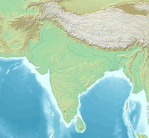
Image: South Asia non political, with rivers

The Indus is a major river of the north-west of the Indian subcontinent.

The rocky interiors of the Himalayas
Gondwana
Videos
Gondwana was a large landmass, sometimes referred to as a supercontinent. The remnants of Gondwana make up around two-thirds of today's continental area, including South America, Africa, Antarctica, Australia, Zealandia, Arabia, and the Indian Subcontinent.

Reconstruction showing final stages of assembly of Gondwana, 550 Mya

Banksia, a grevilleoid Proteaceae, is an example of a plant from a family with a Gondwanan distribution

The plant genus Nothofagus provides a good example of a taxon with a Gondwanan distribution, having originated in the supercontinent and existing in present-day Australia, New Zealand, New Caledonia, and South America's Southern Cone. Fossils have also been found in Antarctica.
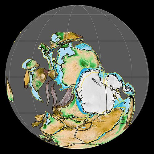
Image: Geology of Asia 450.Ma