Inn (river)
Videos
Page
The Inn is a river in Switzerland, Austria and Germany. The 518 km (322 mi) long river is a right tributary of the Danube, being the third largest tributary of the Danube by discharge. The highest point of its drainage basin is the summit of Piz Bernina at 4,049 m (13,284 ft). The Engadine, the valley of the En, is the only Swiss valley whose waters end up in the Black Sea.

Lower Inn valley from Rattenberg castle

View of the Lower Inn Valley. On the right is the entrance to the Ziller Valley.
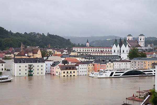
The Old City of Passau during the flood
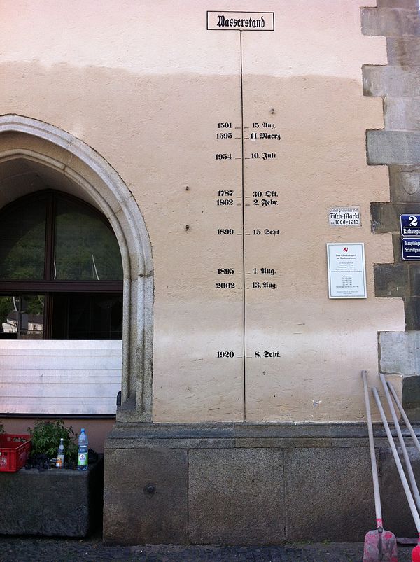
Water level marks on the Town Hall in Passau
Piz Bernina
Videos
Page
Piz Bernina is the highest mountain in the Eastern Alps, the highest point of the Bernina Range, and the highest peak in the Rhaetian Alps. It rises 4,048 m (13,281 ft) and is located south of Pontresina and near the major Alpine resort of St. Moritz, in the Engadin valley. It is also the most easterly mountain higher than 4,000 m (13,000 ft) in the Alps, the highest point of the Swiss canton of Graubünden, and the fifth-most prominent peak in the Alps. Although the summit lies within Switzerland, the massif is on the border with Italy. The "shoulder" known as La Spedla is the highest point in the Italian Lombardy region.

Piz Bernina with the Biancograt to the right

Piz Bernina and the Morteratsch Glacier

Spherical panorama from Piz Bernina
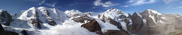
Panorama from Diavolezza. From left to right: Piz Palü, Bellavista, Crast' Agüzza (small rocky peak in the middle), Piz Bernina and Piz Morteratsch