The Interior Plains is a vast physiographic region that spreads across the Laurentian craton of central North America, extending along the east flank of the Rocky Mountains from the Gulf Coast region to the Arctic Beaufort Sea. In Canada, it encompasses the Canadian Prairies separating the Canadian Rockies from the Canadian Shield, as well as the Boreal Plains and Taiga Plains east of the Mackenzie and Richardson Mountains; while in the United States, it includes the Great Plains of the West/Midwest and the tallgrass prairie region to the south of the Great Lakes extending east to the Appalachian Plateau region.
Loess Hills in western Iowa along I-80.
The Rocky Mountains, also known as the Rockies, are a major mountain range and the largest mountain system in North America. The Rocky Mountains stretch 3,000 miles in straight-line distance from the northernmost part of western Canada, to New Mexico in the southwestern United States. Depending on differing definitions between Canada and the U.S., its northern terminus is located either in northern British Columbia's Terminal Range south of the Liard River and east of the Trench, or in the northeastern foothills of the Brooks Range/British Mountains that face the Beaufort Sea coasts between the Canning River and the Firth River across the Alaska-Yukon border. Its southernmost point is near the Albuquerque area adjacent to the Rio Grande rift and north of the Sandia–Manzano Mountain Range. Being the easternmost portion of the North American Cordillera, the Rockies are distinct from the tectonically younger Cascade Range and Sierra Nevada, which both lie farther to its west.
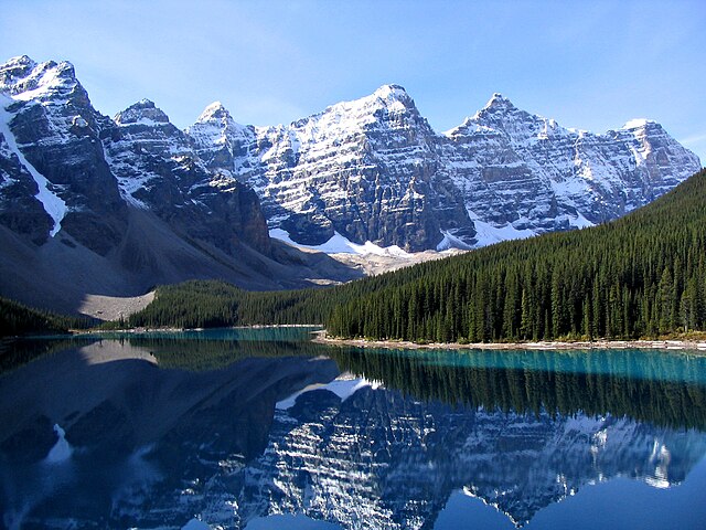
Moraine Lake and the Valley of the Ten Peaks, Banff National Park, Alberta, Canada
The Santa Fe Mountains at the southern end of the Rockies as seen from the Sandia Crest in New Mexico
The summits of the Teton Range in Wyoming
Mount Robson in British Columbia


