Interstate 84 (I-84) in the U.S. state of Oregon is a major Interstate Highway that traverses the state from west to east. It is concurrent with U.S. Route 30 (US 30) for most of its length and runs 376 miles (605 km) from an interchange with I-5 in Portland to the Idaho state line near Ontario. The highway roughly follows the Columbia River and historic Oregon Trail in northeastern Oregon, and is designated as part of Columbia River Highway No. 2 and all of the Old Oregon Trail Highway No. 6; the entire length is also designated as the Vietnam Veterans Memorial Highway. I-84 intersects several of the state's main north–south roads, including US 97, US 197, I-82, and US 395.
The northbound approach on I-5 near its interchange with I-84 in Portland
View of I-84 in the Columbia River Gorge, looking east from Rowena Crest
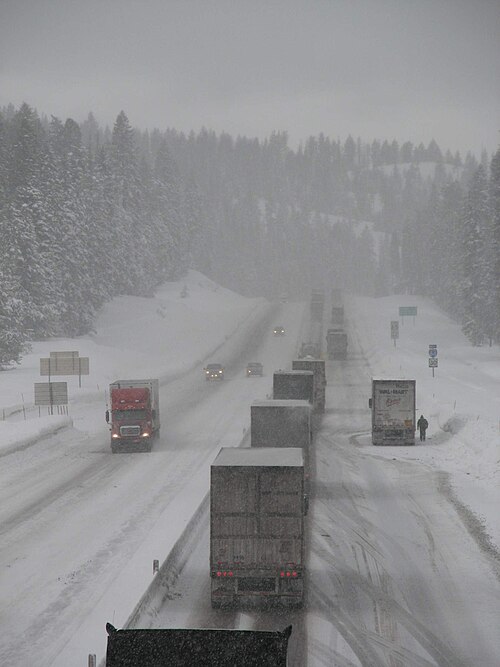
A queue of trucks on a section of I-84 near Meacham, waiting to install snow chains
An Interstate 80N shield seen at Corbett in 1973
The Columbia River Gorge is a canyon of the Columbia River in the Pacific Northwest of the United States. Up to 4,000 feet (1,200 m) deep, the canyon stretches for over eighty miles (130 km) as the river winds westward through the Cascade Range, forming the boundary between the state of Washington to the north and Oregon to the south. Extending roughly from the confluence of the Columbia with the Deschutes River in the east down to the eastern reaches of the Portland metropolitan area, the water gap furnishes the only navigable route through the Cascades and the only water connection between the Columbia Plateau and the Pacific Ocean. It is thus that the routes of Interstate 84, U.S. Route 30, Washington State Route 14, and railroad tracks on both sides run through the gorge.
Looking east up the Columbia River Gorge from near Multnomah Falls.
Image: Wpdms nasa topo columbia river gorge
Bridal Veil Falls in Autumn
A view of the Columbia River Gorge from near the top of Mt. Hamilton, looking south from the Washington side of the gorge. On the far left side of the image, the Bonneville Dam is visible. On the left-center is the small town of North Bonneville. Behind the hills in the center of the image, the peak of Mt. Hood is just barely visible. The large rock at the river's edge on the right side is Beacon Rock, which is 848 feet (258 m) tall. The high point to the right of center is