Inundation, Gibraltar
Videos
Photos
The Inundation was a flooded and fortified area of ground on the sandy isthmus between Spain and Gibraltar, created by the British in the 18th century to restrict access to the territory as part of the fortifications of Gibraltar. It was originally a marshy area known as the Morass at the far south-western end of the isthmus, occupying the area adjacent to the north-western flank of the Rock of Gibraltar. The Morass was dug out and expanded to create an artificial lake which was further obstructed by iron and wooden obstacles in the water. Two small fortifications on either side controlled access to Gibraltar. The only road to and from the town ran along a narrow causeway between the Inundation and the sea which was enfiladed by batteries mounted on the lower slopes of the Rock. The Inundation existed for about 200 years before it was infilled and built over after the Second World War.

View over the Neutral Ground and Inundation from British positions on the Rock of Gibraltar, depicted in 1828

The Inundation seen from the Upper Lines, 1870s
Fortifications of Gibraltar
Videos
Photos
The Gibraltar peninsula, located at the far southern end of Iberia, has great strategic importance as a result of its position by the Strait of Gibraltar where the Mediterranean Sea meets the Atlantic Ocean. It has repeatedly been contested between European and North African powers and has endured fourteen sieges since it was first settled in the 11th century. The peninsula's occupants – Moors, Spanish, and British – have built successive layers of fortifications and defences including walls, bastions, casemates, gun batteries, magazines, tunnels and galleries. At their peak in 1865, the fortifications housed around 681 guns mounted in 110 batteries and positions, guarding all land and sea approaches to Gibraltar. The fortifications continued to be in military use until as late as the 1970s and by the time tunnelling ceased in the late 1960s, over 34 miles (55 km) of galleries had been dug in an area of only 2.6 square miles (6.7 km2).

A 5.25 inch quick-firing dual-purpose gun at Princess Anne's Battery, Gibraltar
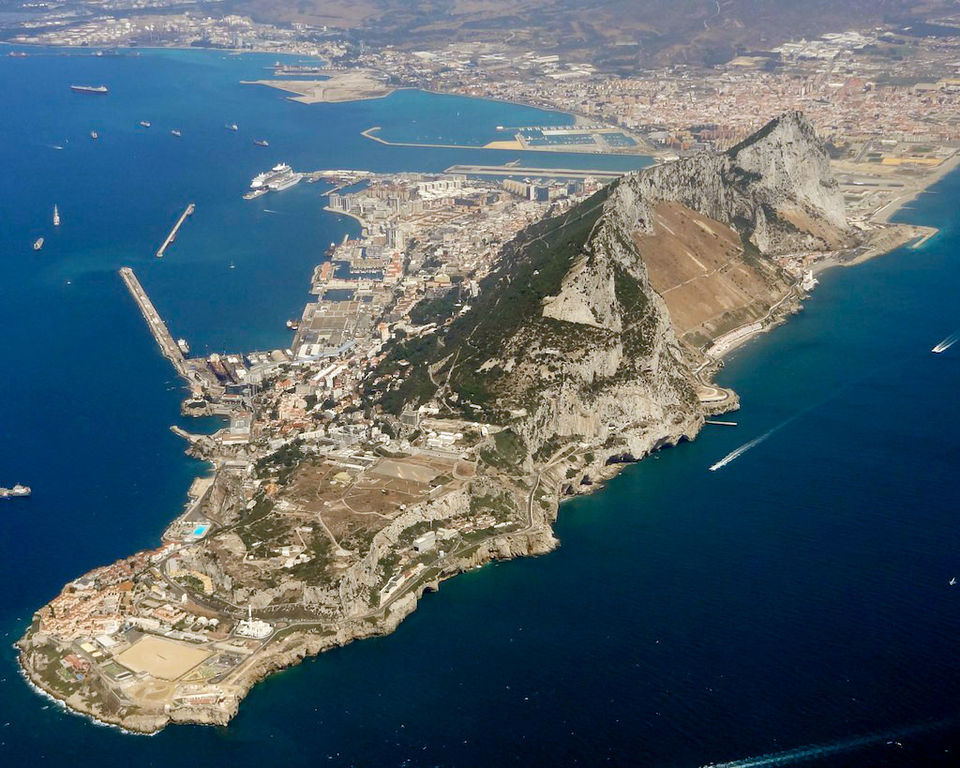
An aerial view of modern Gibraltar, looking north-west

Part of the Moorish city wall with a tower en bec, topped with merlons

The Charles V Wall, built in 1540 and strengthened in 1552 by King Charles I of Spain (Charles V of the Holy Roman Empire)