Iturup
Videos
Photos
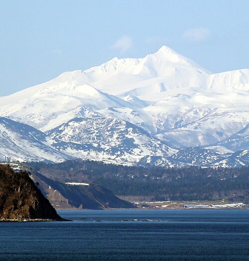
Iturup, also historically known by other names, is an island in the Kuril Archipelago separating the Sea of Okhotsk from the North Pacific Ocean. The town of Kurilsk, administrative center of Kurilsky District, is located roughly midway along its western shore. Iturup is the largest and northernmost of the southern Kurils, ownership of which is disputed by Japan and Russia. It is located between Kunashiri 19 km (12 mi) to its southwest and Urup 37 km (23 mi) to its northeast. The Vries Strait between Iturup and Urup forms the Miyabe Line dividing the predominant plants of the Kurils.

"Staten Eylant" between Hokkaido ("Eso") and the imaginary continent of "Companies Land" on Jan Janssonius's 1654 New and Accurate Description of Japan, the Land of Eso, and Adjacent Islands

Volcanoes of Iturup

Kurilsk, 1981

Iturup, 1981
Kuril Islands
Videos
Photos
The Kuril Islands or Kurile Islands are a volcanic archipelago administered as part of Sakhalin Oblast in the Russian Far East. The islands stretch approximately 1,300 km (810 mi) northeast from Hokkaido in Japan to Kamchatka Peninsula in Russia, separating the Sea of Okhotsk from the north Pacific Ocean. There are 56 islands and many minor islets. The Kuril Islands consist of the Greater Kuril Chain and, at the southwest end, the parallel Lesser Kuril Chain. They cover an area of around 10,503.2 square kilometres (4,055.3 sq mi), with a population of roughly 20,000.

A coastline along one of the Kuril Islands

Caldera of the island Ushishir
Stratovolcano Mt. Ruruy; view from Yuzhno-Kurilsk

Kuril Ainu people next to their traditional dwelling.