Jacques Cartier
Videos
Jacques Cartier was a French-Breton maritime explorer for France. Jacques Cartier was the first European to describe and map the Gulf of Saint Lawrence and the shores of the Saint Lawrence River, which he named "The Country of Canadas" after the Iroquoian names for the two big settlements he saw at Stadacona and at Hochelaga.


This Spanish chart of the Saint Lawrence River, from c. 1541, contains a legend in front of the "isla de Orliens" that says: "Here many French died of hunger"; possibly alluding to Cartier's second settlement in 1535–1536.

The Fleet of Cartier was commemorated on a 1908 Canadian postage stamp.

Plaque on the statue of Jacques Cartier in front of the Gabrielle-Roy public library, in the Saint-Roch neighbourhood of Quebec City.
Francis I of France
Videos
Francis I was King of France from 1515 until his death in 1547. He was the son of Charles, Count of Angoulême, and Louise of Savoy. He succeeded his first cousin once removed and father-in-law Louis XII, who died without a legitimate son.


Francis I, c. 1527–1530

Francis I painted in 1515

Francis I receiving the last breath of Leonardo da Vinci in 1519, by Ingres, painted in 1818
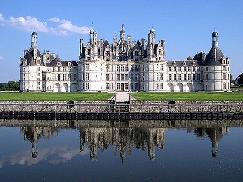
Francis's Château de Chambord displays a distinct French Renaissance architecture.