January 31 – February 3, 2021 nor'easter
Videos
Photos
The January 31 – February 3, 2021 nor'easter, also known as the 2021 Groundhog Day nor'easter, was a powerful, severe, and erratic nor'easter that impacted much of the Northeastern United States and Eastern Canada from February 1–3 with heavy snowfall, blizzard conditions, strong gusty winds, storm surge, and coastal flooding. The storm first developed as an extratropical cyclone off the West Coast of the United States on January 25, with the storm sending a powerful atmospheric river into West Coast states such as California, where very heavy rainfall, snowfall, and strong wind gusts were recorded, causing several hundred thousand power outages and numerous mudslides. The system moved ashore several days later, moving into the Midwest and dropping several inches of snow across the region. On February 1, the system developed into a nor'easter off the coast of the Northeastern U.S., bringing prolific amounts of snowfall to the region. Large metropolitan areas such as Boston and New York City saw as much as 18–24 inches (46–61 cm) of snow accumulations from January 31 to February 2, making it the worst snowstorm to affect the megalopolis since the January 2016 blizzard. It was given the unofficial name Winter Storm Orlena by The Weather Channel.

GOES-16 satellite image of the nor'easter impacting the Northeastern United States at 18:00 UTC (1:00 p.m. EST) on February 1

Snowfall forecast for the Northeastern United States issued late on January 31

A panoramic view of 21.5 inches (55 cm) of snow from the nor'easter burying the ground in Lexington, MA on February 2

GOES-16 geostationary imagery of the winter storm impacting the West Coast on January 27
Nor'easter
Videos
Photos
A nor'easter, is a large-scale extratropical cyclone in the western North Atlantic Ocean. The name derives from the direction of the winds that blow from the northeast. The term is commonly used in the winter in New England and Atlantic Canada.

Nor'easter off the New England coast of the United States responsible for the January 2018 North American blizzard

Compass card (1607), featuring the spelling "Noreast"
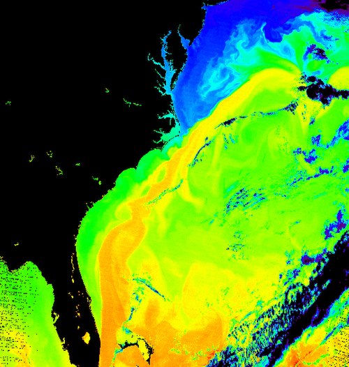
Surface temperature of the sea off the east coast of North America. The corridor in yellow gives the position of the Gulf Stream.