Jelep La
Videos
Page
Jelep La elevation 14,390 feet (4,390 m), is a high mountain pass between Sikkim, India and Tibet Autonomous Region, China. It is on a route that connects Lhasa to India. The pass is about 4 km (2.5 mi) south of Nathu La and is slightly higher. It was frequently used for trade between Tibet and India during the British Raj, with Kalimpong serving as the contact point. The Menmecho Lake lies below the Jelep La.
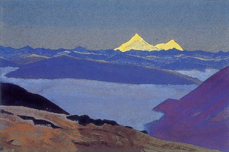
Jelep La Tibetan Frontier by Nicholas Roerich
Nathu La
Videos
Page
Nathu La(Tibetan: རྣ་ཐོས་ལ་, Wylie: Rna thos la, THL: Na tö la, Sikkimese: རྣ་ཐོས་ལ་) is a mountain pass in the Dongkya Range of the Himalayas between China's Yadong County in Tibet, and the Indian states of Sikkim. But minor touch of Bengal in South Asia. The pass, at 4,310 m (14,140 ft), connects the towns of Kalimpong and Gangtok to the villages and towns of the lower Chumbi Valley.

Image: Nathu La, a mountain pass in the Himalayas on the Indo China Border

Image: Nathula Pass Border trade road panoramio
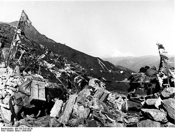
The German expedition to Tibet crossing Nathu La.

Sikkim, Chumbi Valley, with the Nathu La pass (CIA, 1965).