Jurong Island is an island located to the southwest of the main island of Singapore. It was formed from the amalgamation of seven offshore islands, the islands of Pulau Ayer Chawan, Pulau Ayer Merbau, Pulau Merlimau, Pulau Pesek, Pulau Pesek Kechil, Pulau Sakra, Pulau Seraya, Pulau Meskol, Pulau Mesemut Laut, Pulau Mesemut Darat and Anak Pulau. This was done through Singapore's land reclamation efforts. Land reclamation on Jurong Island was completed on 25 September 2009, 20 years earlier than scheduled. Pulau Buaya was joined to Jurong Island via reclamation in 2010. Jurong Island forms a land area of about 32 km2 (12 sq mi) from an initial area of less than 10 km2 (4 sq mi), and is the largest of Singapore's outlying islands.
Jurong Island, photographed in February 2011
Jurong Island lies in the background of this panoramic view of Jurong Industrial Estate. The Jurong Pier Flyover and the island of Pulau Damar Laut, with Jurong Island Highway that leads to Jurong Island, can be seen on the left.
Land reclamation in Singapore
The reclamation of land from surrounding waters is used in Singapore to expand the city-state's limited area of usable, natural land. Land reclamation is most simply done by adding material such as rocks, soil and cement to an area of water; alternatively submerged wetlands or similar biomes can be drained.
Singapore has utilized extensive land reclamation to expand beyond its original geographical borders.
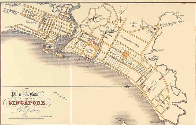
Stamford Raffles's plan for the Town of Singapore, 1822.
Modern Singapore's Marina Bay area, a development made possible through land reclamation
A sand mining boat dredges Cambodia's Tatai River.