K2
Videos
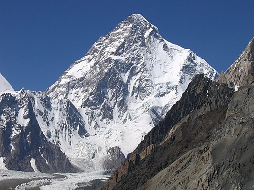
K2, at 8,611 metres (28,251 ft) above sea level, is the second-highest mountain on Earth, after Mount Everest at 8,849 metres (29,032 ft). It lies in the Karakoram range, partially in the Gilgit-Baltistan region of Pakistan-administered Kashmir and partially in the China-administered Trans-Karakoram Tract in the Taxkorgan Tajik Autonomous County of Xinjiang.

K2 from Broad Peak Base Camp

Montgomerie's original sketch from 1856 in which he applied the notation K2

View above Camp-IV of K2

The west face of K2 taken from the Savoia Glacier, on the 1909 expedition
Eight-thousander
Videos
The eight-thousanders are the 14 mountains recognised by the International Mountaineering and Climbing Federation (UIAA) as being more than 8,000 metres (26,247 ft) in height above sea level, and sufficiently independent of neighbouring peaks. There is no precise definition of the criteria used to assess independence, and at times, the UIAA has considered whether the list should be expanded to 20 mountain peaks by including the major satellite peaks of eight-thousanders. All of the eight-thousanders are located in the Himalayan and Karakoram mountain ranges in Asia, and their summits lie in an altitude known as the death zone.

Flight over the Khumbu region; six eight-thousanders are visible

Edurne Pasaban, the first woman to climb all 14 after Oh Eun-sun's claim was disputed

Gerlinde Kaltenbrunner, the first woman to climb all 14 without oxygen

No. 1 – Mount Everest