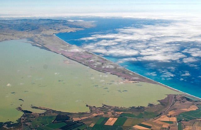
Kaitorete Spit is a long finger of land which extends along the coast of Canterbury in the South Island of New Zealand. It runs west from Banks Peninsula for 25 kilometres, and separates the shallow Lake Ellesmere / Te Waihora from the Pacific Ocean. It is technically a continuous barrier beach, though at its western end it tapers to a point less than 100 metres in width which is occasionally breached at high tide. The spit is noted for its isolation and for its pebbly beaches. At its eastern end is the small settlement of Birdlings Flat, and west of its narrowest point is the settlement of Taumutu.
Kaitorete Spit separating Lake Ellesmere / Te Waihora from the Canterbury Bight
Kaitorete Spit to the south of Lake Ellesmere / Te Waihora, with Christchurch and Lyttelton Harbour to the north
Lake Ellesmere / Te Waihora
Lake Ellesmere / Te Waihora is a broad, shallow coastal lake or waituna, in the Canterbury region of the South Island of New Zealand. It is directly to the west of Banks Peninsula, separated from the Pacific Ocean by the long, narrow, sandy Kaitorete Spit, or more correctly Kaitorete Barrier. It lies partially in extreme southeastern Selwyn District and partially in the southwestern extension of the former Banks Peninsula District, which now is a ward in the city of Christchurch. The lake holds high historical and cultural significance to the indigenous Māori population and the traditional Māori name Te Waihora, means spreading waters. It has officially had a dual English/Māori name since at least 1938.
Aerial view of Lake Ellesmere / Te Waihora
Little River Rail Trail near Lake Ellesmere / Te Waihora
Riparian protection zone on the banks of Hart Creek, in the Selwyn River Catchment, Canterbury


