Kamikita Expressway
Videos
Page
The Kamikita Expressway is a free two-lane expressway in Aomori Prefecture connecting the towns of Shichinohe and Rokunohe. Alongside other tolled roads, the expressway is part of a series of highways that will link the Hachinohe Expressway to the Aomori Expressway. The road is managed by the Ministry of Land, Infrastructure and Transport and is numbered E4A as an extension of the Tōhoku Expressway. It is routed concurrently with an alternate route of Japan National Route 45.
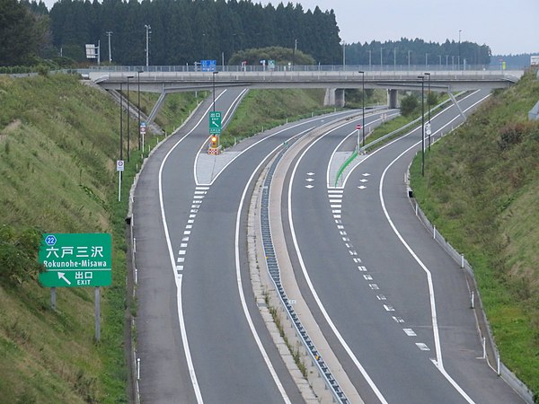
The Kamikita Expressway at Rokunohe-Misawa Interchange

Drivers wait in the minutes before the opening of the section of the Kamikita Expressway between National Route 394 and Aomori Prefecture Route 211.
Aomori Prefecture
Videos
Page
Aomori Prefecture ([a̠o̞mo̞ɾʲikẽ̞ɴ]) is a prefecture of Japan in the Tōhoku region. The prefecture's capital, largest city, and namesake is the city of Aomori. Aomori is the northernmost prefecture on Japan's main island, Honshu, and is bordered by the Pacific Ocean to the east, Iwate Prefecture to the southeast, Akita Prefecture to the southwest, the Sea of Japan to the west, and Hokkaido across the Tsugaru Strait to the north. Aomori Prefecture is the 8th-largest prefecture, with an area of 9,645.64 km2 (3,724.20 sq mi), and the 31st-most populous prefecture, with more than 1.18 million people. Approximately 45 percent of Aomori Prefecture's residents live in its two core cities, Aomori and Hachinohe, which lie on coastal plains. The majority of the prefecture is covered in forested mountain ranges, with population centers occupying valleys and plains. Aomori is the third-most populous prefecture in the Tōhoku region, after Miyagi Prefecture and Fukushima Prefecture. Mount Iwaki, an active stratovolcano, is the prefecture's highest point, at almost 1,624.7 m (5,330 ft).

Image: Terasawa Shimizutomita, Hirosaki shi, Aomori ken 036 8262, Japan panoramio (1)

Image: Sanmon Bodaiji, Mount Osore Mutsu, Aomori DSC00690

Image: Aomori Nebuta AUG 2006 0002
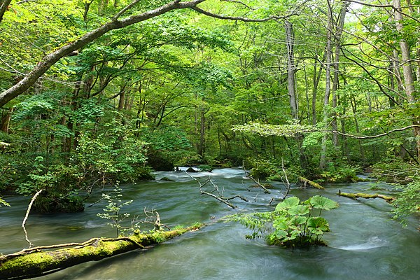
Image: Oirase keiryu