Kargopolsky District
Videos
Photos
Kargopolsky District is an administrative district (raion), one of the twenty-one in Arkhangelsk Oblast, Russia. As a municipal division, it is incorporated as Kargopolsky Municipal District. It is located in the southwest of the oblast and borders with Plesetsky District in the north, Nyandomsky District in the northeast, Konoshsky District in the east, Kirillovsky District of Vologda Oblast in the south, Vytegorsky District, also of Vologda Oblast, in the southwest, and with Pudozhsky District of the Republic of Karelia in the northwest. The area of the district is 10,127 square kilometers (3,910 sq mi). Its administrative center is the town of Kargopol. Population: 18,466 (2010 Russian census); 21,514 (2002 Census); 24,589 (1989 Soviet census). The population of Kargopol accounts for 55.3% of the district's total population.

Primary school in the village of Gavrilovskaya in Kargopolsky District

The village of Niz in winter
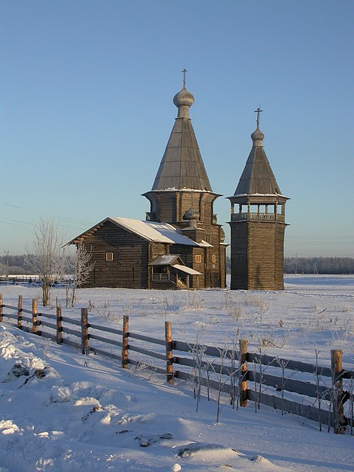
The Saunino Pogost: the wooden church of St. John Chrysostom (1665) with bell tower

The painted ceiling of the St. Michael church in Arkhangelo
Arkhangelsk Oblast
Videos
Photos
Arkhangelsk Oblast is a federal subject of Russia. It includes the Arctic archipelagos of Franz Josef Land and Novaya Zemlya, as well as the Solovetsky Islands in the White Sea. Arkhangelsk Oblast also has administrative jurisdiction over the Nenets Autonomous Okrug (NAO). Including the NAO, Arkhangelsk Oblast has an area of 587,400 square kilometres (226,800 sq mi), it's the largest of first-level administrative divisions in Europe. Its population was 1,227,626 as of the 2010 Census.

Image: Геометрия большого города. Архангельск, 2020 02

Image: Архангельск. Здание проектных организаций 03

Image: Святой Ручей

Image: Solovetsky Islands. Solovetsky Monastery P7130923 2200