Kayah State
Videos
Kayah State, or Karenni State, is a state of Myanmar. Situated in eastern Myanmar, it is bounded on the north by Shan State, on the east by Thailand's Mae Hong Son Province, and on the south and west by Kayin State. It lies approximately between 18° 30′ and 19° 55′ north latitude and between 96° 50′ and 97° 50′ east longitude. The area is 11,670 km2 (4,510 sq mi). Its capital is Loikaw. The estimated population in the 2014 Myanmar Census was 286,738, the smallest among Myanmar's seven states. It is inhabited primarily by the Karenni ethnic group, also known as Red Karen or Kayah, a Sino-Tibetan people.
Htee Zai Kha waterfall, border of Shan and Kayah State

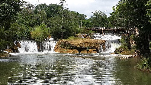
Lawpita Waterfall

Figurines of nine of the subgroups of the Kayah.

Kayah State Government Otfice
Shan people
Videos
The Shan people, also known as the Tai Long or Tai Yai, are a Tai ethnic group of Southeast Asia. The Shan are the biggest minority of Burma (Myanmar) and primarily live in the Shan State of this country, but also inhabit parts of Mandalay Region, Kachin State, Kayah State, Sagaing Region and Kayin State, and in adjacent regions of China, Laos, Assam and Meghalaya, Cambodia, Vietnam and Thailand. Though no reliable census has been taken in Burma since 1935, the Shan are estimated to number 4–6 million, with CIA Factbook giving an estimate of five million spread throughout Myanmar which is about 10% of the overall Burmese population.


1889 photograph of a Shan woman

A Shan deer dance ceremony in the early 1900s

The Shan kinnara and kinnari dance.