Kitwanga or Gitwangak is in the Skeena region of west central British Columbia. Among the Hazelton and Buckley Mountain Ranges, the place is on the north shore of the Skeena River, east of the Kitwanga River confluence. On BC Highway 37, northeast of the junction with BC Highway 16, the locality is by road about 115 kilometres (71 mi) northwest of Smithers, 99 kilometres (62 mi) northeast of Terrace, and 212 kilometres (132 mi) southeast of Stewart.
Gitwangak Battle Hill, Kitwanga, 2017.
Totem poles, Kitwanga, 2017.
St. Paul's Anglican Church and bell tower, Gitwangak, 2017.
Cable ferry, Kitwanga, 1925.
The Skeena River is the second-longest river entirely within British Columbia, Canada. Since ancient times, the Skeena has been an important transportation artery, particularly for the Tsimshian and the Gitxsan—whose names mean "inside the River of Mist" ,and "people of the River of Mist," respectively. The river and its basin sustain a wide variety of fish, wildlife, and vegetation, and communities native to the area depend on the health of the river. The Tsimshian migrated to the Lower Skeena River, and the Gitxsan occupy territory of the Upper Skeena.
The Bulkley River (left) flowing into the Skeena River (right) near Hazelton
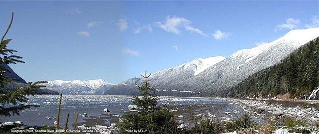
Skeena River at Telegraph Point, east of the city of Prince Rupert, British Columbia
First Nations girl fishing on the Skeena River near Kitwanga, 1915
SS Inlander on the Skeena River at Kitselas Canyon, 1911


