1.
Municipalities of Belgium
–
As such, only Antwerp, having over 500,000 inhabitants, became subdivided into nine districts. The Belgian arrondissements, a level between province and municipality, or the lowest judicial level, are in English sometimes called districts as well. The municipalities with less than 5,000 inhabitants were grouped in so-called canton municipalities, in 1800, these canton municipalities were abolished again and the number of autonomous municipalities became 2,776. Not much changed during the United Kingdom of the Netherlands, only a number of municipalities were merged. In 1831, Belgium was divided into 2,739 municipalities, New municipalities were created until 1928. There were 2,528 municipalities in 1850,2,572 in 1875,2,617 in 1900 and this also includes the municipalities of the East Cantons that were added to Belgium following the First World War. In 1961, the so-called Unitary Law, of which the chapter was dedicated to the territorial organisation of the municipalities, was adopted. The authority to abolish municipalities was entrusted to the branch for a period of 10 years. Municipalities could be merged on financial grounds or on grounds of a geographical, linguistic, economic, in 1964 and in 1969 and 1970, roughly 300 municipalities ceased to exist and were subsumed into other municipalities. The number of municipalities was reduced from 2,663 in 1961 to 2,586 in 1965, article 4 of the constitution states that each municipality must belong to only one of the four official language areas that were established in 1962–63. In the three officially unilingual language areas, a couple of municipalities in the vicinity of another language area must provide limited facilities for speakers of that other language. Lucien Harmegnies, Minister of the Interior in the government of Gaston Eyskens decided to continue the process of reorganization of Belgium. In 1971, the provisions of the Unity Law were extended and modified to apply to large agglomerations and it was another Minister of the Interior, Joseph Michel, who managed the process. On December 30,1975, the law regarding the merger of the municipalities was adopted, the merger became effective on January 1,1977. The merger of 1977 further reduced the number of municipalities in Belgium from 2,359 to 596, because of the specific nature of the reorganization in Antwerp, the law of December 30,1975 didnt enter into force for Antwerp until January 1,1983. The formerly independent municipalities were called districts and were given an advisory function, however, on January 1,2001 they were given an administrative function again. The Mayor is not only the head of the municipality, he or she is also the representative of the Regional, in that capacity, he or she is responsible for the execution of laws, decrees, ordinances and orders. The Mayor is also responsible for the maintenance of order in his or her municipality
2.
Geographic coordinate system
–
A geographic coordinate system is a coordinate system used in geography that enables every location on Earth to be specified by a set of numbers, letters or symbols. The coordinates are chosen such that one of the numbers represents a vertical position. A common choice of coordinates is latitude, longitude and elevation, to specify a location on a two-dimensional map requires a map projection. The invention of a coordinate system is generally credited to Eratosthenes of Cyrene. Ptolemy credited him with the adoption of longitude and latitude. Ptolemys 2nd-century Geography used the prime meridian but measured latitude from the equator instead. Mathematical cartography resumed in Europe following Maximus Planudes recovery of Ptolemys text a little before 1300, in 1884, the United States hosted the International Meridian Conference, attended by representatives from twenty-five nations. Twenty-two of them agreed to adopt the longitude of the Royal Observatory in Greenwich, the Dominican Republic voted against the motion, while France and Brazil abstained. France adopted Greenwich Mean Time in place of local determinations by the Paris Observatory in 1911, the latitude of a point on Earths surface is the angle between the equatorial plane and the straight line that passes through that point and through the center of the Earth. Lines joining points of the same latitude trace circles on the surface of Earth called parallels, as they are parallel to the equator, the north pole is 90° N, the south pole is 90° S. The 0° parallel of latitude is designated the equator, the plane of all geographic coordinate systems. The equator divides the globe into Northern and Southern Hemispheres, the longitude of a point on Earths surface is the angle east or west of a reference meridian to another meridian that passes through that point. All meridians are halves of great ellipses, which converge at the north and south poles, the prime meridian determines the proper Eastern and Western Hemispheres, although maps often divide these hemispheres further west in order to keep the Old World on a single side. The antipodal meridian of Greenwich is both 180°W and 180°E, the combination of these two components specifies the position of any location on the surface of Earth, without consideration of altitude or depth. The grid formed by lines of latitude and longitude is known as a graticule, the origin/zero point of this system is located in the Gulf of Guinea about 625 km south of Tema, Ghana. To completely specify a location of a feature on, in, or above Earth. Earth is not a sphere, but a shape approximating a biaxial ellipsoid. It is nearly spherical, but has an equatorial bulge making the radius at the equator about 0. 3% larger than the radius measured through the poles, the shorter axis approximately coincides with the axis of rotation
3.
Belgium
–
Belgium, officially the Kingdom of Belgium, is a sovereign state in Western Europe bordered by France, the Netherlands, Germany, Luxembourg, and the North Sea. It is a small, densely populated country which covers an area of 30,528 square kilometres and has a population of about 11 million people. Additionally, there is a group of German-speakers who live in the East Cantons located around the High Fens area. Historically, Belgium, the Netherlands and Luxembourg were known as the Low Countries, the region was called Belgica in Latin, after the Roman province of Gallia Belgica. From the end of the Middle Ages until the 17th century, today, Belgium is a federal constitutional monarchy with a parliamentary system of governance. It is divided into three regions and three communities, that exist next to each other and its two largest regions are the Dutch-speaking region of Flanders in the north and the French-speaking southern region of Wallonia. The Brussels-Capital Region is a bilingual enclave within the Flemish Region. A German-speaking Community exists in eastern Wallonia, Belgiums linguistic diversity and related political conflicts are reflected in its political history and complex system of governance, made up of six different governments. Upon its independence, declared in 1830, Belgium participated in the Industrial Revolution and, during the course of the 20th century, possessed a number of colonies in Africa. This continuing antagonism has led to several far-reaching reforms, resulting in a transition from a unitary to a federal arrangement during the period from 1970 to 1993. Belgium is also a member of the Eurozone, NATO, OECD and WTO. Its capital, Brussels, hosts several of the EUs official seats as well as the headquarters of major international organizations such as NATO. Belgium is also a part of the Schengen Area, Belgium is a developed country, with an advanced high-income economy and is categorized as very high in the Human Development Index. A gradual immigration by Germanic Frankish tribes during the 5th century brought the area under the rule of the Merovingian kings, a gradual shift of power during the 8th century led the kingdom of the Franks to evolve into the Carolingian Empire. Many of these fiefdoms were united in the Burgundian Netherlands of the 14th and 15th centuries, the Eighty Years War divided the Low Countries into the northern United Provinces and the Southern Netherlands. The latter were ruled successively by the Spanish and the Austrian Habsburgs and this was the theatre of most Franco-Spanish and Franco-Austrian wars during the 17th and 18th centuries. The reunification of the Low Countries as the United Kingdom of the Netherlands occurred at the dissolution of the First French Empire in 1815, although the franchise was initially restricted, universal suffrage for men was introduced after the general strike of 1893 and for women in 1949. The main political parties of the 19th century were the Catholic Party, French was originally the single official language adopted by the nobility and the bourgeoisie
4.
Communities, regions and language areas of Belgium
–
Belgium is a federal state comprising three communities, three regions, and four language areas. For each of these types, the subdivisions together make up the entire country, in other words. The language areas were established by the Second Gilson Act, which entered force on August 2,1963. The division into language areas was included in the Belgian Constitution in 1970 and this is a schematic overview of the basic federal structure of Belgium as defined by Title I of the Belgian Constitution. Each of the entities either have their own Parliament and Government or their own Council, the language areas have no offices or powers and exist de facto as geographical circumscriptions, serving only to delineate the empowered subdivisions. The institutional communities are thus equally geographically determined, Belgian Communities do not officially refer directly to groups of people but rather to specific political, linguistic and cultural competencies of the country. There is no subnationality in Belgium, the Flemish Region and the Walloon Region each comprise five provinces. The Brussels-Capital Region is not a province, nor does it contain any, the three regions are further subdivided into 589 municipalities, which in general consist of several sub-municipalities. These sub-municipalities were independent municipalities in the past, but no longer serve an official purpose, the Federal State retains a considerable common heritage. This includes justice, defence, federal police, social security, public debt and other aspects of public finances, nuclear energy, the State is responsible for the obligations of Belgium and its federalized institutions towards the European Union and NATO. It controls substantial parts of public health, home affairs and foreign affairs and they supervise the provinces, municipalities and intercommunal utility companies. In several fields, the different levels each have their own say on specificities, each level can be involved in scientific research and international relations associated with its powers. Communities were created in 1970 as cultural communities with limited power, in 1980, more power was transferred from the federal state to these entities and they became simply communities. Both the Flemish and French Community have jurisdiction over the area of the Brussels-Capital Region, consequently, they do not have a defined number of inhabitants. The German-speaking Community is the community with an area over which they have sole jurisdiction as a community. It is located within the Walloon Region, which has transferred some regional powers to the German-speaking Community with regards to its area. The Flemish Region or Flanders occupies the part of Belgium. It has an area of 13,522 km2, or 44. 29% of Belgium
5.
Flemish Community
–
The term community should then not be capitalized. State reforms in Belgium turned the country from a state into a federal one. Cultural communities were the first type of decentralisation in 1970, forming the Dutch, French, later on, in 1980, these became responsible for more cultural matters and were renamed to simply Community, the Dutch Community also being renamed to the Flemish Community. In the same state reform of 1980, the Flemish and Walloon Region were set up, in Flanders it was decided that the institutions of the Flemish Community would take up the tasks of the Flemish Region, so there is only one Flemish Parliament and one Flemish Government. Legally speaking, in the region of Brussel-Capital, the Flemish Community is responsible not for people but for Flemish institutions such as schools, theatres, libraries. The reason is no distinct sub-national status exists in Belgium. Yet, individuals living in Brussels can opt by their own choice for certain policies of the Flemish Community, Dutch is the official language of the Flemish Community. Minorities speak French, Yiddish, Turkish, Arabic, Berber, Italian, Spanish, English, though most of these groups are recent immigrants, since the Middle Ages, Jews have formed the oldest minority to retain its own identity. Compared with most areas in the Netherlands, the dialects of Flemish people still tend to be strong. In Dutch, these are often called tussentaal or, rather derogatorily, more recently, a number of local initiatives have been set up to save the traditional dialects and their diversity. In Brussels, the dialect is heavily influenced by French. Nowadays, most Flemings in Brussels do not speak the local dialect and this is due in part to the relatively large numbers of young Flemings coming to Brussels, after a long period of many more others moving out while French-speakers moved in. In certain municipalities along the border with the Walloon and the Brussels-Capital regions and these cover rights such as to receive official documentation in their own tongue. The community competencies there, are exercised by the two affected institutional communities, the Flemish Community therefore established a local elected council and executive to cater for intermediate-level decision making & public services. The VGC then recognised local, municipal institutions to care of the purely local public service in these community areas. Flanders has a radio and television broadcasting company, the Vlaamse Radio en Televisieomroep or VRT in Dutch. Since 1989, several companies for region-wide radio and television broadcasting have become established. There are also so-called regional broadcast companies of which the range is limited to smaller parts of the Flemish Region
6.
Flemish Region
–
The Flemish Region is one of the three official regions of the Kingdom of Belgium—alongside the Walloon Region and the Brussels-Capital Region. Colloquially, it is simply referred to as Flanders. It occupies the part of Belgium and covers an area of 13,522 km2. It is one of the most densely populated regions of Europe with around 470 inhabitants per square kilometer, immediately after its establishment in 1980, the region transferred all its constitutional competencies to the Flemish Community. Thus, the current Flemish authorities represent all the Flemish people, hence, the Flemish Region is governed by the Flemish Community institutions. However, members of the Flemish Community parliament elected in the Brussels-Capital Region have no right to vote on Flemish regional affairs, the Flemish Region comprises five provinces, each consisting of administrative arrondissements that, in turn, contain municipalities. Brussels city, the seat of the Flemish parliament, is located within the Brussels-Capital Region, Brussels contains both the Flemish Community and the French Community, both having their institutions in Brussels. Flanders is home to a modern economy, with emphasis put on research. Many enterprises work closely with local knowledge and research centres to develop new products, De Lijn serves as the main public transport company, run by the Flemish government. It consists of buses and trams, TEC is the equivalent company in Wallonia, and MIVB-STIB in Brussels. The railway network run by the NMBS, however, is a federal responsibility, the Flemish government is also responsible for about 500 kilometers of regional roads and about 900 kilometers of highways in the territory of the Flemish Region. Other types of roads are roads and municipal roads. Approximately 5,500,000 people live in the area, the official language is Dutch, sometimes colloquially referred to as Flemish. The main dialect groups include West Flemish, East Flemish, Brabantian, French may be used for certain administrative purposes in a limited number of the so-called municipalities with language facilities around the Brussels-Capital Region and on the border with Wallonia. Rim municipalities are Drogenbos, Kraainem, Linkebeek, Sint-Genesius-Rode, Wemmel, Brussels was originally a Dutch-speaking city, but it was frenchified in the 19th and 20th century and is now largely French-speaking. A few municipalities in the Flemish agglomeration of Brussels are now also frenchified, municipalities with language facilities on the border with Wallonia are Bever, Herstappe, Mesen, Ronse, Spiere-Helkijn, Voeren. Communities and regions of Belgium Provinces of regions in Belgium De Vlaamse Leeuw Count of Flanders Flanders Flemish Flemish authorities, toerisme Vlaanderen French Flanders Frans-Vlaanderen The Flemish region reaches 6 million inhabitants
7.
Provinces of Belgium
–
The country of Belgium is divided into three regions. Two of these regions, the Flemish Region or Flanders, and Walloon Region, the third region, the Brussels-Capital Region, is not divided into provinces, as it was originally only a small part of a province itself. Many of the provinces evolved from earlier duchies and counties of the name and similar location. At the time of the creation of Belgium in 1830, only nine provinces existed, including the province of Brabant and these divisions reflected political tensions between the French-speaking Walloons and the Dutch-speaking Flemish, the Brussels-Capital Region is officially bilingual. The division into provinces is fixed by Article 5 of the Belgian Constitution, the provinces are subdivided into 43 administrative arrondissements, and further into 589 municipalities. These each had their own identities and governments, though in the modern period almost all the Belgian states became part of larger entities. Each of the provinces of Belgium takes its name from one of these predecessors. At the time of the independence of Belgium from the Netherlands in 1830, the first article of the Belgian Constitution said, Belgium is divided into provinces. These provinces are Antwerp, Brabant, West Flanders, East Flanders, Hainaut, Liège, Limburg, Luxembourg, Namur, in 1839 half of the province of Limburg became part of the Netherlands, which consequently has its own province of Limburg. In 1920, following the First World War, Belgium annexed the Eupen-Malmedy territory, during the second half of the 20th century, Belgium transitioned from a unitary state to a federal state with three Communities and three Regions. As part of the reforms, the province of Brabant was split in 1995 three ways, into two provinces and into the Brussels-Capital Region. The two new Brabant provinces became part of the Flemish Region and the Walloon Region respectively, the remaining eight provinces became part of these regions as well, so the Flemish Region and the Walloon Region each contain five provinces. The Provincial Councils are the bodies of the population of the provinces. This is the equivalent of the States-Provincial in the Netherlands, the numbers of seats in the Provincial Councils are proportional to the population of the province, the numbers were reduced in both Flanders and Wallonia, starting 2013. They are directly elected each six years, at the time of the municipal elections. Before 1994, the elections instead coincided with the national elections. Until then, the provincial councils also appointed Provincial Senators to the Belgian Senate, the executive branch was previously called the Permanent Deputation. In the Flemish Region it is now called the Deputation and it consists of the Governor
8.
West Flanders
–
West Flanders is the most western province of the Flemish Region, also named Flanders, in Belgium. It borders on the Netherlands, the Flemish province of East Flanders and the Walloon province of Hainaut in Belgium, on France, other important cities are Kortrijk in the south and Ostend on the coast, Roeselare and Ypres. The province has an area of 3,125 km² which is divided into eight administrative districts containing 64 municipalities, the North Sea coast of Belgium, an important tourism destination, lies in West Flanders. A tram line runs the length of the coast, from De Panne on the French border to Knokke-Heist on the Dutch border, West Flanders consists of the North Sea coast, followed by a very flat polder landscape. Only in the south are some hills, with the Kemmelberg being the highest point in the province. The Leie and IJzer are the main rivers, West Flanders is the only Belgian province that borders both France and The Netherlands. In the north of the province, most industry is concentrated in and around the cities of Bruges, both cities also have important seaports, the port of Bruges-Zeebrugge and the port of Ostend. The south is known for its industry, with companies such as Beaulieu. The region around Kortrijk is called the Dallas of Belgium for its entrepreneurship, tourism is also an important industry in West Flanders. Major touristic attractions include the Belgian coast, the center of Bruges, and Flanders Fields. The region has a distinct dialect of Dutch called West Flemish. This distinctive dialect is a part of the sense of identity of the inhabitants of the region. The city of Bruges has one playing at the highest level of football in Belgium. With Cercle Brugge it also has one playing in the Belgian First Division B. Other cities with teams playing at the highest level are Kortrijk, Ostend, the teams Knack Randstad Roeselare and Prefaxis Menen play in the highest volleyball league. Knack Randstad Roeselare also plays in the CEV Champions League, the European Championsleague, BC Oostende is a basketball team which plays in the major basketball league of Belgium. The Province of West Flanders is divided into 4 judicial arrondissements, municipalities that have city status have a behind their name. Official website of the Province of West Flanders
9.
Arrondissements of Belgium
–
Arrondissements of Belgium are subdivisions below the provinces of Belgium. There are administrative, judicial and electoral arrondissements and these may or may not relate to identical geographical areas. The 43 administrative arrondissements are a level between the municipalities and the provinces. Brussels-Capital forms a single arrondissement for all 19 municipalities in the region by that name, Belgium had 27 judicial arrondissements until April 1,2014. Until 1999 the electoral districts for the election of the parliaments were electoral arrondissements, the arrondissement of Brussels-Capital is not part of any province and consequently forms its own electoral district
10.
Open Vlaamse Liberalen en Democraten
–
Open Flemish Liberals and Democrats, commonly known as Open Vld or simply as the VLD, is a liberal and conservative-liberal Flemish political party in Belgium. The party was created in 1992 from the former Party for Freedom and Progress, the party led the government for three cabinets under Guy Verhofstadt from 1999 until March 2008. Open VLD most recently formed the Federal Government with N-VA, CD&V, in the Flemish Parliament, the VLD formed a coalition government with sp. a-Spirit and Christian Democratic and Flemish from after the 2004 regional election until the 2009 regional election. Ideologically, Open VLD started as a liberal, somewhat Thatcherite party under its founder. The VLD rapidly became more centrist and gave up much of its free market approach, Party chairman Bart Somers called in November 2006 for a revolution within the party, saying that a liberal party, like the VLD, can be only progressive and social. Several of its thinkers such as Boudewijn Bouckaert, president of Nova Civitas, in 2004 the VLD teamed up with the minority social-liberal party Vivant for both the Flemish and European elections. VLD-Vivant lost the elections to arch rivals CD&V and the Flemish Bloc, the VLD fell from second to third place among the Flemish political parties, slipping narrowly behind the sp. a-Spirit cartel. Internal feuds, the support for electoral rights for immigrants and an economic policy were seen as the main reasons for its election defeat. From 2007 the party kept having electoral difficulties, first due to competition from split-off List Dedecker and after 2010 from the liberal-conservative Flemish-nationalist party N-VA, under the presidency of current chairwoman Gwendolyn Rutten the Open-Vld took on a more rightwing socio-economic course again. As such the party is the oldest political party of Belgium. In 1846, Walthère Frère-Orban succeeded in creating a program which could unite several liberal groups into one party. Before 1960, the Liberal Party of Belgium was barely organised, the school pact of 1958, as a result of which the most important argument for the traditional anti-clericalism was removed, gave the necessary impetus for a thorough renewal. During the liberal party congress of 1961, the Liberal Party was reformed into the bilingual Party for Freedom and Progress and it is a central principle of Classical Liberalism that employers and employees do NOT have opposed long term interests. In the late 1960s and the early 1970s, the tensions between the different communities in Belgium rose and there were disagreements within the movement as well. In 1972, the unitary PVV-PLP was split into separate a Flemish, willy De Clercq became the first chairman of the independent Party of Freedom and Progress. De Clercq, together with Frans Grootjans and Herman Vanderpoorten, set out the lines for the new party and this reform was coupled an Ethical Congress, on which the PVV adopted very progressive and tolerant stances regarding abortion, euthanasia, adultery, homosexuality and gender equality. In 1982, the 29-year-old reformer Guy Verhofstadt became the chairman of the party, Annemie Neyts succeeded him as chairman, becoming the first female party chairman. In 1989, Verhofstadt once more became the chairman of the PVV, in 1992, the PVV was reformed into the Flemish Liberals and Democrats under the impulse of Verhofstadt
11.
Christen-Democratisch en Vlaams
–
Christian Democratic and Flemish is a Christian democratic Flemish political party in Belgium. The party has ties to both trade unionism and trade associations and the Farmers League. Until 2001, the party was named the Christian Peoples Party and it was traditionally the largest political party of Flanders, until it was overtaken by the New Flemish Alliance in the 2010s. CD&V participated in most governments and has generally the largest number of mayors, most Prime Ministers of Belgium and Ministers-President of Flanders have been CD&V politicians. Herman Van Rompuy, the president of the European Council from 2009 to 2014, is one of the politicians of CD&V. CD&V is a member of the European Peoples Party and Centrist Democrat International, the history of the CD&V dates back to the 19th century. It originated in the 19th century catholic party, or Parti conservateur, at the end of the century, the new fraction of the so-called Christian democrats shifted the focus of the party slightly to the left. In the interwar years the party was renamed Catholic Bloc, then, the Christian Social Party existed from 1945 until 1968. In 1968, the PSC-CVP was split into to the French-speaking Christian Social Party, in 2001 the CVP changed its name to the CD&V. The party was almost continually in power from its establishment until 1999, in 1999, the Flemish Liberals and Democrats became the largest party in Belgium, and formed a majority purple government of liberals, social democrats and greens. The same happened in the Flemish Government, but with the addition of Flemish nationalists, in 2003 CD&V again lost the federal elections which continuated the federal center-left coalition, but this time without the Greens. In 2004, Flemish elections were held and the CD&V once more became the largest political party by representation in the Flemish Parliament, after successful local elections in 2006, the party became the largest party in the Belgian Chambre of Representatives after the federal elections of 2007. The CD&V led the subsequent coalition talks, which repeatedly stalled, on the 20 March 2008, a new federal government was finally assembled, led by Yves Leterme. Kris Peeters subsequently became the next minister-president of Flanders, from 30 December 2008 till 25 November 2009, Herman Van Rompuy led his first cabinet before becoming the first permanent president of the European Council. Afterwards, Yves Leterme led his second government, in June 2009, Flemish elections were held and the CD&V remained the largest party of Flanders. Kris Peeters stayed as Flemish minister-president, the party also remained the largest Flemish party in the European Parliament after the 2009 European elections. In 2010, the Open Flemish Liberals and Democrats decided to out of the federal coalition. The federal elections of 2010 resulted in a loss of historic proportions for CD&V
12.
New Flemish Alliance
–
The New Flemish Alliance is a Flemish nationalist and conservative political party in Belgium, founded in 2001. The N-VA is a regionalist and separatist movement that self-identifies with the promotion of civic nationalism and it is part of the Flemish Movement, and strives for the peaceful and gradual secession of Flanders from Belgium. In recent years it has become the largest party of Flanders as well as of Belgium as a whole, the main objective of the party is to work on Flemish independence by gradually obtaining more powers for both Belgian communities separately. Furthermore, it emphasizes its non-revolutionary and pro-European character in order to legitimize increased Flemish autonomy, the N-VA advocates free-market economics, and their manifesto proposes immediate tax reductions to stimulate the economy. They also advocate deepening ties with the European Union, the N-VA stems from the Peoples Union, a Belgian political party and broad electoral alliance of Flemish nationalists. Towards the end of the 20th century, with a steadily declining electorate and these experiments were opposed by the more traditional centre-right party base. Factions subsequently clashed multiple times, over the course of the party. A party referendum was held on the future of the party, the right wing gained a substantial plurality of 47% and inherited the party infrastructure. Since no faction got a majority, however, the name Volksunie could no longer be used. In the autumn of 2001, the New Flemish Alliance was founded, seven members of parliament from the Peoples Union joined the new party. The new party created a party manifesto and a statement of principles. The first party congress was held in May 2002, voting on a party program, the party participated in elections for the first time in the 2003 federal elections, but struggled with the election threshold of 5%. This threshold was reached in West Flanders, the constituency of Geert Bourgeois. With only one representative and no senator, the party lost government funding. They joined forces in the elections in 2004 and won. Both parties joined the new Flemish government, led by CD&V leader Yves Leterme, Geert Bourgeois became a minister, and Bart De Wever became the new party leader in October 2004. The cartel was briefly broken when the former right-wing liberal Jean-Marie Dedecker left the Open Flemish Liberals and Democrats and entered the N-VA on behalf of the party executive. However, the party congress did not put Dedecker on the election list, instead preferring to continue the cartel with CD&V, Dedecker saw this as a vote of no confidence, and left the party after only 10 days, to form his own party, List Dedecker
13.
French language
–
French is a Romance language of the Indo-European family. It descended from the Vulgar Latin of the Roman Empire, as did all Romance languages, French has evolved from Gallo-Romance, the spoken Latin in Gaul, and more specifically in Northern Gaul. Its closest relatives are the other langues doïl—languages historically spoken in northern France and in southern Belgium, French was also influenced by native Celtic languages of Northern Roman Gaul like Gallia Belgica and by the Frankish language of the post-Roman Frankish invaders. Today, owing to Frances past overseas expansion, there are numerous French-based creole languages, a French-speaking person or nation may be referred to as Francophone in both English and French. French is a language in 29 countries, most of which are members of la francophonie. As of 2015, 40% of the population is in Europe, 35% in sub-Saharan Africa, 15% in North Africa and the Middle East, 8% in the Americas. French is the fourth-most widely spoken mother tongue in the European Union, 1/5 of Europeans who do not have French as a mother tongue speak French as a second language. As a result of French and Belgian colonialism from the 17th and 18th century onward, French was introduced to new territories in the Americas, Africa, most second-language speakers reside in Francophone Africa, in particular Gabon, Algeria, Mauritius, Senegal and Ivory Coast. In 2015, French was estimated to have 77 to 110 million native speakers, approximately 274 million people are able to speak the language. The Organisation internationale de la Francophonie estimates 700 million by 2050, in 2011, Bloomberg Businessweek ranked French the third most useful language for business, after English and Standard Mandarin Chinese. Under the Constitution of France, French has been the language of the Republic since 1992. France mandates the use of French in official government publications, public education except in specific cases, French is one of the four official languages of Switzerland and is spoken in the western part of Switzerland called Romandie, of which Geneva is the largest city. French is the language of about 23% of the Swiss population. French is also a language of Luxembourg, Monaco, and Aosta Valley, while French dialects remain spoken by minorities on the Channel Islands. A plurality of the worlds French-speaking population lives in Africa and this number does not include the people living in non-Francophone African countries who have learned French as a foreign language. Due to the rise of French in Africa, the total French-speaking population worldwide is expected to reach 700 million people in 2050, French is the fastest growing language on the continent. French is mostly a language in Africa, but it has become a first language in some urban areas, such as the region of Abidjan, Ivory Coast and in Libreville. There is not a single African French, but multiple forms that diverged through contact with various indigenous African languages, sub-Saharan Africa is the region where the French language is most likely to expand, because of the expansion of education and rapid population growth
14.
West Flemish
–
West Flemish is a dialect of the Dutch language spoken in western Belgium and adjoining parts of the Netherlands and France. Some of the cities where West Flemish is widely spoken are Bruges, Kortrijk, Ostend, Roeselare. The dialects of the rest of the Dutch province of Zeeland, Zeelandic, are included in West Flemish. West Flemish is listed as a language in UNESCOs online Red Book of Endangered Languages. West Flemish phonology differs a lot from the standard Dutch phonology, the best known are the velar fricatives g and ch in Dutch, being realised as glottal h -, and the overall lack of diphthongs compared to Dutch. The following differences are listed by their Dutch spelling, as different letters have evolved to the same sound in Dutch. Pronunciations can also differ a bit from region to region, sch - /sx/ is realised as, or. Ei - /ɛi/ is realised as or, ij - /ɛi/ is realised as. Au - /ʌu/ is realised as ou - /ʌu/ is realised as, it resembles a lot the long oe that is used in Dutch. Ie - /i/ is more stressed towards aa - /aː/ is realised as, due to the non-existent /x/ and /ɣ/ sounds in West Flemish, native speakers of the dialect have to concentrate a lot to pronounce these sounds. This often results in hyper-correction of the /h/ sounds to a /x/ or /ɣ/, the Dutch language also has many words with an -en suffix. While standard Dutch and most Dutch dialects dont pronounce the final n, West Flemish typically drops the e, for base words already ending with n, the final n sound is often prolonged to make the suffix clear. This mute-e is similar to many English words, beaten, listen, the short o in words can also be pronounced as a short u. This happens spontaneously on some words, but other words keep their original short o sounds, similarly, the short a can turn into a short o in some words without apparent reason. The diftong ui doesnt exist in West Flemish, and is pronounced as a u or a long ie. Similar to the ui, the o can turn into an on some words. This transition often shows similarities with English and this phenomenon is shared with the Lower Saxon Germanic dialects, and even more prominent in English. Under influence of Standard Dutch, the number of people that uses the -s suffix for the form on these words diverging from Dutch is diminishing
15.
Municipality
–
It is to be distinguished from the county, which may encompass rural territory and/or numerous small communities such as towns, villages and hamlets. The term municipality may also mean the governing or ruling body of a given municipality, a municipality is a general-purpose administrative subdivision, as opposed to a special-purpose district. The term is derived from French municipalité and Latin municipalis, a municipality can be any political jurisdiction from a sovereign state, such as the Principality of Monaco, or a small village, such as West Hampton Dunes, New York. The power of municipalities range from virtual autonomy to complete subordination to the state, municipalities may have the right to tax individuals and corporations with income tax, property tax, and corporate income tax, but may also receive substantial funding from the state. Similar terms include Spanish ayuntamiento, also called municipalidad, Polish gmina, Dutch/Flemish Gemeente, in Australia, the term local government area is used in place of the generic municipality. Here, the LGA Structure covers only incorporated areas of Australia, incorporated areas are legally designated parts of states and territories over which incorporated local governing bodies have responsibility. In Canada, municipalities are local governments established through provincial and territorial legislation, the Province of Ontario has different tiers of municipalities, including lower, upper, and single tiers. Types of upper tier municipalities in Ontario include counties and regional municipalities, nova Scotia also has regional municipalities, which include cities, counties, districts, or towns as municipal units. In India, a Nagar Palika or Municipality is a local body that administers a city of population 100,000 or more. Under the Panchayati Raj system, it directly with the state government. Generally, smaller cities and bigger towns have a Nagar Palika. Nagar Palikas are also a form of local self-government entrusted with duties and responsibilities. Such a corporation in Great Britain consists of a head as a mayor or provost, since local government reorganisation, the unit in England, Northern Ireland and Wales is known as a district, and in Scotland as a council area. A district may be awarded borough or city status, or can retain its district title, in Jersey, a municipality refers to the honorary officials elected to run each of the 12 parishes into which it is subdivided. This is the highest level of government in this jurisdiction. In the United States, municipality is usually understood as a city, town, village, or other local government unit, in the Peoples Republic of China, a direct-controlled municipality is a city with equal status to a province, Beijing, Tianjin, Shanghai, and Chongqing. In Taiwan, a municipality is a city with equal status to a province, Kaohsiung, New Taipei, Taichung, Tainan, Taipei. In Portuguese language usage, there are two words to distinguish the territory and the administrative organ, when referring to the territory, the word concelho is used, when referring to the organ of State, the word município is used
16.
North Sea
–
The North Sea is a marginal sea of the Atlantic Ocean located between Great Britain, Scandinavia, Germany, the Netherlands, Belgium, and France. An epeiric sea on the European continental shelf, it connects to the ocean through the English Channel in the south and it is more than 970 kilometres long and 580 kilometres wide, with an area of around 570,000 square kilometres. The North Sea has long been the site of important European shipping lanes as well as a major fishery, the North Sea was the centre of the Vikings rise. Subsequently, the Hanseatic League, the Netherlands, and the British each sought to dominate the North Sea and thus the access to the markets, as Germanys only outlet to the ocean, the North Sea continued to be strategically important through both World Wars. The coast of the North Sea presents a diversity of geological and geographical features, in the north, deep fjords and sheer cliffs mark the Norwegian and Scottish coastlines, whereas in the south it consists primarily of sandy beaches and wide mudflats. Due to the population, heavy industrialization, and intense use of the sea and area surrounding it. In the southwest, beyond the Straits of Dover, the North Sea becomes the English Channel connecting to the Atlantic Ocean, in the east, it connects to the Baltic Sea via the Skagerrak and Kattegat, narrow straits that separate Denmark from Norway and Sweden respectively. In the north it is bordered by the Shetland Islands, and connects with the Norwegian Sea, the North Sea is more than 970 kilometres long and 580 kilometres wide, with an area of 570,000 square kilometres and a volume of 54,000 cubic kilometres. Around the edges of the North Sea are sizeable islands and archipelagos, including Shetland, Orkney, the North Sea receives freshwater from a number of European continental watersheds, as well as the British Isles. A large part of the European drainage basin empties into the North Sea including water from the Baltic Sea, the largest and most important rivers flowing into the North Sea are the Elbe and the Rhine – Meuse watershed. Around 185 million people live in the catchment area of the rivers discharging into the North Sea encompassing some highly industrialized areas, for the most part, the sea lies on the European continental shelf with a mean depth of 90 metres. The only exception is the Norwegian trench, which extends parallel to the Norwegian shoreline from Oslo to a north of Bergen. It is between 20 and 30 kilometres wide and has a depth of 725 metres. The Dogger Bank, a vast moraine, or accumulation of unconsolidated glacial debris and this feature has produced the finest fishing location of the North Sea. The Long Forties and the Broad Fourteens are large areas with uniform depth in fathoms. These great banks and others make the North Sea particularly hazardous to navigate, the Devils Hole lies 200 miles east of Dundee, Scotland. The feature is a series of trenches between 20 and 30 kilometres long,1 and 2 kilometres wide and up to 230 metres deep. Other areas which are less deep are Cleaver Bank, Fisher Bank, the International Hydrographic Organization defines the limits of the North Sea as follows, On the Southwest
17.
Flanders
–
Flanders is the Dutch-speaking northern portion of Belgium, although there are several overlapping definitions, including ones related to culture, language, politics and history. It is one of the communities, regions and language areas of Belgium, the demonym associated with Flanders is Fleming, while the corresponding adjective is Flemish. The official capital of Flanders is Brussels, although Brussels itself has an independent regional government, in historical contexts, Flanders originally refers to the County of Flanders, which around AD1000 stretched from the Strait of Dover to the Scheldt estuary. In accordance with late 20th century Belgian state reforms the area was made two political entities, the Flemish Community and the Flemish Region. These entities were merged, although geographically the Flemish Community, which has a cultural mandate, covers Brussels. Flanders has figured prominently in European history, as a consequence, a very sophisticated culture developed, with impressive achievements in the arts and architecture, rivaling those of northern Italy. Belgium was one of the centres of the 19th century industrial revolution, geographically, Flanders is generally flat, and has a small section of coast on the North Sea. Much of Flanders is agriculturally fertile and densely populated, with a density of almost 500 people per square kilometer. It touches France to the west near the coast, and borders the Netherlands to the north and east, the Brussels Capital Region is an enclave within the Flemish Region. Flanders has exclaves of its own, Voeren in the east is between Wallonia and the Netherlands and Baarle-Hertog in the consists of 22 exclaves surrounded by the Netherlands. It comprises 6.5 million Belgians who consider Dutch to be their mother tongue, the political subdivisions of Belgium, the Flemish Region and the Flemish Community. The first does not comprise Brussels, whereas the latter does comprise the Dutch-speaking inhabitants of Brussels, the political institutions that govern both subdivisions, the operative body Flemish Government and the legislative organ Flemish Parliament. The two westernmost provinces of the Flemish Region, West Flanders and East Flanders, forming the central portion of the historic County of Flanders, a feudal territory that existed from the 8th century until its absorption by the French First Republic. Until the 1600s, this county also extended over parts of France, one of the regions conquered by the French in Flanders, namely French Flanders in the Nord department. French Flanders can be divided into two regions, Walloon Flanders and Maritime Flanders. The first region was predominantly French-speaking already in the 1600s, the latter became so in the 20th century, the city of Lille identifies itself as Flemish, and this is reflected, for instance, in the name of its local railway station TGV Lille Flandres. The region conquered by the Dutch Republic in Flanders, now part of the Dutch province of Zeeland, the significance of the County of Flanders and its counts eroded through time, but the designation remained in a very broad sense. In the Early modern period, the term Flanders was associated with the part of the Low Countries
18.
Oostduinkerke
–
Oostduinkerke is a place in the Belgian province of West Flanders, where it is located on the southern west coast of Belgium, so that part of it is a seaside resort. Once a municipality of its own, Oostduinkerke now is a sub-municipality in the municipality of Koksijde, the name Oostduinkerke translates as East Dunkirk. The town originally shared its name with the French city of Dunkirk, therefore, in the 13th century, Oostduinkerke lies amidst a dune area, which is now a protected nature reserve. To go for walks in the reserves or on the beach or on the promenade is a refreshing experience. The sandy beach stretches from 250 to 700 m at ebb-tide and extends over 30 km, via De Panne to the beach of Dunkirk, Oostduinkerke is known for its shrimpers on horseback, a considerable tourist attraction. It is the place in the world where you can see such shrimpers. Fishery folklore is very much alive. The National Fishery Museum gives a survey of Flemish fishery and shows among other things scale models of fishing boats from 800 AD up to the present. Other museums are, The Key and Lock Museum, a regional museum t Krekelhof, Oostduinkerke is also home to Koksijde Golf ter Hille, a par-72 golf course. The British Military Cemetery bears witness to British sacrifices in the Battle of Dunkirk, National Fishery Museum Map of the Flemish coast
19.
Population density
–
Population density is a measurement of population per unit area or unit volume, it is a quantity of type number density. It is frequently applied to living organisms, and most of the time to humans and it is a key geographical term. Population density is population divided by land area or water volume. Low densities may cause a vortex and lead to further reduced fertility. This is called the Allee effect after the scientist who identified it, commonly this may be calculated for a county, city, country, another territory, or the entire world. The worlds population is around 7,000,000,000, therefore, the worldwide human population density is around 7,000,000,000 ÷510,000,000 =13.7 per km2. If only the Earths land area of 150,000,000 km2 is taken into account and this includes all continental and island land area, including Antarctica. If Antarctica is also excluded, then population density rises to over 50 people per km2, thus, this number by itself does not give any helpful measurement of human population density. Several of the most densely populated territories in the world are city-states, microstates, cities with high population densities are, by some, considered to be overpopulated, though this will depend on factors like quality of housing and infrastructure and access to resources. Most of the most densely populated cities are in Southeast Asia, though Cairo, for instance, Milwaukee has a greater population density when just the inner city is measured, and the surrounding suburbs excluded. Arithmetic density, The total number of people / area of land, physiological density, The total population / area of arable land. Agricultural density, The total rural population / area of arable land, residential density, The number of people living in an urban area / area of residential land. Urban density, The number of people inhabiting an urban area / total area of urban land, ecological optimum, The density of population that can be supported by the natural resources. S. States by population density Selected Current and Historic City, Ward & Neighborhood Density
20.
Nieuwpoort, Belgium
–
Nieuwpoort is a municipality located in Flanders, one of the three regions of Belgium, and in the Flemish province of West Flanders. The municipality comprises the city of Nieuwpoort proper and the towns of Ramskapelle, on January 1,2008, Nieuwpoort had a total population of 11,062. The total area is 31.00 km² which gives a density of 350 inhabitants per km². The current mayor of Nieuwpoort is Rolland Crabbe In Nieuwpoort, the Yser flows into the North Sea and it is also the home of a statue created by Jan Fabre called Searching for Utopia. It obtained city rights in 1163 from Count Philip of Flanders, the Battle of Nieuwpoort, between the Dutch and the Spanish, happened here in 1600. The city was a Dunkirker base, painter Victor Boucquet made two of the altar-pieces for the great church in the 17th century. The city was occupied by French forces for six years between 1757 and 1763, as part of the conditions of the Second Treaty of Versailles between France and Austria. A large waterworks infrastructure project called the Ganzepoot was constructed in Nieuwpoort in the 19th century to drain the polders and channel water in and around the town, the old city centre of Nieuwpoort is located about three kilometers from the current coastline. Close to the sea, a new tourist centre has developed, both parts form one contiguous built up area, connected by buildings along the Albert I Laan street and the fishing port. Besides Nieuwpoort proper, two villages in the Flemish polders are part of the municipality, Sint-Joris and Ramskapelle. Nieuwpoort is located by the sea, at the coastal line, it borders the municipalities Koksijde at its town Oostduinkerke and Middelkerke at its town Lombardsijde
21.
Veurne
–
Veurne is a city and municipality in the Belgian province of West Flanders. The municipality comprises the town of Veurne proper and the settlements of Avekapelle, Booitshoeke, Bulskamp, De Moeren, Eggewaartskapelle, Houtem, Steenkerke, Vinkem, Wulveringem, and Zoutenaaie. Veurne, in Latin Furna, is first found in 877 as a possession of the Saint Bertin Abbey in Saint-Omer, around 890 AD, it was noted as a fortification against the Viking raids. It soon was placed at the head of the castellany of Veurne, Veurne became a city in the 12th century. During the following century, trade with England flourished, in 1270, however, the relations with England came to a standstill and the city’s economy went into a long decline, hence the nickname of the Veurne Sleepers. On August 20,1297, the Battle of Veurne was fought in the struggle between the Flemish cities and the French king. The beautiful gothic church of Saint Walburga and the tower of the church of Saint Nicolas, Saint Walburga housed a chapter of canons. Saint Nicholas and Saint Denis were the two parish churches and possessions of the Norbertine abbey of Saint Nicholas. The 15th century saw the construction of a new city hall, as most of the Westhoek, the city and the neighbourghood strongly recessed during the economic and religious problems around 1566–1583. But when the town and the castellany officially got together, the town flourished, most of the other historic buildings date from this time, the prosperous reign of the Archdukes Albert and Isabella around 1600. In 1644 the Capucines organised a procession, since 1646, this procession was organised by the Sodales, a religious confraternity, that organised a crossway during Advent time, under the leadership of the Norbertine monk Jacob Clou. The hooded Sodales took a cross for penitence and this procession was expanded at the end of the 17th century with scenes from the Bible, and is the only one of his kind, remaining up to now in Flanders. The second half of the 17th century was marked by the miseries brought to the region by Louis XIV’s wars, vauban built heavy fortifications around the city, the outlines of which are still noticeable from the air today. Joseph II of Austria put them down and closed some of the institutions, putting a temporary end to the penitents’ procession. Those few cloisters that were still operating were closed at the French Revolution, from the Battle of Waterloo until World War I, Veurne could enjoy a century of quiet and prosperity. In 1831, Veurne was the first city to welcome Belgium’s new king, Leopold I, during World War I, Veurne was located within the Yser pocket of Belgian resistance against the German troops. During the Battle of the Yser, the Veurne city hall became the headquarters for the Belgian troops under King Albert I, in 1920, the French President, Raymond Poincaré, came to Veurne to award the city the Croix de guerre with palm. Veurne suffered some damage during World War II, mainly from allied bombing, today, the city is a regional centre, which gives commercial, medical, and educational services to the surrounding communities while enjoying increasing tourist attention
22.
Adinkerke
–
Adinkerke is a village in the municipality of De Panne in western Belgium close to the French border. It forms a conurbation with the town of De Panne. Adinkerke railway station is also the terminus of the Belgian coast tram line to De Panne, Nieuwpoort. Near the city is Plopsaland, formerly Meli-Park, the kerke suffix is common in west Flanders as an area surrounding a church. The closest French towns are Ghyvelde and Bray-Dunes, which can be accessed via the E40 motorway, N39 main road, the roads names in brackets employ French nomenclature once crossing the border. There are regular NMBS trains to Brussels, access by train to Dunkirk is via Gare de Lille Flandres which is in France. The line across the border is out of use, dk bus run buses from the station forecourt to Gare de Dunkerque. A campaign group called Trekhaak-73 is seeking to re-open the railway line, in the First World War, from June to November 1917 the Commonwealth XV Corps held the front from the Belgian coast to St. Georges. The 24th and 39th Casualty Clearing Stations were posted at Oosthoek from July to November, Adinkerke Military Cemetery contains 365 burials. Further Commonwealth War Graves Commission graves can be found in the Adinkerke Churchyard Extension, Adinkerke has the unusual claim to fame of having the greatest number of tobacconists per capita of any area in Europe. Previously, tobacconists were open around the clock, which provided the advantage of offering other commercial, while this may have proved beneficial to travellers, local people were inconvenienced by the constant traffic, so the local mayor ordered the tobacco stores to close during the night. A weak euro combined with increasingly expensive tobacco prices has resulted in more and more UK shoppers to make the day trip to Adinkerke to stock up on cheap tobacco, tax increases have made the UK the second most expensive place to buy tobacco in Europe. Adinkerke tobacco shops cater to English shoppers, selling popular UK brands and accepting payment in sterling
23.
De Panne
–
De Panne is a town and a municipality located on the North Sea coast of the Belgian province of West Flanders. There it borders France, which implies that it is the westernmost location of Belgium, the municipality comprises apart from De Panne the village of Adinkerke. On 1 January 2006 De Panne had a population of 10,060 on a total area of 23.90 km². Famous people who lived or died in De Panne include King Albert I and Queen Elisabeth, and John Aidan Liddell, VC, who died in De Panne in August 1915. The Belgian royal family lived in De Panne during the First World War because it is located in the fraction of their country that was not conquered by the Germans. De Panne is home to Plopsaland, an aimed at young children. De Panne was also the place where the first land yachts intended for sport were built, on 17 July 1831, Leopold I, the first Belgian king, sailed to Calais from England, and arrived in Belgium in De Panne. The Leopold I Esplanade, which includes a statue of him, since 1977 the town has hosted the Three Days of De Panne cycle race, which is held in the run up to, and traditionally used by riders as preparation for, the Tour of Flanders. De Panne Railway Station is located in nearby Adinkerke, there are regular NMBS trains to Brussels. The line across the border to Dunkirk is out of use, dk bus run buses from the station forecourt to Gare de Dunkerque. A cross-border campaign group called Trekhaak-73 is seeking to re-open the railway line, the cemetery is located at Kerkstraat 69 in De Panne,1 km south of the church. Besides Belgian soldiers who died in the First World War there are also British soldiers who died in the Second World War,3,744 soldiers have been buried here. Close nearby is Adinkerke Military Cemetery
24.
Abbey
–
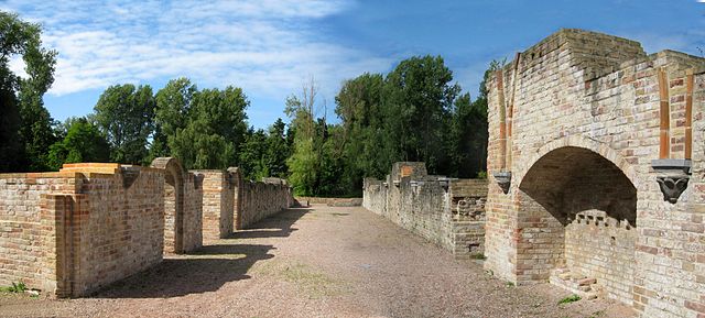
An abbey is a complex of buildings used by members of a religious order under the governance of an abbot or abbess. It provides a place for activities, work and housing of Christian monks. The concept of the abbey has developed over centuries from the early monastic ways of religious men and women where they would live isolated from the lay community about them. Religious life in an abbey may be monastic, an abbey may be the home of an enclosed religious order or may be open to visitors. The layout of the church and associated buildings of an abbey often follows a set plan determined by the religious order. Abbeys are often self-sufficient while using any abundance of produce or skill to provide care to the poor and needy, some abbeys offer accommodation to people who are seeking spiritual retreat. There are many famous abbeys across Europe, the earliest known Christian monasteries were groups of huts built near the residence of a famous ascetic or other holy person. Disciples wished to be close to their man or woman in order to study their doctrine or imitate their way of life. In the earliest times of Christian monasticism, ascetics would live in social isolation and they would subsist whilst donating any excess produce to the poor. However, increasing religious fervor about the ways and or persecution of them would drive them further away from their community. For instance, the cells and huts of anchorites have been found in the deserts of Egypt, in 312 AD, Anthony the Great retired to the Thebaid region of Egypt to escape the persecution of the Emperor Maximian. Anthony was the best known of the anchorites of his due to his degree of austerity, sanctity. The deeper he withdrew into the wilderness, the more numerous his disciples became and they refused to be separated from him and built their cells close to him. This became a first true monastic community, Anthony, according to Johann August Wilhelm Neander, inadvertently became the founder of a new mode of living in common, Coenobitism. At Tabennae on the Nile, in Upper Egypt, Saint Pachomius laid the foundations for the life by arranging everything in an organized manner. He built several monasteries, each with about 1,600 separate cells laid out in lines and these cells formed an encampment where the monks slept and performed some of their manual tasks. There were nearby large halls such as the church, refectory, kitchen, infirmary, an enclosure protecting all these buildings gave the settlement the appearance of a walled village. This layout, known as the laurae, became popular throughout Palestine, as well as the laurae, communities known as caenobia developed
25.
Cistercians
–
A Cistercian is a member of the Cistercian Order (/sɪˈstɜːrʃən/, abbreviated as OCist or SOCist, a religious order of monks and nuns. They are variously called the Bernardines, after the highly influential St, the original emphasis of Cistercian life was on manual labour and self-sufficiency, and many abbeys have traditionally supported themselves through activities such as agriculture and brewing ales. Over the centuries, however, education and academic pursuits came to dominate the life of their monasteries, after that the followers of the older pattern of life became known as the Cistercians of the Original Observance. The term Cistercian, derives from Cistercium, the Latin name for the village of Cîteaux and it was in this village that a group of Benedictine monks from the monastery of Molesme founded Cîteaux Abbey in 1098, with the goal of following more closely the Rule of Saint Benedict. The best known of them were Robert of Molesme, Alberic of Cîteaux and the English monk Stephen Harding, Bernard of Clairvaux entered the monastery in the early 1110s with 30 companions and helped the rapid proliferation of the order. By the end of the 12th century, the order had spread throughout France and into England, Wales, Scotland, Ireland, Spain, Portugal, Italy, the keynote of Cistercian life was a return to literal observance of the Rule of St Benedict. The most striking feature in the reform was the return to manual labour, especially field-work, Cistercian architecture is considered one of the most beautiful styles of medieval architecture. Additionally, in relation to such as agriculture, hydraulic engineering and metallurgy. The monastery church of Cluny Abbey, the largest in Europe, had become wealthy from rents, tithes, feudal rights and pilgrims who passed through Cluniac houses on the Way of St. James. On March 21,1098, Roberts small group acquired a plot of marshland just south of Dijon called Cîteaux, during the first year, the monks set about constructing lodging areas and farming the lands of Cîteaux, making use of a nearby chapel for Mass. In Roberts absence from Molesme, however, the abbey had gone into decline, and Pope Urban II, the remaining monks of Cîteaux elected Alberic as their abbot, under whose leadership the abbey would find its grounding. Robert had been the idealist of the order, and Alberic was their builder, upon assuming the role of abbot, Alberic moved the site of the fledgling community near a brook a short distance away from the original site. Alberic discontinued the use of Benedictine black garments in the abbey and he returned the community to the original Benedictine ideal of manual work and prayer, dedicated to the ideal of charity and self sustenance. Alberic also forged an alliance with the Dukes of Burgundy, working out a deal with Duke Odo of Burgundy concerning the donation of a vineyard as well as stones with which they built their church. The church was consecrated and dedicated to the Virgin Mary on November 16,1106, on January 26,1108, Alberic died and was soon succeeded by Stephen Harding, the man responsible for carrying the order into its crucial phase. The order was fortunate that Stephen was an abbot of extraordinary gifts, and he framed the original version of the Cistercian Constitution or regulations, the Carta caritatis. Although this was revised on several occasions to meet needs, from the outset it emphasised a simple life of work, love, prayer. Cistercian abbeys also refused to admit children, allowing adults to choose their religious vocation for themselves – a practice later emulated by many of the older Benedictine houses
26.
Liturgy
–
Liturgy is the customary public worship performed by a religious group, according to its beliefs, customs and traditions. As a religious phenomenon, liturgy is a response to and participation in. Ritualization may be associated with events such as birth, coming of age, marriage. It thus forms the basis for establishing a relationship with a divine agency, methods of dress, preparation of food, application of cosmetics or other hygienic practices are all considered liturgical activities. Technically speaking, liturgy is a subset of ritual, when ritual is undertaken to participate in a divine act or assist a divine action, it is liturgy. If the ritual does not have this purpose it is not liturgy, a daily activity such as the Muslim salah and Jewish synagogue services would be ritual but not liturgy. If the Temple were re-established, the ritual undertaken by the Judaic priesthood within the Temple would be liturgy, for a simple definition, liturgy is basically the pattern/way of worship the worshippers, worship. So you could use orthodox liturgy which would have different aspects to the Eucharistic liturgy or the catholic liturgy. The word liturgy, derived from the term in ancient Greek, leitourgia. In origin it signified the often expensive offerings wealthy Greeks made in service to the people, and thus to the polis, through the leitourgia, the rich carried a financial burden and were correspondingly rewarded with honours and prestige. The leitourgia were assigned by the polis, the State and Roman Empire, the performance of such supported the patrons standing among the elite and the popular at large. The holder of a Hellenic leitourgia was not taxed a specific sum, but was entrusted with a particular ritual, however groups of rich citizens were assigned to pay for expenses such as civic amenities and even payment of warships. Eventually, under the Roman Empire, such obligations, known as munera, devolved into a competitive, Buddhist liturgy is a formalized service of veneration and worship performed within a Buddhist Sangha community in nearly every traditional denomination and sect in the Buddhist world. It is often done once or more times a day and can vary among the Theravada, Mahayana, the liturgy mainly consists of chanting or reciting a sutra or passages from a sutras, a mantra, and several gathas. Depending on what practice the practitioner wishes to undertake, it can be done at a temple or at home, the liturgy is almost always performed in front of an object or objects of veneration and accompanied by offerings of light, incense, water and food. Jewish liturgy are the prayer recitations that form part of the observance of Rabbinic Judaism and these prayers, often with instructions and commentary, are found in the siddur, the traditional Jewish prayer book. In general, Jewish men are obligated to pray three times a day within specific time ranges, while, according to the Talmud, women are only required to pray once daily, as they are generally exempted from obligations that are time dependent. Additional prayers, Musaf are recited by Orthodox and Conservative congregations on Shabbat, major Jewish holidays, a fifth prayer service, Neila, is recited only on Yom Kippur, the Day of Atonement
27.
Battle of Dunkirk
–
The Battle of Dunkirk took place in Dunkirk/Dunkerque, France, during the Second World War between the Allies and Nazi Germany. As part of the Battle of France on the Western Front, after the Phoney War, the Battle of France began in earnest on 10 May 1940. To the east, the German Army Group B invaded the Netherlands, in response, the Supreme Allied Commander—French General Maurice Gamelin—initiated Plan D and entered Belgium to engage the Germans in the Netherlands. The plan relied heavily on the Maginot Line fortifications along the German-French border, gamelin instead committed the forces under his command, three mechanised armies, the French First and Seventh and the British Expeditionary Force to the River Dyle. After reaching the Channel, the German forces swung north along the coast, threatening to capture the ports and trap the British, in one of the most widely debated decisions of the war, the Germans halted their advance on Dunkirk. Contrary to popular belief, what became known as the Halt Order did not originate with Adolf Hitler. Field Marshals Gerd von Rundstedt and Günther von Kluge suggested that the German forces around the Dunkirk pocket should cease their advance on the port and consolidate, Hitler sanctioned the order on 24 May with the support of the Oberkommando der Wehrmacht. The army was to halt for three days, which gave the Allies sufficient time to organise the Dunkirk evacuation and build a defensive line. Despite the Allies gloomy estimates of the situation, with Britain even discussing a conditional surrender to Germany, on 10 May 1940, Winston Churchill became Prime Minister of the United Kingdom. By 26 May, the BEF and the French 1st Army were bottled up in a corridor to the sea, about 60 mi deep, most of the British forces were still around Lille, over 40 mi from Dunkirk, with the French further south. Two massive German armies flanked them, General Fedor von Bocks Army Group B was to the east, and General Gerd von Rundstedts Army Group A to the west. On 24 May, Hitler had visited General von Rundstedts headquarters at Charleville and this order allowed the Germans to consolidate their gains and prepare for a southward advance against the remaining French forces. The terrain around Dunkirk was thought unsuitable for armour, Hitler was familiar with Flanders marshes from the First World War, despite his pilots need to rest after two weeks of nonstop combat, Luftwaffe commander Hermann Göring asked for the chance to destroy the forces in Dunkirk. The Allied forces destruction was initially assigned to the air force. Von Rundstedt later called one of the great turning points of the war. The true reason for the decision to halt the German armour on 24 May is still debated, one theory is that Von Rundstedt and Hitler agreed to conserve the armour for Fall Rot, an operation to the south. It is possible that the Luftwaffes closer ties than the armys to the Nazi Party contributed to Hitlers approval of Görings request, another theory—which few historians have given credence—is that Hitler was still trying to establish diplomatic peace with Britain before Operation Barbarossa. Whatever the reasons for Hitlers decision, the Germans confidently believed the Allied troops were doomed, american journalist William Shirer reported on 25 May, German military circles here tonight put it flatly
28.
Paul Delvaux
–
Paul Delvaux was a Belgian painter famous for his paintings of female nudes. He was influenced by the works of Giorgio de Chirico, and was briefly associated with surrealism. Delvaux was born in Antheit in the Belgian province of Liège, the young Delvaux took music lessons, studied Greek and Latin, and absorbed the fiction of Jules Verne and the poetry of Homer. All of his work was to be influenced by these readings and he studied at the Académie Royale des Beaux-Arts in Brussels, albeit in the architecture department owing to his parents disapproval of his ambition to be a painter. Nevertheless, he pursued his goal, attending painting classes taught by Constant Montald, the painters Frans Courtens and Alfred Bastien also encouraged Delvaux, whose works from this period were primarily naturalistic landscapes. He completed some 80 paintings between 1920 and 1925, which was the year of his first solo exhibition, delvauxs paintings of the late 1920s and early 1930s, which feature nudes in landscapes, are strongly influenced by such Flemish Expressionists as Constant Permeke and Gustave De Smet. A change of style around 1933 reflects the influence of the art of Giorgio de Chirico. This spectacle captivated Delvaux, supplying him with motifs that would appear throughout his subsequent work, although Delvaux associated for a period with the Belgian surrealist group, he did not consider himself a Surrealist in the scholastic sense of the word. As Marc Rombaut has written of the artist, Delvaux, always maintained an intimate and privileged relationship to his childhood, which is the underlying motivation for his work and always manages to surface there. This childhood, existing within him, led him to the dimension in art. Sometimes they are accompanied by skeletons, men in bowler hats, Delvaux would repeat variations on these themes for the rest of his long life, although some departures can be noted. In the late 1950s he produced a number of scenes in which trains are observed by a little girl seen from behind. These compositions contain nothing overtly surrealistic, yet the clarity of detail is hallucinatory in effect. Trains had always been a subject of special interest to Delvaux, in 1959 he executed a mural at the Palais des Congrès in Brussels, one of several large scale decorative commissions Delvaux undertook. He was named director of the Académie Royale des Beaux-Arts in 1965, in 1982 the Paul Delvaux Museum opened in Saint-Idesbald. Delvaux died in Veurne in 1994, list of Belgian painters Carels, G. Deun, C. v. & Delvaux, P. Paul Delvaux, his life. ISBN 0-8478-1201-4 Paul Delvaux Foundation Biography at the Guggenheim Museum Website Paul Delvaux exhibition in Valencia
29.
Cyclo-cross
–
Cyclo-cross is a form of bicycle racing. Races for senior categories are generally between 30 minutes and a long, with the distance varying depending on the ground conditions. The sport is strongest in the road cycling countries such as Belgium, France. Cyclo-cross has some parallels with mountain bike racing, cross-country cycling. Cyclo-cross bicycles are similar to racing bicycles, lightweight, with somewhat narrow tires. They are typically differentiated by their greater tire clearances, lower gearing, stronger frames, cantilever brakes or disc brakes and they also share characteristics with mountain bicycles in that they utilize knobby tread tires for traction and, increasingly, disc brakes. They have to be lightweight because competitors need to carry their bicycle to overcome barriers or slopes too steep to climb in the saddle, compared with other forms of cycle racing, tactics are fairly straightforward, and the emphasis is on the riders aerobic endurance and bike-handling skills. A cyclo-cross rider is allowed to bicycles and receive mechanical assistance during a race. While the rider is on the course gumming up one bicycle with mud, his or her pit crew can work quickly to clean, repair, having a mechanic in the pits is more common for professional cyclo-cross racers. The average cyclo-cross racer might have a member or friend holding their spare bike. There are many stories about the origins of cyclo-cross and this was sometimes called steeple chase as the only visible landmark in the next town was often the steeple. This was a way for them to stay in shape during the winter months, in addition, riding off-road in more difficult conditions than smooth pavement increased the intensity at which the cyclists were riding and improved their on-the-road bike handling abilities. Forced running sections, or portage, were incorporated to help deliver warm blood to the feet and toes, daniel Gousseau of France is credited as having inspired the first cyclo-cross races and organized the first French National Championship in 1902. Géo Lefèvre, the originator of the idea for the Tour de France, after Octave Lapize attributed his win in the 1910 Tour de France to his off season training in cyclo-cross the sport began to spread to countries bordering France. Belgium organized its first National Championship in 1910, Switzerland did so in 1912, then Luxembourg in 1923, Spain in 1929, the first United States Cyclo-cross National Championships took place on October 20,1963 in Palo Park, IL, near Chicago. These championships in the midwest continued until 1969, Cyclo-cross began to become popular in the United States in the 1970s, in New England and California. The Cyclo-cross National Championships restarted in 1975 in Berkeley, CA and have continued to be held every year at locations throughout the United States. The Surf City race series held in Santa Cruz, CA has contributed to the history of cyclo-cross in the United States, the sport has experienced a growth in popularity in the United States since the mid 1990s
30.
UCI Cyclo-cross World Championships
–
The UCI Cyclo-cross World Championships are the world championships for cyclo-cross organised by the Union Cycliste Internationale. Since 2016, five events are organized each year - mens elite, womens elite, mens under 23, womens under 23, traditionally, the elite events are held on a Sunday with the other events held on the Saturday the day before. The UCI awards a medal and a rainbow jersey to the winner. Silver and bronze medals are awarded to the second and third place contestants, World champions wear their rainbow jersey until the following years championship, but they may wear it only in the type of event in which they won it. First held in 1950 it replaced the Critérium International de Cyclo-cross which and it has since been held annually and is traditionally disputed at the end of January or the beginning of February. At first there was only the event for elite men, events for junior and under 23 men were added in 1979 and 1996 respectively, womens events were added for the elites and under 23s in 2000 and 2016 respectively. Beyond these, there also was an event for amateurs from 1967 till 1993, Cyclo-cross being mostly centred in Europe has made it take quite a while for the world championships to be held in another continent. This finally changed with the 2013 edition which took place in Louisville, Kentucky, belgium at the UCI Cyclo-cross World Championships European Cyclo-cross Championships Official website
31.
Golf course
–
A golf course is the grounds where the game of golf is played. It comprises a series of holes, each consisting of a ground, a fairway, the rough and other hazards. A standard round of golf consists of 18 holes, most courses contain 18 holes, some share fairways or greens, and a subset has nine holes, played twice per round. Par-3 courses consist of nine or 18 holes all of which have a par of three strokes, many older courses are links, often coastal. Courses are private, public, and municipally owned, and typically feature a pro shop, many private courses are found at country clubs. Although a specialty within landscape design or landscape architecture, golf course architecture is considered a field of study. While golf courses often follow the landscape, some modification is unavoidable. This is increasingly the case as new courses are likely to be sited on less optimal land. Bunkers and sand traps are almost always artificial, although other hazards may be natural, the layout of a fairway follows certain traditional principles, such as the number of holes, their par values, and the number of holes of each par value per course. It is also preferable to arrange greens to be close to the tee box of the next hole, to minimize travel distance while playing a round. Combined with the need to all the fairways within what is frequently a compact square or rectangular plot of land. In complex areas, two holes may share the same tee box, fairway, or even green and it is also common for separate tee-off points to be positioned for men, women, and amateurs, each one respectively lying closer to the green. Eighteen-hole courses are traditionally broken down into a front 9 and a back 9. On older courses, the holes may be out in one long loop, beginning and ending at the clubhouse, and thus the front 9 is referred to on the scorecard as out. More recent courses tend to be designed with the front 9, a successful design is as visually pleasing as it is playable. Most golf courses have only par-3, -4, and -5 holes, typical distances for the various holes from standard tees are as follows. Terrain can also be a factor, so that a long downhill hole might be rated par 4 and this compensates for the generally longer distance pro players can put on tee and fairway shots as compared to the average bogey golfer. The game of golf is played in what is called a round and this consists of playing a set number of holes in an order predetermined by the course
32.
Albina, Suriname
–
Albina is a town in eastern Suriname, and is capital of the Marowijne District. Albina can be reached by bus via the East-West Link, the distance between Paramaribo and Albina is about 150 kilometres. Because of the war in the half of the 1980s a great part of the area including the road to Albina was destroyed. Much of Albina was destroyed during the Maroon rebellions in the 1980s–1990s, the town has a small airport, the Albina Airstrip, with a 650-metre asphalt runway in use since 1953. Albina has a boat connection to Galibi. The journey across the water takes about 1.5 hrs, there is a beach and a small tourist shop. The main reason tourists visit Galibi is to see the turtles, poachers also come, to collect the eggs to sell them on the market
33.
Suriname
–
Suriname, officially known as the Republic of Suriname, is a sovereign state on the northeastern Atlantic coast of South America. It is bordered by French Guiana to the east, Guyana to the west, at just under 165,000 square kilometers, it is the smallest country in South America. Suriname has a population of approximately 566,000, most of live on the countrys north coast, in and around the capital and largest city. Long inhabited by cultures of indigenous tribes, Suriname was explored and contested by European powers before coming under Dutch rule in the late 17th century. In 1954, the country one of the constituent countries of the Kingdom of the Netherlands. Its indigenous peoples have been active in claiming land rights and working to preserve their traditional lands. Suriname is considered to be a culturally Caribbean country, and is a member of the Caribbean Community, while Dutch is the official language of government, business, media, and education, Sranan, an English-based creole language, is a widely used lingua franca. Suriname is the territory outside Europe where Dutch is spoken by a majority of the population. The people of Suriname are among the most diverse in the world, spanning a multitude of ethnic, religious, and linguistic groups. This area was occupied by cultures of indigenous peoples long before European contact, remnants of which can be found in petroglyph sites at Werehpai. The name Suriname may derive from a Taino indigenous people called Surinen, British settlers, who founded the first European colony at Marshalls Creek along the Suriname River, spelled the name as Surinam. When the territory was taken over by the Dutch, it part of a group of colonies known as Dutch Guiana. The official spelling of the countrys English name was changed from Surinam to Suriname in January 1978, a notable example is Surinames national airline, Surinam Airways. The older English name is reflected in the English pronunciation, /ˈsʊrᵻnæm/ or /ˈsʊrᵻnɑːm/, in Dutch, the official language of Suriname, the pronunciation is, with the main stress on the third syllable and a schwa terminal vowel. Indigenous settlement of Suriname dates back to 3,000 BC, the largest tribes were the Arawak, a nomadic coastal tribe that lived from hunting and fishing. They were the first inhabitants in the area, the Carib also settled in the area and conquered the Arawak by using their superior sailing ships. They settled in Galibi at the mouth of the Marowijne River, while the larger Arawak and Carib tribes lived along the coast and savanna, smaller groups of indigenous peoples lived in the inland rainforest, such as the Akurio, Trió, Warrau, and Wayana. Beginning in the 16th century, French, Spanish, and English explorers visited the area, a century later, Dutch and English settlers established plantation colonies along the many rivers in the fertile Guiana plains
34.
Coast Tram (Belgium)
–
The Coast Tram is a public transport service connecting the cities and towns along the entire Belgian coast, between De Panne near the French border and Knokke-Heist. At 68 km in length, it is the longest tram line in the world, the line is built at 1,000 mm metre gauge and fully electrified at 600 V DC. On its creation, the line was managed by the NMVB, the service makes 69 stops along the 68 km long line, with a tram running every ten minutes during the peak summer months, during which it is used by over 3 million passengers. The service has recently made more accessible through the addition of low-floor centre sections to existing vehicles. This avoids delays to the schedule when the road bridge that the tram line normally follows is raised for boats passing under it. A similar feature exists at the end of Ostend station around the lock entrance to the Vlotdok. De Lijn NMVB / SNCV De Kusttram De Lijn Buurtspoorweg foto archief TRAMANIA Buurtspoorweg sponsoring UrbanRail. net page
35.
Knokke-Heist
–
Knokke-Heist is a municipality located in the Belgian province of West Flanders. The municipality comprises the towns of Heist-aan-Zee, Knokke, Duinbergen, on January 1,2006 Knokke-Heist had a total population of 34,063. The total area is 56.44 km² which gives a density of 603 inhabitants per km². Knokke-Heist is located along the North Sea in an area on the Belgian border with the Netherlands. It is one of Belgium’s better known and more affluent seaside resorts, originally, the marshy Zwin area was mostly settled by shepherds and fishermen. New parishes were founded and the settlement of Sint-Anna-ter-Muiden, later made part of Westkapelle. The strategic importance of the Zwin harbour came to light in 1301, during the Hundred Years War that followed shortly after, several battles were fought between France and England for supremacy of the area including the Battle of Sluys in June 1340. The local population tried to remain neutral as it was tied to Flanders, then allied to France. Under Philip the Bold’s leadership, it took advantage of the peace of the end of the century to fortify the canal linking the Zwin to the port of Bruges. The beginning of the 15th century witnessed several renewed English attacks on neighboring Sluis, with devastating effects on the local economy, the end of the century was marked by internal rebellions against Maximilian of Austria and strategic flooding of the polders. The reign of Charles V in the century saw peace coming back to the region. This was also the time when the Zwin started silting and when apple orchards were planted to supplement the local economy, the strength of this agricultural rebirth and of the cattle trade allowed the local farmers to weather future economic crises relatively well. Following the Treaty of Utrecht in 1713, the territory of Knokke was annexed to the Netherlands, after the Battle of Fleurus, Bruges, Knokke and the neighboring municipalities were included in the department of the Lys. The construction of the Leopold Canal in 1857 made the closing of the Zwin, the development of Knokke and Heist as tourist destinations followed soon after. The area known as Het Zoute includes the exclusive Royal Zoute Golf Club, the Zwin, a 158 ha coastal nature reserve. This large salt-water marsh area is also a bird sanctuary. The Sincfala museum, located in Heist, documents the regional history, a butterfly garden was established near Moeder Siska, the coffeehouse that makes clover-shaped waffles which dates from 1892. There are many sculptures in Knokke-Heist located on the beach and on the wave breakers, the pink fountain located at the tourism center
36.
Knokke
–
Knokke is a town in the municipality of Knokke-Heist, which is located in the province of West Flanders in Flanders, Belgium. The town itself has 15,653 inhabitants, while the municipality of Knokke-Heist has 33,818 inhabitants, Knokke is the most north-eastern seaside resort on the Belgian coast. It lies adjacent to the Dutch border, separated from the Dutch territory by the Zwin nature reserve, Knokke came into existence as a result of the construction of dikes that were to protect the area around the Zwin sea-arm. The artists rented a small cottage and founded the Cercle des Artistes in 1880. It gradually became a town with upscale clientele, restaurants. St. Georges Anglican Church serves the English-speaking community, nowadays Knokke is well known for its beaches and for the dike system to which it owes its origins. The largest of Belgiums ten casinos, Knokke Casino, is located on a promenade and is open 20 hours a day. The town lies at the end of the Belgian Coast Tram line and is also served by NMBS trains at Knokke railway station. The N34 connects Knokke to De Panne, list of monumental buildings in West-Vlaanderen Official website
37.
Heist-aan-Zee
–
Heist-aan-Zee, or Heist, is a town in Knokke-Heist, West Flanders, Belgium. Till 1971 it was a municipality and it was a prominent summer beach resort in the 1890s. It had a beach front lined with hotels and a dike paved walked way on a storm fender, fishing boats were mooring on the beach, and one could purchase a ticket to bathe in the sea
38.
Zeebrugge
–
Zeebrugge is a village on the coast of Belgium and a subdivision of Bruges, for which it is the modern port. Zeebrugge serves as both the port of Bruges-Zeebrugge and a seafront resort with hotels, cafés, a marina. An expressway to Bruges connects Zeebrugge to the European motorway system, one can also get to and it is Belgiums most important fishing port and the wholesale fish market located there is one of the largest in Europe. Zeebrugge has the largest LNG terminal complex in Europe, the harbour was the site of the Zeebrugge Raid on 23 April 1918, when the British Royal Navy temporarily put the German inland naval base at Bruges out of action. Admiral Roger Keyes planned and led the raid that stormed the German batteries and this action blocked access to the port and prevented U-boats and other shipping from using it. The raid, although a morale boosting victory in Britain, was only a military success. Later, Zeebrugges harbour was the scene of disaster when in 1987 the MS Herald of Free Enterprise passenger ferry capsized killing 193 people
39.
Blankenberge
–
This article relates to the Belgian coastal town of Blankenberge. For German towns with the names, see Blankenberg or Blankenburg Blankenberge is a town. The municipality comprises the town of Blankenberge proper and the settlement of Uitkerke, on 1 December 2014, Blankenberge had a total population of 19,897. The total area of the municipality is 17.41 km², like most other Flemish coastal towns, a main characteristic of this one is that it is a national and to a certain extent international seaside resort. Apart from the beach, theres a structure unique along the Belgian coast. Adolf Eugen Fick, physician and physiologist, died in Blankenberge in 1901, frans Masereel, Flemish painter and woodcutter born here in 1889. Leo Van Paemel, artist born in Blankenberge, Blankenberge has schools from both school networks in Belgium. The two secondary schools are, Sint-Jozef – Sint-Pieter Blankenberge Maerlant-Middenschool • Maerlant Atheneum Both schools have numeral different elementary schools organized by the same instances, Blankenberge railway station was opened in 1863. Trains operated by NMBS run towards Brussels, and the Kusttram run by De Lijn runs along the Belgian coast of the North Sea, Blankenberge is twinned with, Chikura, Chiba, Japan Every year a couple of students from Japan visit Blankenberge and live with families over here. Afterworth students from Blankenberge go and visit Chikura for eight days and this is organised by vzw Tweedaagse Voettocht van Blankenberge. Official website in English Tourist Information Blankenberge The Pier Blankenberge
40.
Wenduine
–
Wenduine is a seaside resort on the North Sea coast in western Belgium. This one time fishing village now is a district of the Flemish municipality of De Haan, there it is located between the village with this name and the more northerly situated town of Blankenberge. Wenduine is served by the Kusttram
41.
De Haan, Belgium
–
De Haan is a place and a municipality located in the Belgian province of West Flanders. The municipality comprises the villages of De Haan proper, Klemskerke, Vlissegem, on January 1,2006 De Haan had a total population of 11,925. The total area is 42.17 km² which gives a density of 283 inhabitants per km². The coastal village of De Haan proper has maintained a low skyline so its buildings in Belle Époque style are still prominently visible. The town has an 18-hole golf course situated in its dunes, today, it is the only links course in the country. Its most famous resident was Albert Einstein, who lived in the villa Savoyarde for six months in 1933 after leaving Nazi Germany, womens volleyball club Volley De Haan plays at the highest level of the Belgian league pyramid. De Haan has stations on The Coast Tram, official website - Information available in Dutch and limited information available in French, English and German photos of De Haan