Krafla is a volcanic caldera of about 10 km (6.2 mi) in diameter with a 90 km (56 mi) long fissure zone. It is located in the north of Iceland in the Mývatn region and is situated on the Iceland hotspot atop the Mid-Atlantic Ridge, which forms the divergent boundary between the North American Plate and the Eurasian Plate. Its highest peak reaches up to 818 m (2,684 ft) and it is 2 km (1.2 mi) in depth. There have been 29 reported eruptions in recorded history.
Aerial view of Krafla (mountain) and Krafla caldera with Leirhnjúkur in 2008
Lava flow during a rift eruption at Krafla, 1984
Mývatn is a shallow lake situated in an area of active volcanism in the north of Iceland, near Krafla volcano. It has a high amount of biological activity. The lake and the surrounding wetlands provides a habitat for a number of waterbirds, especially ducks.
The lake was created by a large basaltic lava eruption 2300 years ago, and the surrounding landscape is dominated by volcanic landforms, including lava pillars and rootless vents (pseudocraters). The effluent river Laxá is known for its rich fishing for brown trout and Atlantic salmon.
Mývatn, near Höfði Nature Park
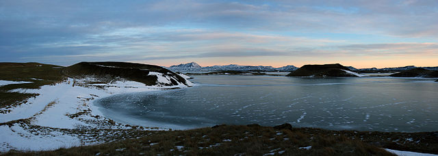
Shore of Mývatn.
The plateau surrounding Mývatn. In the distance are Gæsafjöll (882m, left), Krafla (818m, centre-left, behind the dark Vindbelgur (529m)), Hverfjall (caldera at centre), Búrfell (953m, centre-right), and Bláfjall (1222m, right).
Panorama of Mývatn from the town of Skútustaðir, November 2007