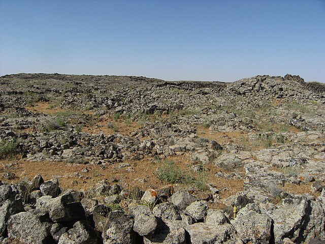
The Lajat, also spelled Lejat, Lajah, el-Leja or Laja, is the largest lava field in southern Syria, spanning some 900 square kilometers. Located about 50 kilometers (31 mi) southeast of Damascus, the Lajat borders the Hauran plain to the west and the foothills of Jabal al-Druze to the south. The average elevation is between 600 and 700 meters above sea level, with the highest volcanic cone being 1,159 meters above sea level. Receiving little annual rainfall, the Lajat is largely barren, though there are scattered patches of arable land in some of its depressions.
The landscape of the Lajat (pictured) largely consists of gray, volcanic rock with scattered patches of arable land
The ruins of basaltic stone structures in the Lajat
Roman-era buildings in the modern town of Shahba (ancient Phillipopolis), located in the southeastern edge of Lajat
The Byzantine-era basilica of Saint George in Izra (ancient Zorava), located in the southwestern edge of the Lajat
Damascus is the capital and largest city of Syria, the oldest current capital in the world and, according to some, the fourth holiest city in Islam. Known colloquially in Syria as aš-Šām (الشَّام) and dubbed, poetically, the "City of Jasmine", Damascus is a major cultural center of the Levant and the Arab world.
Umayyad Mosque General view of Damascus • Mount Qasioun Maktab Anbar • Azm Palace Sulaymaniyya Takiyya
Damascus in spring seen from Spot satellite
Mount Qasioun overlooking the city
One of the rare periods the Barada river is high, seen here next to the Four Seasons hotel in downtown Damascus


