Lake Oahe is a large reservoir behind Oahe Dam on the Missouri River; it begins in central South Dakota and continues north into North Dakota in the United States. The lake has an area of 370,000 acres (1,500 km2) and a maximum depth of 205 ft (62 m). By volume, it is the fourth-largest reservoir in the US. Lake Oahe has a length of approximately 231 mi (372 km) and has a shoreline of 2,250 mi (3,620 km). 51 recreation areas are located along Lake Oahe, and 1.5 million people visit the reservoir every year. The lake is named for the 1874 Oahe Indian Mission.
Lake Oahe in winter, 2009
The Oahe Dam is a large earthen dam on the Missouri River, just north of Pierre, South Dakota, United States. Begun in 1948 and opened in 1962, the dam creates Lake Oahe, the fourth-largest man-made reservoir in the United States. The reservoir stretches 231 miles (372 km) up the course of the Missouri to Bismarck, North Dakota. The dam's power plant provides electricity for much of the north-central United States. It is named for the Oahe Indian Mission established among the Lakota Sioux in 1874.
Oahe Dam from the International Space Station
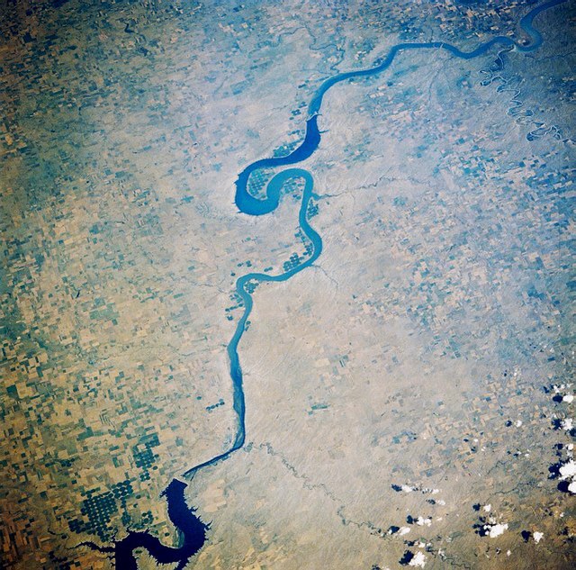
Upper Lake Oahe (Reservoir), between Pollock, South Dakota, and Cannon Ball, North Dakota, as seen from space, October 1985. North is at the bottom of the photo.
Looking southeast from space, August, 1989. The lower Oahe Reservoir and Oahe Dam are near the bottom of this view; Lake Sharpe and Big Bend Dam are near the top. Pierre, South Dakota is near the bottom of the photo; Chamberlain, South Dakota is near the top.
Oahe powerhouse showing surge tanks and powerhouse, looking to north-west