Land Ordinance of 1785
Videos
Photos
The Land Ordinance of 1785 was adopted by the United States Congress of the Confederation on May 20, 1785. It set up a standardized system whereby settlers could purchase title to farmland in the undeveloped west. Congress at the time did not have the power to raise revenue by direct taxation, so land sales provided an important revenue stream. The Ordinance set up a survey system that eventually covered over three-quarters of the area of the continental United States.

Diagram of the 1785 Land Ordinance showing how the method of subdivision can be applied from the scale of the country down to the scale of a single lot
Surveying
Videos
Photos
Surveying or land surveying is the technique, profession, art, and science of determining the terrestrial two-dimensional or three-dimensional positions of points and the distances and angles between them. These points are usually on the surface of the Earth, and they are often used to establish maps and boundaries for ownership, locations, such as the designed positions of structural components for construction or the surface location of subsurface features, or other purposes required by government or civil law, such as property sales.

A surveyor using a total station

A student using a theodolite in field
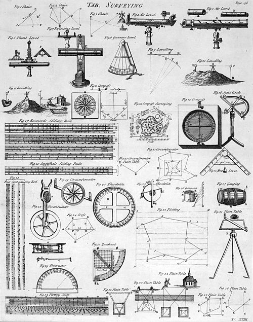
Table of Surveying, 1728 Cyclopaedia

A railroad surveying party at Russel's Tank, Arizona in the 1860s