Lidar
Videos
Lidar is a method for determining ranges by targeting an object or a surface with a laser and measuring the time for the reflected light to return to the optical receiver. Lidar may operate in a fixed
Lidar-derived image of the Marching Bears Mound Group, Effigy Mounds National Monument, United States

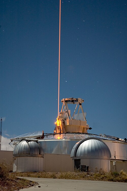
A frequency addition source of optical radiation (FASOR) used at the Starfire Optical Range for lidar and laser guide star experiments is tuned to the sodium D2a line and used to excite sodium atoms in the upper atmosphere.

This lidar may be used to scan buildings, rock formations, et cetera, to produce a 3D model. The lidar can aim its laser beam in a wide range: its head rotates horizontally; a mirror tilts vertically. The laser beam is used to measure the distance to the first object on its path.

A DSM lidar view of Ferrybridge Henge (bottom right) and the surrounding roads and area in West Yorkshire
Effigy Mounds National Monument preserves more than 200 prehistoric mounds built by pre-Columbian Mound Builder cultures, mostly in the first millennium CE, during the later part of the Woodland perio
Lidar
…Lidar-derived image of the Marching Bears Mound Group, Effigy Mounds National Monument, United States Lidar (, an acronym of light detection and ranging or laser imaging, detection, and ranging, often stylized LiDAR) is a method for…

Big Bear Mound at Effigy Mounds National Monument

An entrance to Effigy Mounds National Monument

Woodland conical mounds at Effigy Mounds National Monument, Sny Magill Unit, Clayton County, Iowa