Little Colorado River
Videos
The Little Colorado River is a tributary of the Colorado River in the U.S. state of Arizona, providing the principal drainage from the Painted Desert region. Together with its major tributary, the Puerco River, it drains an area of about 26,500 square miles (69,000 km2) in eastern Arizona and western New Mexico. Although it stretches almost 340 miles (550 km), only the headwaters and the lowermost reaches flow year-round. Between St. Johns and Cameron, most of the river is a wide, braided wash, only containing water after heavy snowmelt or flash flooding.


The Grand Falls of the Little Colorado River, seen at peak flow in April

The Little Colorado River in its canyon

Navajo Indians crossing the Little Colorado River, ca.1900
Grand Canyon
Videos
The Grand Canyon is a steep-sided canyon carved by the Colorado River in Arizona, United States. The Grand Canyon is 277 miles (446 km) long, up to 18 miles (29 km) wide and attains a depth of over a mile.


The Colorado River flowing through the Grand Canyon in Arizona

Image of the Grand Canyon and surrounding area taken from the International Space Station
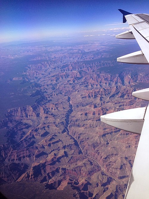
The Grand Canyon from an airplane, with the Colorado River visible

Rockfalls in recent times, along with other mass wasting, have further widened the canyon