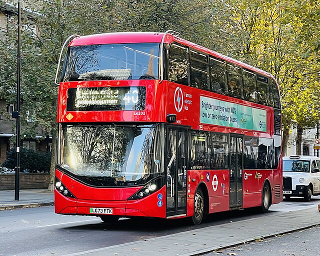
Northumberland Park, London
Northumberland Park is a ward in the Tottenham area of London Borough of Haringey, in Greater London, England. It is residential, consisting of houses and flats, it is the location of Tottenham Hotspur Stadium, the home ground of Tottenham Hotspur F. C.. The ward is represented by three Labour councillors. Northumberland Park, the ward, Northumberland Park the estate are at the north-east of Tottenham, at the extreme north-east of Haringey. Within Haringey, it borders White Hart Lane to the east. and Bruce Grove to the southeast and Tottenham Hale to the south. It borders Edmonton in Enfield to its north and Lea Valley to the east, it includes a number of major housing estates – Northumberland Park estate, Stellar House, Altair Close and The Lindales. As of 2018, the ward has a population of 16,641, a high proportion of which are from ethnic backgrounds; those of Black ethnicity form the largest ethnic grouping in the ward, representing 40.3% of the population, while those classified as White British form 16.6% of the population, proportionally the highest and lowest in Haringey respectively.
50.8% of the population identify themselves as Christian and 24.2% Muslim, the largest proportion of Muslims of all wards in Haringey. 13.2% profess no religion. The ward is the most deprived in Haringey, one of the most deprived in London. Nationally, it was ranked among the 2–3% most deprived of all wards in 2015; the median household income in Northumberland Park is the lowest in Haringey below the average of London. It has a higher level of unemployment than the averages of Haringey and London; the Northumberland Development Project is a major project that centers on the construction of the Tottenham Hotspur Stadium but include hotels, residential units, retail spaces. It is intended to be the catalyst for a 20-year regeneration program for Tottenham planned by the Haringey Council. Among the projects planned is the High Road West regeneration scheme which aims to redevelop the area between the stadium and White Hart Lane station; the White Hart Lane Station will be rebuilt, while the Northumberland Park railway station is being reconstructed with significant improvements for services planned.
The area has been included in the Tottenham Area Action Plan a controversial program to improve the standard of housing and employment, while maximising the use of the land asset. This acts as a politically approved framework for development by the Haringey Development Vehicle a joint venture company 50/50 owned by London Borough of Haringey and Lendlease; the setting up of this organisation, approved by the Haringey Cabinet was opposed by 20 of the Labour councillors in the 49 member council. There are various transportation links including White Hart Lane railway station and Northumberland Park railway station and Northumberland Park bus stand, served by routes W3, 476 and 341, it is the location of the London Underground's Victoria line depot. There are a number of shops located at the end nearest to Tottenham High Road. There is one pub open along Northumberland Park road,'The Bill Nicholson' known as'The Northumberland Arms', colloquially known as "The Billy Nick" after the Tottenham Hotspur manager Bill Nicholson and is frequented by Spurs fans on match days
London Underground
The London Underground is a public rapid transit system serving London and some parts of the adjacent counties of Buckinghamshire and Hertfordshire in the United Kingdom. The Underground has its origins in the Metropolitan Railway, the world's first underground passenger railway. Opened in January 1863, it is now part of the Metropolitan lines; the network has expanded to 11 lines, in 2017/18 carried 1.357 billion passengers, making it the world's 11th busiest metro system. The 11 lines collectively handle up to 5 million passengers a day; the system's first tunnels were built just below the surface. The system has 250 miles of track. Despite its name, only 45% of the system is underground in tunnels, with much of the network in the outer environs of London being on the surface. In addition, the Underground does not cover most southern parts of Greater London, with fewer than 10% of the stations located south of the River Thames; the early tube lines owned by several private companies, were brought together under the "UndergrounD" brand in the early 20th century and merged along with the sub-surface lines and bus services in 1933 to form London Transport under the control of the London Passenger Transport Board.
The current operator, London Underground Limited, is a wholly owned subsidiary of Transport for London, the statutory corporation responsible for the transport network in Greater London. As of 2015, 92% of operational expenditure is covered by passenger fares; the Travelcard ticket was introduced in 1983 and Oyster, a contactless ticketing system, in 2003. Contactless card payments were introduced in 2014, the first public transport system in the world to do so; the LPTB was a prominent patron of art and design, commissioning many new station buildings and public artworks in a modernist style. The schematic Tube map, designed by Harry Beck in 1931, was voted a national design icon in 2006 and now includes other TfL transport systems such as the Docklands Light Railway, London Overground and Tramlink. Other famous London Underground branding includes the roundel and Johnston typeface, created by Edward Johnston in 1916; the idea of an underground railway linking the City of London with the urban centre was proposed in the 1830s, the Metropolitan Railway was granted permission to build such a line in 1854.
To prepare construction, a short test tunnel was built in 1855 in Kibblesworth, a small town with geological properties similar to London. This test tunnel was used for two years in the development of the first underground train, was in 1861, filled up; the world's first underground railway, it opened in January 1863 between Paddington and Farringdon using gas-lit wooden carriages hauled by steam locomotives. It was hailed as a success, carrying 38,000 passengers on the opening day, borrowing trains from other railways to supplement the service; the Metropolitan District Railway opened in December 1868 from South Kensington to Westminster as part of a plan for an underground "inner circle" connecting London's main-line stations. The Metropolitan and District railways completed the Circle line in 1884, built using the cut and cover method. Both railways expanded, the District building five branches to the west reaching Ealing, Uxbridge and Wimbledon and the Metropolitan extended as far as Verney Junction in Buckinghamshire, more than 50 miles from Baker Street and the centre of London.
For the first deep-level tube line, the City and South London Railway, two 10 feet 2 inches diameter circular tunnels were dug between King William Street and Stockwell, under the roads to avoid the need for agreement with owners of property on the surface. This opened in 1890 with electric locomotives that hauled carriages with small opaque windows, nicknamed padded cells; the Waterloo and City Railway opened in 1898, followed by the Central London Railway in 1900, known as the "twopenny tube". These two ran electric trains in circular tunnels having diameters between 11 feet 8 inches and 12 feet 2.5 inches, whereas the Great Northern and City Railway, which opened in 1904, was built to take main line trains from Finsbury Park to a Moorgate terminus in the City and had 16-foot diameter tunnels. While steam locomotives were in use on the Underground there were contrasting health reports. There were many instances of passengers collapsing whilst travelling, due to heat and pollution, leading for calls to clean the air through the installation of garden plants.
The Metropolitan encouraged beards for staff to act as an air filter. There were other reports claiming beneficial outcomes of using the Underground, including the designation of Great Portland Street as a "sanatorium for asthma and bronchial complaints", tonsillitis could be cured with acid gas and the Twopenny Tube cured anorexia. With the advent of electric Tube services, the Volks Electric Railway, in Brighton, competition from electric trams, the pioneering Underground companies needed modernising. In the early 20th century, the District and Metropolitan railways needed to electrify and a joint committee recommended an AC system, the two companies
Whitehall
Whitehall is a road in the City of Westminster, Central London, which forms the first part of the A3212 road from Trafalgar Square to Chelsea. It is the main thoroughfare running south from Trafalgar Square towards Parliament Square; the street is recognised as the centre of the Government of the United Kingdom and is lined with numerous departments and ministries, including the Ministry of Defence, Horse Guards and the Cabinet Office. The name'Whitehall' is used as a metonym for the British civil service and government, as the geographic name for the surrounding area; the name was taken from the Palace of Whitehall, the residence of Kings Henry VIII through to William III, before its destruction by fire in 1698. Whitehall was a wide road that led to the front of the palace; as well as government buildings, the street is known for its memorial statues and monuments, including Britain's primary war memorial, the Cenotaph. The Whitehall Theatre, now the Trafalgar Studios, has been popular for farce comedies since the mid-20th century.
The name Whitehall was used for several buildings in the Tudor period. It either referred to a building made of light stone, or as a general term for any festival building; this included the Royal Palace of Whitehall. The street runs through the City of Westminster, it is part of the A3212, a main road in Central London that leads towards Chelsea via the Houses of Parliament and Vauxhall Bridge. It runs south from Trafalgar Square, past numerous government buildings, including the old War Office building, Horse Guards, the Ministry of Defence, the Cabinet Office and the Department of Health, it ends at the Cenotaph, the road ahead being Parliament Street. Great Scotland Yard and Horse Guards Avenue branch off to the east, while Downing Street branches off to the west at the southern section of the street; the nearest tube stations are Charing Cross at the north end, Westminster at the south. Numerous London bus routes run along Whitehall, including 12, 24, 53, 88, 159 and 453. There has been a route connecting Charing Cross to Westminster since the Middle Ages.
The name Whitehall was only used for the section of road between Charing Cross and Holbein Gate. It had become a residential street by the 16th century, had become a popular place to live by the 17th, with residents including Lord Howard of Effingham and Edmund Spenser; the Palace of Whitehall, to the east of the road, was named York Palace, but was renamed during the reign of Henry VIII. The palace was redesigned in 1531–32 and became the King's main residence in the decade, he married Anne Boleyn here in 1533, followed by Jane Seymour in 1536, died at the palace in 1547. Charles I owned an extensive art collection at the palace and several of William Shakespeare's plays had their first performances here, it ceased to be a royal residence after 1689. The palace was damaged by fire in 1691, following which the front entrance was redesigned by Sir Christopher Wren. In 1698, most of the palace burned to the ground accidentally after a fire started by a careless washerwoman. Wallingford House was constructed in 1572 by William Knollys, 1st Earl of Banbury along the western edge of Whitehall.
It was subsequently used by Charles I. During the reign of William III, it was bought for the Admiralty; the Old Admiralty Buildings now sit on the house's site. Banqueting House was built as an extension to the Palace of Whitehall in 1622 by Inigo Jones, it is the only surviving portion of the palace after it was burned down, was the first Renaissance building in London. It became a museum to the Royal United Services Institute and has been opened to the public since 1963. Oliver Cromwell moved to the street in 1647. Two years Charles I was carried through Whitehall on the way to his trial at Westminster Hall. Whitehall itself was a wide street and had sufficient space for a scaffold to be erected for the King's execution at Banqueting House, he made a brief speech there before being beheaded. Cromwell died at the Palace of Whitehall in 1658. During the Great Plague of London in 1665, people boarded coaches at Whitehall at the edge of urban London, in an attempt to escape; the King and court temporarily moved to Oxford to avoid the plague, while Samuel Pepys remarked in his diary on 29 June, "By water to Whitehall, where the Court is full of waggons and people ready to go out of town.
This end of town every day grows bad with plague". By the 18th century, traffic was struggling along the narrow streets south of Holbein Gate, which led to King Street Gate being demolished in 1723. Holbein Gate, in turn, was demolished in 1759. Meanwhile, Parliament Street was a side road alongside the palace, leading to the Palace of Westminster. After the Palace of Whitehall was destroyed, Parliament Street was widened to match Whitehall's width; the present appearance of the street dates from 1899 after a group of houses between Downing Street and Great George Street were destroyed. By the time the palace was destroyed, separation of crown and state had become important, with Parliament being necessary to control military requirements and pass laws; the government wanted to be some distance from the monarch, the buildings around Whitehall, physically separated from St James's Pal
London General
London General is a bus company operating services in Greater London. It is a subsidiary of the Go-Ahead Group and operates most buses under contract to Transport for London; the company is named after the London General Omnibus Company, the principal operator of buses in London between 1855 and 1933. The modern-day London General commenced operating on 1 April 1989 when London Buses was divided into 11 separate business units, its original logo being an omnibus in reflection of the name's history. In 1994 the company was sold in a management buyout, before being sold to the Go-Ahead Group in May 1996; the company moved its offices to an address in Merton, adjacent to the Merton bus garage. In August 2008, Go-Ahead's London bus operations all adopted the Go-Ahead London trading name, although the individual company names are still applied beneath the logo. In October 2009, Go-Ahead completed the purchase of East Thames Buses from Transport for London and incorporated it into London General. Although Transport for London's normal practice is to put routes out for tender, London General began a new five-year contract for all East Thames Buses routes without going through the tendering process.
In March 2012, First London's Northumberland Park garage was purchased. On 1 April 2014, the London operations of Metrobus depots in Croydon and Orpington were integrated into London General. On 25 April 2014, the Vehicle and Operator Services Agency formally increased London General's licence to accommodate the Metrobus buses. However, as at September 2014, the buses continued to carry Metrobus branding. London General operates 9 bus garages; as at October 2017, Sutton garage operate routes 80, 93, 151, 154, 164, 213 and N155. Opened by the London General Omnibus Company in January 1924 at cost of £30,000, Sutton garage had a capacity for 100 buses. During its early years, less than half of the garage was put to use, holding only 40 buses by 1926; this would change somewhat by the extension of the Underground to Morden and major house-building projects in the area. Between 1945 and 1953, it had an allocation of 100 Utility Daimlers numbered from D182 - D281. By 1952, the garage had 128 buses allocated, achieved by parking buses in surrounding streets.
However, this would soon fall again, to 100 in 1966, 82 in 1976 and 62 in 1987. The garage passed to the reborn London General bus company in the run-up to privatisation in 1985. Sutton Garage partly took control of route 200 at a yard in Colliers Wood in 1989, after Cityrama withdrew from their contract. Sutton was responsible for providing drivers for the service, whilst Merton garage were contracted to do the maintenance. By 1994, the garage allocation had grown to 85 buses and again to 92 in 2001, including 10 buses subcontracted to Surrey County Council. Sutton helped when Carshalton garage closed in 1964; as of October 2017, Putney garage operate routes 14, 22, 74, 337, 424, 430, 485, 639, 670, N22 and N74. With its ancestry going back to the horse bus days of the 1880s, Chelverton Road Garage was converted to a motor-bus garage in 1912; the garage is well hidden in a side road with a modest frontage, yet it has an allocation of 112. It has been modernised twice, firstly in 1935 and again in 1985.
The garage was well known for being allocated the pre-war RTs in 1940. During the war the garage was used to store de-licensed buses. Renamed Putney in 1963 after the closure of Putney Bridge garage it started to receive both short and long wheelbase AEC Routemasters for its central London routes; the Routemasters remained at the garage until July 2005 when both the 14 and 22 were converted to low floor one-person-operated buses. As of October 2017, Merton garage operate routes 44, 57, 131, 152, 163, 164, 200, 219, 270, 280 and 655, it runs the St. Bede's School private bus services 514 and 519, which run between the Caterham area and the school, on behalf of Surrey County Council; the garage was modernised in 1960, again in 1991 when a new roof was fitted and various stores and welfare areas were moved to provide a larger, unobstructed parking area, long and narrow. Merton was responsible for the maintenance of vehicles for route 200 in 1988/9 after the withdrawal of the Cityrama sightseeing company, whilst the route was operated from Sutton garage.
The garage has become Go-Ahead London's head office, following the sale of Raleigh House and the acquisition of the former pub next door. As at August 2017, Croydon garage operate routes 119, 127, 202, 355, 359, 405, 434, 455 and X26 The Beddington Lane depot was opened by Metrobus in December 2005 to house route 127, surrendered early by Centra. Work was completed on the garage buildings in February 2006; this garage took over the London routes that ran from Godstone with the exception of the 146 and 246 which moved to Orpington. As of March 2018, the Green Street Green garage operate routes 126, 138, 162, 233, 246, 320, 352, 353, 358, 654, R1, R2, R3, R4, R6, R8, R9 and R11. A former farm, Green Street Green depot was for many years the only garage for all of Metrobus' London tendered routes since the award of route 61 in 1986. More routes have been operated from Godstone and in December 2005 a new depot was constructed in Croydon to cope with new tender awards. During mid-2005 major reconstruction started on the Green Street Green site to make improvements and provide an expansion.
During these works, a temporary base was being used at Sevenoaks in next to the base of what was Southlands Travel. As at April 2019, Northumberland Park garage operate routes 76, 153, 191, 192, 357, 379, 476, 616, 657, 675, W10. Capital Citybus was bought out by the management team in late 1995
Putney
Putney is a district in south-west London, England in the London Borough of Wandsworth. It is centred 6.1 miles south-west of Charing Cross. The area is identified in the London Plan as one of 35 major centres in Greater London. Putney is an ancient parish which covered 9.11 square kilometres and was until 1889 in the Hundred of Brixton in the county of Surrey. Its area has been reduced by the loss of Roehampton to the south-west, an offshoot hamlet that conserved more of its own clustered historic core. In 1855 the parish was included in the area of responsibility of the Metropolitan Board of Works and was grouped into the Wandsworth District. In 1889 the area became part of the County of London; the Wandsworth District became the Metropolitan Borough of Wandsworth in 1900. Since 1965 Putney has formed part of the London Borough of Wandsworth in Greater London; the benefice of the parish remains a perpetual curacy whose patron is the Dean and Chapter of Worcester. The church, founded in the medieval period as a chapel of ease to Wimbledon, was rebuilt in the early Tudor period and in 1836 was again rebuilt, the old tower restored, at an expense of £7000 defrayed by subscription, a rate, a grant of £400 from the Incorporated Society.
It has a small chantry chapel removed from the east end of the south aisle, rebuilt at the east end of the north side, preserving the old style. In 1684, Thomas Martyn bequeathed lands for the foundation and support of a charity school for 20 boys, sons of watermen. A charitable almshouse for 12 men and women, dedicated to the Holy Trinity, was erected by Sir Abraham Dawes, who provided it with an endowment. Putney was the birthplace of Thomas Cromwell, made Earl of Essex by Henry VIII and of Edward Gibbon, author of the Decline and Fall of the Roman Empire, born in 1737. John Toland, a noted free-thinker and was buried at Putney in 1722. Robert Wood, under-Secretary of State for the Southern Department, who published The Ruins of Palmyra about the Roman ruins he visited at Baalbek in Syria, other archæological works lies here. William Pitt, Earl of Chatham, died at a house on Putney Heath. In the 1840s Putney was still a part-wooded, part-agricultural village focussed closest to the Thames, opposite to Fulham, with which it was connected by a wooden bridge.
It was street-lit with gas paved, well supplied with water. At that time Putney took on London's premier role in civil engineering; the College for Civil Engineers relocated to Putney in 1840, for the purpose of affording sound instruction in the theory and practice of civil engineering and architecture, in all those branches of science and learning which are adapted to the advanced state of society, constitute an education that fits the student for any pursuit or profession. Putney had a second place of worship for Independents, Roehampton was in the process of achieving separate parish status; the proprietors of the bridge distributed £31 per annum to watermen, watermen's widows and children, the parish received benefit from Henry Smith's and other charities. Putney in 1887 covered 9 square kilometres. Putney appears in the Domesday Book of 1086 as Putelei, it was noted that it did not fall into the category of local jurisdictions known as a manor, but obtained 20 shillings from the ferry or market toll at Putney belonging to the manor of Mortlake.
The ferry was mentioned in the household accounts of Edward I: Robert the Ferryman of Putney and other sailors received 3/6d for carrying a great part of the royal family across the Thames and for taking the king and his family to Westminster. One famous crossing at Putney was that of Cardinal Wolsey in 1529 upon his'disgrace' in falling out of favour with Henry VIII and on ceasing to be the holder of the Great Seal of England; as he was riding up Putney Hill he was overtaken by one of the royal chamberlains who presented him with a ring as a token of the continuance of his majesty's favour. When the Cardinal had heard these words of the king, he lighted from his mule and knelt down in the dirt upon both knees, holding up his hands for joy, said "When I consider the joyful news that you have brought to me, I could do no less than rejoice; every word pierces so my heart, that the sudden joy surmounted my memory, having no regard or respect to the place. The first bridge of any kind between the two parishes of Fulham and Putney was built during the Civil War: after the Battle of Brentford in 1642, the Parliamentary forces built a bridge of boats between Fulham and Putney.
According to an account from the period:The Lord General hath caused a bridge to be built upon barges and lighters over the Thames between Fulham and Putney, to convey his army and artillery over into Surrey, to follow the king's forces. The first permanent bridge between Fulham and Putney was completed in 1729, was the second bridge to be built across the Thames in London. One story runs that "in 1720 Sir Robert Walpole was returning from seeing George I at Kingston and being in a hurry to get to the House of Commons rode together with his servant to P
Orpington
Orpington is a town and electoral ward in the London Borough of Bromley, Greater London, England, at the south-eastern edge of London's urban sprawl. It is identified in the London Plan as one of 35 major centres in Greater London. Before the creation of Greater London in 1965, Orpington was in the county of Kent. Stone Age tools have been found in several areas of Orpington, including Goddington Park, Priory Gardens, the Ramsden estate, Poverest. Early Bronze Age pottery fragments have been found in the Park Avenue area. During the building of Ramsden Boys School in 1956, the remains of an Iron Age farmstead were excavated; the area was occupied in Roman times, as shown by Crofton Roman Villa and the Roman bath-house at Fordcroft. During the Anglo-Saxon period, Fordcroft Anglo-Saxon cemetery was used in the area; the first record of the name Orpington occurs in 1038, when King Cnut's treasurer Eadsy gave land at "Orpedingetune" to the Monastery of Christ Church at Canterbury. The parish church pre-dates the Domesday Book.
On 22 July 1573, Queen Elizabeth I was entertained at Bark Hart and her horses stabled at the Anchor and Hope Inn. On the southern edge of Orpington, Green St Green is recorded as'Grenstretre', which means a road covered with grass, it is known in the 1800s as Greenstead Green. Until the railway came, the local commercial centre was nearby St Mary Cray, rather than Orpington. St Mary Cray had a regular market, industry, whereas Orpington was just a small country village surrounded by soft fruit farms, hop fields and orchards; these crops attracted Romani people, working as itinerant pickers, to annual camps in local meadows and worked-out chalk pits. Although this work has ended, the Borough still provides a permanent site for travellers at Star Lane, historic gatherings are commemorated in local street names, such as Romany Rise. In 1967, Eric Lubbock Liberal MP for Orpington, promoted a Private Member's Bill to provide permanent Gypsy sites. In 1971, an international meeting of Romany people was held at Orpington.
Orpington has been part of the London Borough of Bromley since the 1st of April 1965, previous to this Orpington's local government was the Orpington Urban District. Orpington forms part of the Orpington and the current MP is Jo Johnson who has held the seat since 2010. Gareth Bacon is the London Assembly member for the Bexley and Bromley constituency in which Orpington is located. Orpington's mayor is Councillor Ian Payne due to Orpington being a part of the London Borough of Bromley. 2011 census data reports that the population of Orpington was 15,311 with 52% being female leaving 48% male. The average age is 42 above the national average age of 40. 86% of Orpington's population was born in England, second is Scotland with 1.1%. 95.1% of Orpington's population speak English, second is all other Chinese with just 0.4%. Christianity is the prominent religion in Orpington with 63.1% of the population identifying as Christian, no religion was second with 24.4% and Muslim third at 2.1%. Notably 45 people identify as 5 Buddhist as their religion.
51.1% of the local population is married, 23.8% are single, 8.2% cohabit with a partner of the opposite sex and 0.5% cohabit with a partner of the same sex. The leading occupation is professionals who make up 19.2% of the population followed by administrative and secretarial at 16.2%. After the Conservative member for the Orpington constituency, Donald Sumner, had resigned to become a county court judge, a by-election was held on 15 March 1962. Orpington was considered a safe Conservative seat, but Eric Lubbock, the Liberal candidate, won with a 22% swing away from the Conservatives; the result was headline news across the nation. It is from this win that the revival of the Liberal Party is dated; the High Street and adjacent Walnuts Shopping Centre contain a variety of high-street shops. There is a general market three days a week in front of Orpington College. A large Tesco supermarket opened in 2009 on the site of a former multi-storey car park. There are several restaurants in the town centre.
A restricted parking zone was introduced into Orpington high street, which enabled the council to wipe away road markings indicating parking restrictions. By combining the lack of markings, with CCTV monitoring, the council has been able to reduce the amount of street clutter and improve the quality of the High Street environment. There are ` big box' retail outlets including the new Nugent Shopping Park. Following the relocation of Marks & Spencer from their town-centre store to the Nugent Shopping Park, their previous site was taken over by Sainsbury's, who moved from their site nearby in the Walnuts; the Walnuts Leisure Centre, just east of the High Street, has a six-lane, 33.3 metre indoor swimming pool, squash courts and a gym with sauna and steam room, as well as a sports hall used for activities such as badminton, basketball and fitness classes. The sports hall is used for Women's Artistic Gymnastics, the leisure centre has been the main training venue for Orpington Gymnastic Club since the opening of the centre.
The Walnuts has been home to the Orpington Ojays swimming club for nearly 40 years. The club caters for those learning to swim right through to elite swimmers who wish to swim competitively at county and national level. There are other leisure centres such as one situated at Harris Academy Orpingt
Greater London
Greater London is a ceremonial county of England, located within the London region. This region forms the administrative boundaries of London and is organised into 33 local government districts—the 32 London boroughs and the City of London, located within the region but is separate from the county; the Greater London Authority, based in Southwark, is responsible for strategic local government across the region and consists of the Mayor of London and the London Assembly. The City of London Corporation is the principal local authority for the City of London, with a similar role to that of the 32 London borough councils. Administratively, Greater London was first established as a sui generis council area under the Greater London Council between 1963 and 1986; the county of Greater London was created on 1 April 1965 through the London Government Act 1963. The area was re-established as a region in 1994; the Greater London Authority was formed in 2000. The region had a population of 8,174,000 at the 2011 census.
The Greater London Built-up Area is used in some national statistics and is a measure of the continuous urban area and includes areas outside the administrative region. The term Greater London has been and still is used to describe different areas in governance, statistics and common parlance. In terms of ceremonial counties, London is divided into the small City of London and the much wider Greater London; this arrangement has come about because as the area of London grew and absorbed neighbouring settlements, a series of administrative reforms did not amalgamate the City of London with the surrounding metropolitan area, its unique political structure was retained. Outside the limited boundaries of the City, a variety of arrangements has governed the wider area since 1855, culminating in the creation of the Greater London administrative area in 1965; the term Greater London was used well before 1965 to refer to the Metropolitan Police District, the area of the Metropolitan Water Board, the London Passenger Transport Area and the area defined by the Registrar General as the Greater London Conurbation.
The Greater London Arterial Road Programme was devised between 1913 and 1916. One of the larger early forms was the Greater London Planning Region, devised in 1927, which occupied 1,856 square miles and included 9 million people. Although the London County Council was created covering the County of London in 1889, the county did not cover all the built-up area West Ham and East Ham, many of the LCC housing projects, including the vast Becontree Estates, were outside its boundaries; the LCC pressed for an alteration in its boundaries soon after the end of the First World War, noting that within the Metropolitan and City Police Districts there were 122 housing authorities. A Royal Commission on London Government was set up to consider the issue; the LCC proposed a vast new area for Greater London, with a boundary somewhere between the Metropolitan Police District and the home counties. Protests were made at the possibility of including Windsor and Eton in the authority; the Commission made its report in 1923.
Two minority reports favoured change beyond the amalgamation of smaller urban districts, including both smaller borough councils and a central authority for strategic functions. The London Traffic Act 1924 was a result of the Commission. Reform of local government in the County of London and its environs was next considered by the Royal Commission on Local Government in Greater London, chaired by Sir Edwin Herbert, which issued the'Herbert Report' after three years of work in 1960; the commission applied three tests to decide if a community should form part of Greater London: how strong is the area as an independent centre in its own right. Greater London was formally created by the London Government Act 1963, which came into force on 1 April 1965, replacing the administrative counties of Middlesex and London, including the City of London, where the London County Council had limited powers, absorbing parts of Essex, Hertfordshire and Surrey. Greater London had a two-tier system of local government, with the Greater London Council sharing power with the City of London Corporation and the 32 London Borough councils.
The GLC was abolished in 1986 by the Local Government Act 1985. Its functions were devolved to the City Corporation and the London Boroughs, with some functions transferred to central government and joint boards. Greater London formed the London region in 1994; the London referendum, 1998 established a public will to recreate an upper tier of government to cover the region. The Greater London Authority, London Assembly and the directly elected Mayor of London were created in 2000 by the Greater London Authority Act 1999. In 2000, the outer boundary of the Metropolitan Police District was re-aligned to the Greater London boundary; the 2000 and 2004 mayoral elections were won by Ken Livingstone, the final leader of the GLC. The 2008 and 2012 elections were won by Boris Johnson; the 2016 election was won by Sadiq Khan. Greater London includes the most associated parts of the Greater London Urban Area and their historic buffers and includes, in five boroughs, significant parts of the Metropolitan Green Belt which protects designated greenfield land in a similar way to the city's parks.
The closest and furthest boundaries are with Essex to the northeast between Sewardstonebury next to Epping Forest and Chingford and with the Mar