Main (river)
Videos
The Main is the longest tributary of the Rhine. It rises as the White Main in the Fichtel Mountains of northeastern Bavaria and flows west through central Germany for 525 kilometres (326 mi) to meet the Rhine below Rüsselsheim, Hesse. The cities of Mainz and Wiesbaden are close to the confluence.

The Main River in Würzburg

Position of the Main in Germany
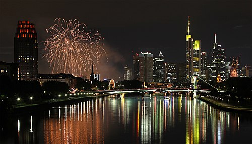
The Main in Frankfurt at night

Main in Offenbach am Main
Rhine
Videos
The Rhine is one of the major European rivers. The river begins in the Swiss canton of Graubünden in the southeastern Swiss Alps. It forms part of the Swiss-Liechtenstein, Swiss-Austrian, and Swiss-German borders. After that the Rhine defines much of the Franco-German border, after which it flows in a mostly northerly direction through the German Rhineland. Finally in Germany, the Rhine turns into a predominantly westerly direction and flows into the Netherlands where it eventually empties into the North Sea. It drains an area of 9,973 km2 and its name derives from the Celtic Rēnos. There are also two German states named after the river, North Rhine-Westphalia and Rhineland-Palatinate.

The Rhine in Basel, Switzerland

Lake Toma seen from the Rhine's upstream end

The confluence of the Anterior Rhine to the lower left and the Posterior Rhine in the background forms the Alpine Rhine (to the left) next to Reichenau.

The Rhine between Sargans in Switzerland (left) and Balzers in Liechtenstein (right) with the Gonzen (1,829 m (6,001 ft), left), the Girrenspitz (2,099 m (6,886 ft)) in the back, and the Maziferchopf (855 m (2,805 ft)) to the right