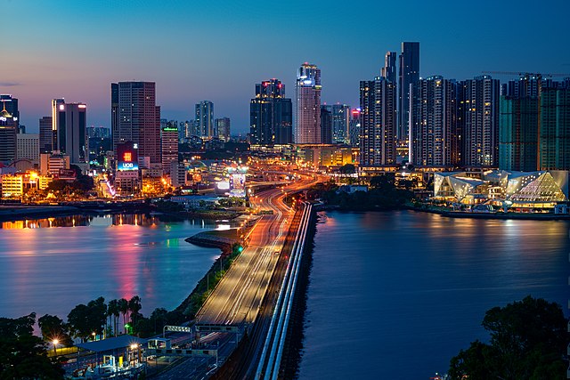
Malaysia–Singapore border
The Malaysia–Singapore border is an international maritime border between the Southeast Asian countries of Malaysia, which lies to the north of the border, and Singapore to the south. The boundary is formed by straight lines between maritime geographical coordinates running along or near the deepest channel of the Straits of Johor.
The Johor–Singapore Causeway between Malaysia and Singapore. The end of Singaporean territory in the foreground (Woodlands) and the start of Malaysian territory in the background (Johor Bahru) can be clearly seen with the differences in road surface, street lights and markings near the midsection of the Causeway.
The demarcation line between Singapore (left) and Malaysia (right)
Pedra Branca is an outlying island and the easternmost point of Singapore. The name of the island, which is Portuguese for "white rock", refers to whitish guano deposited on the rock. The island consists of a small outcrop of granite rocks with an area of about 8,560 square metres (92,100 sq ft) at low tide. During the low water spring tide it measures, at its longest, 137 metres (449 ft) and has an average width of 60 metres (200 ft). Pedra Branca is situated at 1°19′48″N 104°24′27″E, where the Singapore Strait meets the South China Sea.
Pedra Branca and Horsburgh Lighthouse
A replica of Long Ya Men at the Labrador Nature Reserve, put up in 2005 as part of the Singapore Zheng He's 600th Anniversary Celebrations
Thomas and William Daniell's etching of Pedra Branca before the building of Horsburgh Lighthouse, c. 1820
Horsburgh Lighthouse, a painting by John Turnbull Thomson (1821–1884) showing the island of Pedra Branca just after the completion of the lighthouse in 1851, which he designed.


