Mariana Islands
Videos
The Mariana Islands, also simply the Marianas, are a crescent-shaped archipelago comprising the summits of fifteen longitudinally oriented, mostly dormant volcanic mountains in the north-western Pacif

Tropical dry forest on Saipan

Ruins of Guma Taga on Tinian. The pillars/columns are called latte (pronounced læ'di) stones, a common architectural element of prehistoric structures in the Mariana Islands, upon which elevated buildings were built. Earthquakes had toppled the other latte at this site by the time this photo was taken; an earthquake in 1902 toppled the one seen on the left, and today only the one on the right remains standing.

Reception of the Manila Galleon by the Chamorro in the Ladrones Islands, c. 1590 Boxer Codex

A stamp from the Marianas' late Spanish colonial period, 1898–1899
Guam
Videos
Guam is an organized, unincorporated territory of the United States in the Micronesia subregion of the western Pacific Ocean. Guam's capital is Hagåtña, and the most populous village is Dededo. It is
Mariana Islands
…into two jurisdictions of the United States: the Commonwealth of the Northern Mariana Islands and, at the southern end of the chain, the territory of Guam. The islands were named after the influential Spanish queen Mariana of Austria following their colonization in the 17th century. The indigenous inhabitants…

The main street of Hagåtña c. 1899–1900.

U.S. Marines walk through the ruins of Hagåtña, July 1944.
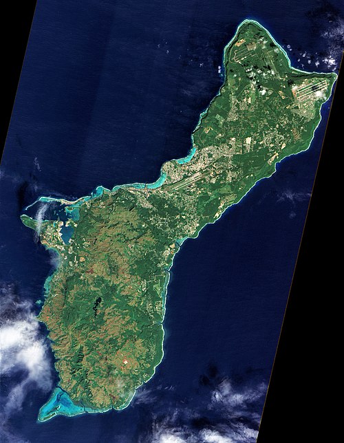
A photograph of Guam from space captured by NASA's now decommissioned Earth observation satellite, Earth Observing-1 (EO-1), December 2011.