Martin Waldseemüller was a German cartographer and humanist scholar. Sometimes known by the Latinized form of his name, Hylacomylus, his work was influential among contemporary cartographers. His collaborator Matthias Ringmann and he are credited with the first recorded usage of the word America to name a portion of the New World in honour of Italian explorer Amerigo Vespucci in a world map they delineated in 1507. Waldseemüller was also the first to map South America as a continent separate from Asia, the first to produce a printed globe, and the first to create a printed wall map of Europe. A set of his maps printed as an appendix to the 1513 edition of Ptolemy's Geography is considered to be the first example of a modern atlas.
Martin Waldseemüller (19th-century painting)
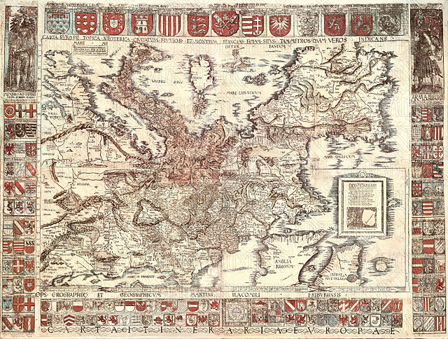
Carta Itineraria Europae from 1520: South is at the top.
Cartography is the study and practice of making and using maps. Combining science, aesthetics and technique, cartography builds on the premise that reality can be modeled in ways that communicate spatial information effectively.
Valcamonica rock art (I), Paspardo r. 29, topographic composition, 4th millennium BCE
The Tabula Rogeriana, drawn by Muhammad al-Idrisi for Roger II of Sicily in 1154. South is at the top.
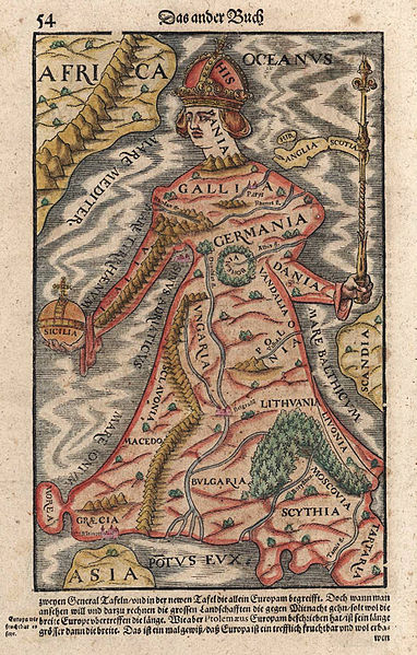
Europa regina in Sebastian Münster's "Cosmographia", 1570
A pre-Mercator nautical chart of 1571, from Portuguese cartographer Fernão Vaz Dourado (c. 1520 – c. 1580). It belongs to the so-called plane chart model, where observed latitudes and magnetic directions are plotted directly into the plane, with a constant scale, as if the Earth were a plane (Portuguese National Archives of Torre do Tombo, Lisbon).