Maxwell Land Grant
Videos
Page
The Maxwell Land Grant, also known as the Beaubien-Miranda Land Grant, was a 1,714,765-acre (6,939.41 km2) Mexican land grant in Colfax County, New Mexico, and part of adjoining Las Animas County, Colorado. This 1841 land grant was one of the largest contiguous private landholdings in the history of the United States. The New Mexico communities of Cimarron, Dawson, Elizabethtown, Baldy Town, Maxwell, Miami, Raton, Rayado, Springer, Ute Park and Vermejo Park came to be located within the grant, as well as numerous places that are now ghost towns.

The grant was owned by frontiersman Lucien B. Maxwell.
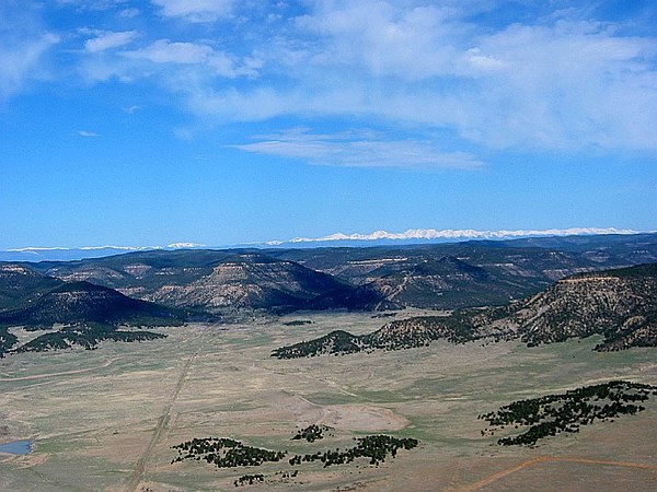
The lands of the grant reach from the Great Plains to the crest of the Sangre de Cristo mountains an east-west distance of almost 50 mi (80 km).

Baldy Mountain, 12,441 ft (3,792 m) in elevation, is in the grant area.

Fishers Peak in Colorado is the northeastern boundary of the grant.
Colfax County, New Mexico
Videos
Page
Colfax County is a county in the U.S. state of New Mexico. As of the 2020 census, the population was 12,387. Its county seat is Raton. It is south from the Colorado state line. This county was named for Schuyler Colfax (1823–1885), seventeenth Vice President of the United States under U.S. President Ulysses S. Grant.

Colfax County Courthouse in Raton

Veterans Monument at Colfax County Courthouse in Raton

Former Atchison, Topeka, and Santa Fe Railroad car displayed at Raton