Meramec River
Videos
The Meramec River, sometimes spelled Maramec River, is one of the longest free-flowing waterways in the U.S. state of Missouri, draining 3,980 square miles (10,300 km2) while wandering 218 miles (351 km) from headwaters southeast of Salem to where it empties into the Mississippi River near St. Louis at Arnold and Oakville. The Meramec watershed covers
six Missouri Ozark Highland counties—Dent, Phelps, Crawford, Franklin, Jefferson, and St. Louis—and portions of eight others—Maries, Gasconade, Iron, Washington, Reynolds, St. Francois, Ste. Genevieve, and Texas. Between its source and its mouth, it falls 1,025 feet (312 m). Year-round navigability begins above Maramec Spring, just south of St. James. The Meramec's size increases at the confluence of the Dry Fork, and its navigability continues until the river enters the Mississippi at Arnold, Missouri.

At Onondaga Cave State Park

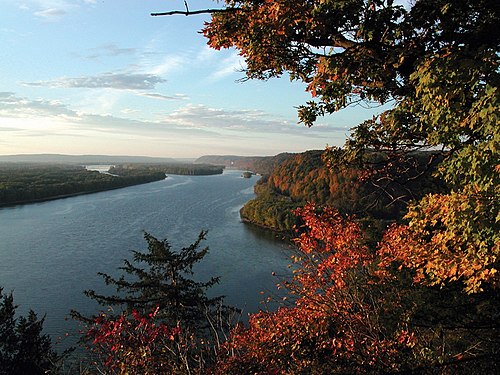
The Meramec River looking north from Route 66 State Park

Canoers enjoy a float trip on the Meramec below Leasburg

The Meramec River flowing through Castlewood State Park near St. Louis
Mississippi River
Videos
The Mississippi River is the primary river, and second-longest river, of the largest drainage basin in the United States. From its traditional source of Lake Itasca in northern Minnesota, it flows generally south for 2,340 miles (3,766 km) to the Mississippi River Delta in the Gulf of Mexico. With its many tributaries, the Mississippi's watershed drains all or parts of 32 U.S. states and two Canadian provinces between the Rocky and Appalachian mountains. The main stem is entirely within the United States; the total drainage basin is 1,151,000 sq mi (2,980,000 km2), of which only about one percent is in Canada. The Mississippi ranks as the thirteenth-largest river by discharge in the world. The river either borders or passes through the states of Minnesota, Wisconsin, Iowa, Illinois, Missouri, Kentucky, Tennessee, Arkansas, Mississippi, and Louisiana.

The source of the Mississippi River at Lake Itasca

The first bridge (and only log bridge) over the Mississippi, about 25 feet south of its source at Lake Itasca

Former head of navigation, St. Anthony Falls, Minneapolis, Minnesota