The Merced River, in the central part of the U.S. state of California, is a 145-mile (233 km)-long tributary of the San Joaquin River flowing from the Sierra Nevada into the San Joaquin Valley. It is most well known for its swift and steep course through the southern part of Yosemite National Park, where it is the primary watercourse flowing through Yosemite Valley. The river's character changes dramatically once it reaches the plains of the agricultural San Joaquin Valley, where it becomes a slow-moving meandering stream.
The Merced River in Yosemite Valley
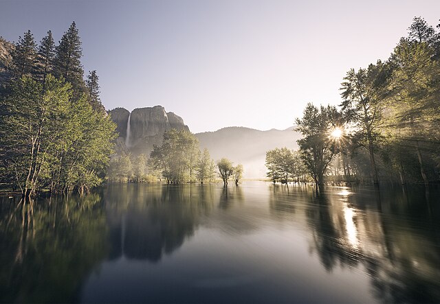
Sunrise over the Merced River as seen from Swinging Bridge in June 2023. Upper Yosemite Falls is visible on the left-hand side of the image. Demonstrated in this photo is the particularly high water level of the Merced River in 2023 as a result of the record snowpack received by the Sierra Nevada mountains.
Upper Yosemite Valley from Glacier Point
May Lake, located at the headwaters of Snow Creek, is one of many lakes that feed the Merced River
The San Joaquin River is the longest river of Central California. The 366-mile (589 km) long river starts in the high Sierra Nevada, and flows through the rich agricultural region of the northern San Joaquin Valley before reaching Suisun Bay, San Francisco Bay, and the Pacific Ocean. An important source of irrigation water as well as a wildlife corridor, the San Joaquin is among the most heavily dammed and diverted of California's rivers.
San Joaquin River near Vernalis
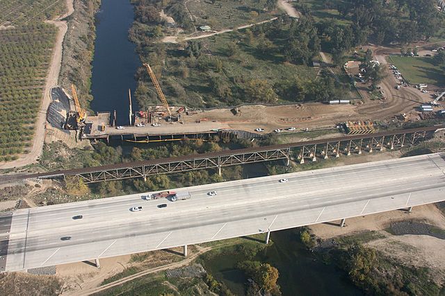
Crossings of California State Route 99 and the Union Pacific Railroad along the northern border of Fresno. The early stages of construction of California High-Speed Rail's San Joaquin River Viaduct is also visible.
The San Joaquin at Mendota Pool during the high flows of April 2006
Headwaters of the Middle Fork San Joaquin River, just downstream of Thousand Island Lake