A mesocyclone is a meso-gamma mesoscale region of rotation (vortex), typically around 2 to 6 mi in diameter, most often noticed on radar within thunderstorms. In the northern hemisphere it is usually located in the right rear flank of a supercell, or often on the eastern, or leading, flank of a high-precipitation variety of supercell. The area overlaid by a mesocyclone’s circulation may be several miles (km) wide, but substantially larger than any tornado that may develop within it, and it is within mesocyclones that intense tornadoes form.
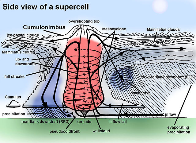
Supercell diagram with the mesocyclone rotation in red.
Mesocyclones are sometimes visually identifiable by a rotating wall cloud like the one in this thunderstorm over Texas.
A tornado developing under a wall cloud within a mesocyclone near Falcon, Colorado
Mesoscale meteorology is the study of weather systems and processes at scales smaller than synoptic-scale systems but larger than microscale and storm-scale. Horizontal dimensions generally range from around 5 kilometres (3 mi) to several hundred kilometers. Examples of mesoscale weather systems are sea breezes, squall lines, and mesoscale convective complexes.
A meso-beta scale vortex