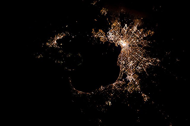
1.
Metropolis
–
The term is Greek and means the mother city of a colony, that is, the city which sent out settlers. This was later generalized to a city regarded as a center of an activity, or any large. A big city belonging to an urban agglomeration, but which is not the core of that agglomeration, is not generally considered a metropolis. The plural of the word is most commonly metropolises, although the correct plural is metropoles, in the ancient past, metropolis was the designation for a city or state of origin of a colony. Many large cities founded by ancient civilizations have been considered important world metropoles of their times due to their large populations, some of these ancient metropoles survived until the modern days and are among the worlds oldest continuously inhabited cities. This usage equates the province with the diocese or episcopal see, in modern usage the word has come to refer to a metropolitan area, a set of adjacent and interconnected cities clustered around a major urban center. In this sense, metropolitan usually means spanning the whole metropolis or proper of a metropolis, the concept of a global city is of a city that has a direct and tangible effect on global affairs through socioeconomic means. The term has become familiar, because of the rise of globalization. An attempt to define and categorize world cities by financial criteria was made by the Globalization and World Cities Research Network, the study ranked cities based on their provision of advanced producer services such as accountancy, advertising, finance and law. The inventory identifies three levels of cities and several sub-ranks. A metropolis is not necessarily a global city—or, being one, it not be among the top-ranking—due to its standards of living, development. A metropolis that is also a city is a global metropolis. Cairo and Alexandria are considered Egypts biggest metropolis, lagos is Nigerias biggest metropolis city. In South Africa, a municipality or Category A municipality is a municipality which executes all the functions of local government for a conurbation. This is by contrast to areas which are rural, where the local government is divided into district municipalities. There are eight municipalities in South Africa. In the Peoples Republic of Bangladesh, there are eleven metropolitan areas, Dhaka North, Dhaka South, Gazipur Chittagong, Rajshahi, Khulna, Sylhet, Barisal, lands are highly priced and residents are considered to have a better urban lifestyle. Special police departments are allotted for the cities, and there are city corporations for which mayors are elected for five-year regimes
2.
Metro Area
–
Metro Area is a Brooklyn-based house and nu-disco duo composed of Morgan Geist and Darshan Jesrani. Geist grew up in Wayne, New Jersey, while Jesrani is from upstate New York, both arrived at electronic music through their interest in rock music and both had been producing music independently since the mid-90s. The two met through internet mailing lists in 1995 or 1996, after collaborating under the names Sage. and Phenom, they began Metro Area in 1998, releasing four 12s on Environ under that name between 1999 and 2001. Edits of six tracks from these releases later turned up on their 2002 self-titled album, both Jesrani and Geist are DJs as well as producers, in 2002 and 2003 they hosted a monthly residency at APT in the Meatpacking District, called Party Out of Bounds. Morgan Geist also works under the name Storm Queen and is best known for the successful single Look Right Through, Metro Area Fabric 43 Metro Area 5 &6
3.
Jurisdictions
–
Jurisdiction is the practical authority granted to a legal body to administer justice within a defined area of responsibility, e. g. Michigan tax law. In federations like the U. S. areas of jurisdiction apply to local, state, colloquially it is used to refer to the geographical area to which such authority applies, e. g. the court has jurisdiction over all of Colorado. The legal term refers only to the authority, not to a geographical area. International laws and treaties provide agreements which nations agree to be bound to, supranational organizations provide mechanisms whereby disputes between nations may be resolved through arbitration or mediation. When a country is recognized as de jure, it is an acknowledgment by the de jure nations that the country has sovereignty. However, it is often at the discretion of each nation whether to co-operate or participate, if a nation does agree to participate in activities of the supranational bodies and accept decisions, the nation is giving up its sovereign authority and thereby allocating power to these bodies. The fact that organizations, courts and tribunals have been created raises the difficult question of how to co-ordinate their activities with those of national courts. But, to invoke the jurisdiction in any case, all the parties have to accept the prospective judgment as binding. This reduces the risk of wasting the Courts time, each such group may form transnational institutions with declared legislative or judicial powers. For example, in Europe, the European Court of Justice has been given jurisdiction as the appellate court to the member states on issues of European law. This jurisdiction is entrenched and its authority could only be denied by a member if that member nation asserts its sovereignty. Hence, in the Netherlands, all treaties and the orders of international organizations are effective without any action being required to convert international into municipal law, in nations adopting this theory, the local courts automatically accept jurisdiction to adjudicate on lawsuits relying on international law principles. Otherwise the courts have a discretion to apply international law where it does not conflict with statute or the common law. According to the Supreme Court of the United States, the treaty power authorizes Congress to legislate under the Necessary and this concerns the relationships both between courts in different jurisdictions, and between courts within the same jurisdiction. The usual legal doctrine under which questions of jurisdiction are decided is termed forum non conveniens, to deal with the issue of forum shopping, nations are urged to adopt more positive rules on conflict of laws. In addition, the Lugano Convention binds the European Union and the European Free Trade Association, council Regulation 44/2001 now also applies as between the rest of the EU Member States and Denmark due to an agreement reached between the European Community and Denmark. In some legal areas, at least, the CACA enforcement of judgments is now more straightforward. At a national level, the rules still determine jurisdiction over persons who are not domiciled or habitually resident in the European Union or the Lugano area
4.
Municipality
–
It is to be distinguished from the county, which may encompass rural territory and/or numerous small communities such as towns, villages and hamlets. The term municipality may also mean the governing or ruling body of a given municipality, a municipality is a general-purpose administrative subdivision, as opposed to a special-purpose district. The term is derived from French municipalité and Latin municipalis, a municipality can be any political jurisdiction from a sovereign state, such as the Principality of Monaco, or a small village, such as West Hampton Dunes, New York. The power of municipalities range from virtual autonomy to complete subordination to the state, municipalities may have the right to tax individuals and corporations with income tax, property tax, and corporate income tax, but may also receive substantial funding from the state. Similar terms include Spanish ayuntamiento, also called municipalidad, Polish gmina, Dutch/Flemish Gemeente, in Australia, the term local government area is used in place of the generic municipality. Here, the LGA Structure covers only incorporated areas of Australia, incorporated areas are legally designated parts of states and territories over which incorporated local governing bodies have responsibility. In Canada, municipalities are local governments established through provincial and territorial legislation, the Province of Ontario has different tiers of municipalities, including lower, upper, and single tiers. Types of upper tier municipalities in Ontario include counties and regional municipalities, nova Scotia also has regional municipalities, which include cities, counties, districts, or towns as municipal units. In India, a Nagar Palika or Municipality is a local body that administers a city of population 100,000 or more. Under the Panchayati Raj system, it directly with the state government. Generally, smaller cities and bigger towns have a Nagar Palika. Nagar Palikas are also a form of local self-government entrusted with duties and responsibilities. Such a corporation in Great Britain consists of a head as a mayor or provost, since local government reorganisation, the unit in England, Northern Ireland and Wales is known as a district, and in Scotland as a council area. A district may be awarded borough or city status, or can retain its district title, in Jersey, a municipality refers to the honorary officials elected to run each of the 12 parishes into which it is subdivided. This is the highest level of government in this jurisdiction. In the United States, municipality is usually understood as a city, town, village, or other local government unit, in the Peoples Republic of China, a direct-controlled municipality is a city with equal status to a province, Beijing, Tianjin, Shanghai, and Chongqing. In Taiwan, a municipality is a city with equal status to a province, Kaohsiung, New Taipei, Taichung, Tainan, Taipei. In Portuguese language usage, there are two words to distinguish the territory and the administrative organ, when referring to the territory, the word concelho is used, when referring to the organ of State, the word município is used
5.
Neighbourhood
–
A neighbourhood, or neighborhood, is a geographically localised community within a larger city, town, suburb or rural area. Neighbourhoods are often social communities with considerable face-to-face interaction among members, the Old English word for neighbourhood was neahdæl. ”Most of the earliest cities around the world as excavated by archaeologists have evidence for the presence of social neighbourhoods. Historical documents shed light on life in numerous historical preindustrial or nonwestern cities. Neighbourhoods are typically generated by social interaction among people living near one another, in this sense they are local social units larger than households not directly under the control of city or state officials. In addition to social neighbourhoods, most ancient and historical cities also had administrative districts used by officials for taxation, record-keeping, administrative districts are typically larger than neighbourhoods and their boundaries may cut across neighbourhood divisions. In some cases, however, administrative districts coincided with neighbourhoods, for example, in the T’ang period Chinese capital city Chang’an, neighbourhoods were districts and there were state officials who carefully controlled life and activity at the neighbourhood level. Neighbourhoods in preindustrial cities often had some degree of social specialisation or differentiation, ethnic neighbourhoods were important in many past cities and remain common in cities today. One factor contributing to neighbourhood distinctiveness and social cohesion in past cities was the role of rural to urban migration and this was a continual process in preindustrial cities, and migrants tended to move in with relatives and acquaintances from their rural past. Neighbourhoods have been the site of delivery or service interventions in part as efforts to provide local, quality services. Alfred Kahn, as early as the mid-1970s, described the experience, theory and fads of neighbourhood service delivery over the decade, including discussion of income transfers. Neighbourhoods, as an aspect of community, also are the site of services for youth, including children with disabilities. While the term neighbourhood organisation is not as common in 2015, community and economic development activists have pressured for reinvestment in local communities and neighbourhoods. Community and Economic Development may be understood in different ways, and may involve faith-based groups, urban sociology even has a subset termed neighbourhood sociology which supports the study of local communities and the diversity of urban neighbourhoods. Neighbourhoods are also used in studies from postal codes and health disparities. Neighbourhoods are convenient, and always accessible, since you are already in your neighbourhood when you walk out your door, successful neighbourhood action frequently requires little specialised technical skill, and often little or no money. Action may call for an investment of time, but material costs are often low, with neighbourhood action, compared to activity on larger scales, results are more likely to be visible and quickly forthcoming. The streets are cleaner, the crosswalk is painted, the trees are planted, visible and swift results are indicators of success, and since success is reinforcing, the probability of subsequent neighbourhood action is increased. The social support that a neighbourhood may provide can serve as a buffer against various forms of adversity
6.
Township
–
The word township is used to refer to various kinds of settlements in different countries. While a township may be associated with an area, there are many exceptions to this rule. In Australia, Canada, and the United States, they may be too small to be considered urban. In Australia, the designation of township traditionally refers to a town or a small community in a rural district. The term refers purely to the settlement, it does not refer to a unit of government, in Canada, two kinds of township occur in common use. In eastern Canada, a township is one form of the subdivision of a county, in Canadian French, this is a canton. Townships are referred to as lots in Prince Edward Island, they merely form census subdivisions and are not administrative units. In Canada, a municipality is a city, town, township, county and it is also a specific designation for certain municipalities in Quebec, Nova Scotia and Ontario. In western Canada, townships exist only for the purpose of land division by the Dominion Land Survey and these townships are nominally six miles by six miles. Townships are designated by their number and range number. Township 1 is the first north of the First Base Line, in China, townships are found at the fourth level of the administrative hierarchy, together with ethnic townships, towns and subdistricts. In local government in New Zealand, there are no towns or townships. All land is part of either a city or a district, the term municipality has become rare in New Zealand since about 1979 and has no legal status. The term township is, however, still in usage in New Zealand. The expression would generally equate to that of village in England, in the Philippines, townships referred to administrative divisions established during the American Civil Government in the country. Many of these divisions were originally established as rancherias during the Spanish Regime. The term was replaced with municipal district. Most municipal districts would later be converted into municipalities by executive orders from the Philippine President
7.
City
–
A city is a large and permanent human settlement. Cities generally have complex systems for sanitation, utilities, land usage, housing, a big city or metropolis usually has associated suburbs and exurbs. Such cities are associated with metropolitan areas and urban areas. Once a city expands far enough to another city, this region can be deemed a conurbation or megalopolis. Damascus is arguably the oldest city in the world, in terms of population, the largest city proper is Shanghai, while the fastest-growing is Dubai. There is not enough evidence to assert what conditions gave rise to the first cities, some theorists have speculated on what they consider suitable pre-conditions and basic mechanisms that might have been important driving forces. The conventional view holds that cities first formed after the Neolithic revolution, the Neolithic revolution brought agriculture, which made denser human populations possible, thereby supporting city development. The advent of farming encouraged hunter-gatherers to abandon nomadic lifestyles and to settle near others who lived by agricultural production, the increased population density encouraged by farming and the increased output of food per unit of land created conditions that seem more suitable for city-like activities. In his book, Cities and Economic Development, Paul Bairoch takes up position in his argument that agricultural activity appears necessary before true cities can form. According to Vere Gordon Childe, for a settlement to qualify as a city, it must have enough surplus of raw materials to support trade and a relatively large population. To illustrate this point, Bairoch offers an example, Western Europe during the pre-Neolithic, when the cost of transport is taken into account, the figure rises to 200,000 square kilometres. Bairoch noted that this is roughly the size of Great Britain, the urban theorist Jane Jacobs suggests that city formation preceded the birth of agriculture, but this view is not widely accepted. In his book City Economics, Brendan OFlaherty asserts Cities could persist—as they have for thousands of years—only if their advantages offset the disadvantages, OFlaherty illustrates two similar attracting advantages known as increasing returns to scale and economies of scale, which are concepts usually associated with businesses. Their applications are seen in more basic economic systems as well, increasing returns to scale occurs when doubling all inputs more than doubles the output an activity has economies of scale if doubling output less than doubles cost. To offer an example of these concepts, OFlaherty makes use of one of the oldest reasons why cities were built, in this example, the inputs are anything that would be used for protection and the output is the area protected and everything of value contained in it. OFlaherty then asks that we suppose the protected area is square, the advantage is expressed as, O = s 2, where O is the output and s stands for the length of a side. This equation shows that output is proportional to the square of the length of a side, the inputs depend on the length of the perimeter, I =4 s, where I stands for the quantity of inputs. So there are increasing returns to scale, O = I2 /16 and this equation shows that with twice the inputs, you produce quadruple the output
8.
Town
–
A town is a human settlement larger than a village but smaller than a city. The size definition for what constitutes a town varies considerably in different parts of the world, the word town shares an origin with the German word Zaun, the Dutch word tuin, and the Old Norse tun. The German word Zaun comes closest to the meaning of the word. An early borrowing from Celtic *dunom, in English and Dutch, the meaning of the word took on the sense of the space which these fences enclosed. In England, a town was a community that could not afford or was not allowed to build walls or other larger fortifications. In the Netherlands, this space was a garden, more specifically those of the wealthy, in Old Norse tun means a place between farmhouses, and is still used in a similar meaning in modern Norwegian. If there was any distinction between toun and burgh as claimed by some, it did not last in practice as burghs, for example, Edina Burgh or Edinburgh was built around a fort and eventually came to have a defensive wall. In some cases, town is a name for city or village. Sometimes, the town is short for township. A places population size is not a determinant of urban character. In many areas of the world, as in India at least until recent times, in the United Kingdom, there are historical cities that are far smaller than the larger towns. Some forms of settlement, such as temporary mining locations, may be clearly non-rural. Towns often exist as governmental units, with legally defined borders. In the United States these are referred to as incorporated towns, in other cases the town lacks its own governance and is said to be unincorporated. Note that the existence of a town may be legally set forth through other means. In the case of planned communities, the town exists legally in the form of covenants on the properties within the town. Australian geographer Thomas Griffith Taylor proposed a classification of towns based on their age, although there is no official use of the term for any settlement. In Albanian qytezë means small city or new city, while in ancient times small residential center within the walls of a castle
9.
Commuter town
–
A commuter town is a town whose residents normally work elsewhere, although they live, eat and sleep in these neighborhoods. The name also suggests that these communities have little commercial or industrial activity beyond a small amount of retail, oriented toward locals. A commuter town may also be known as an exurb, or a community, bedroom town or bedroom suburb. The phrase bedroom town has also adopted into the Japanese wasei-eigo word bed town. Suburbs and commuter towns often coincide, but not always, similar to college town, resort town, and mill town, the term commuter town describes the municipalitys predominant economic function. A suburb, in contrast, is a community of size, density, political power. A towns economic function may change, for example when improved transport brings commuters to industrial suburbs or railway towns in search of suburban living, commuter towns may be in rural or semi-rural areas, with a ring of green space separating them from the larger city or town. Where urban sprawl and conurbation have erased clear lines among towns and cities in large metropolitan areas, commuter towns can arise for a number of different reasons. Sometimes, as in Sleepy Hollow, New York or Tiburon, California, in other cases, a pleasant small town, such as Warwick, New York, over time attracts more residents but not large businesses to employ them, requiring denizens to commute to employment centers. Another cause, particularly relevant in the American South and West, is the growth of once-small cities. Owing largely to the creation of the Interstate Highway System. As a result, many cities were absorbed into the suburbs of these larger cities. Often, however, commuter towns form when workers in a region cannot afford to live where they work, the late 20th century dot-com bubble and United States housing bubble drove housing costs in Californian metropolitan areas to historic highs, spawning exurban growth in adjacent counties. For example, most cities in western Riverside County, California can be considered exurbs of Orange County, California and Los Angeles County, as of 2003, over 80% of the workforce of Tracy, California was employed in the San Francisco Bay Area. A related phenomenon is common in the towns of the American West that require large workforces, yet emphasize building larger single-family residences. In certain major European cites, such as Berlin and London, around London, several towns – such as Basildon, Crawley, Harlow, and Stevenage – were built for this purpose by the Commission for New Towns. In some cases, commuter towns can result from negative economic conditions, steubenville, Ohio, for instance, had its own regional identity along with neighboring Weirton, West Virginia until the collapse of the steel industry in the 1980s. In 2013, Jefferson County, Ohio was added to the Pittsburgh metropolitan area as part of its larger Combined Statistical Area, long-time residents may be displaced by new commuter residents due to rising house prices
10.
Suburb
–
A suburb is a residential area or a mixed use area, either existing as part of a city or urban area or as a separate residential community within commuting distance of a city. In some areas, such as Australia, China, New Zealand, the United Kingdom, and a few U. S. states, new suburbs are routinely annexed by adjacent cities. In others, such as Arabia, Canada, France, and much of the United States, Suburbs first emerged on a large scale in the 19th and 20th centuries as a result of improved rail and road transport, which led to an increase in commuting. Suburbs tend to proliferate around cities that have an abundance of adjacent flat land, the English word is derived from the Old French subburbe, which is in turn derived from the Latin suburbium, formed from sub and urbs. The first recorded usage of the term in English, was made by John Wycliffe in 1380, in Australia and New Zealand, suburbs have become formalised as geographic subdivisions of a city and are used by postal services in addressing. In rural areas in both countries, their equivalents are called localities, the terms inner suburb and outer suburb are used to differentiate between the higher-density suburbs in proximity to the city center, and the lower-density suburbs on the outskirts of the urban area. The term middle suburbs is also used, Suburbs, in this sense, can range from areas that seem more like residential areas of a city proper to areas separated by open countryside from the city centre. In large cities such as London, suburbs include formerly separate towns and villages that have been gradually absorbed during a growth and expansion. In the United States and Canada, suburb can refer either to an residential area of a city or town or to a separate municipality or unincorporated area outside a town or city. The earliest appearance of suburbs coincided with the spread of the first urban settlements, large walled towns tended to be the focus around which smaller villages grew up in a symbiotic relationship with the market town. The word suburbani was first used by the Roman statesman Cicero in reference to the large villas, as populations grew during the Early Modern Period in Europe, urban towns swelled with a steady influx of people from the countryside. In some places, nearby settlements were swallowed up as the city expanded. The peripheral areas on the outskirts of the city were generally inhabited by the very poorest, by the mid-19th century, the first major suburban areas were springing up around London as the city became more overcrowded and unsanitary. A major catalyst in suburban growth came from the opening of the Metropolitan Railway in the 1860s, the line joined the capitals financial heart in the City to what were to become the suburbs of Middlesex. Harrow was reached in 1880, and the line extended as far as Verney Junction in Buckinghamshire, more than 50 miles from Baker Street. Unlike other railway companies, which were required to dispose of surplus land, in 1912, it was suggested that a specially formed company should take over from the Surplus Lands Committee and develop suburban estates near the railway. However, World War I delayed these plans and it was only in 1919, with expectation of a housing boom. The term Metro-land was coined by the Mets marketing department in 1915 when the Guide to the Extension Line became the Metro-land guide and this promoted the land served by the Met for the walker, visitor and later the house-hunter
11.
County
–
A county is a geographical region of a country used for administrative or other purposes, in certain modern nations. The term is derived from the Old French conté or cunté denoting a jurisdiction under the sovereignty of a count or a viscount. The modern French is comté, and its equivalents in other languages are contea, contado, comtat, condado, Grafschaft, graafschap, Gau, when the Normans conquered England, they brought the term with them. The Saxons had already established the districts became the historic counties of England. The Vikings introduced the term earl to the British Isles, thus, the Anglo-Saxons earl and earldom were taken as equivalent to the continental use of count and county under the conquering Normans, and over time the two blended and became equivalent terms. Further, the term became a synonym for the native English word scir or, in Modern English. Since a shire was a division of the kingdom, the term county evolved to designate an administrative division of states or of a national government in most other modern uses. A county may be subdivided into districts, hundreds, townships or other administrative jurisdictions within the county. A county usually, but not always, contains cities, towns, townships, villages, or other municipal corporations, Provinces in Argentina are divided into departments, except in the Buenos Aires Province, where they are called partidos. The Autonomous City of Buenos Aires is divided into communes, in the eastern states of Australia, counties are used in the administration of land titles. They do not generally correspond to a level of government, but are used in the identification of parcels of land, canadas five oldest provinces – New Brunswick, Nova Scotia, Ontario, Quebec and Prince Edward Island – are divided into counties. In addition to counties, Ontario is also subdivided into districts, district municipalities, metropolitan municipalities. British Columbia, Manitoba, Newfoundland and Labrador, Northwest Territories, Nunavut, Saskatchewan, the word county is used to translate the Chinese term xiàn. In Mainland China, governed by the Peoples Republic of China, counties are the level of local government. There are 1,464 counties in the PRC out of a total of 2,862 county-level divisions, the number of counties has remained more or less constant since the Han dynasty. The county remains one of the oldest levels of government in China, the county government was particularly important in imperial China because this was the lowest layer at which the imperial government functioned. The head of a county during imperial times was the magistrate, in older context, prefecture and district are alternative terms to refer to xiàn before the establishment of the Republic of China. The English nomenclature county was adopted following the establishment of the ROC, contrary to the typical rural location of a county in Western countries, a city in China may enclose several counties
12.
District
–
A district is a type of administrative division that, in some countries, is managed by local government. Across the world, areas known as districts vary greatly in size, spanning entire regions or counties, several municipalities, subdivisions of municipalities, school district, in Afghanistan, a district is a subdivision of a province. There are almost 400 districts in the country, electoral districts are used in state elections. Districts were also used in several states as cadastral units for land titles, some were used as squatting districts. New South Wales had several different types of districts used in the 21st century, in Austria, a district is an administrative division normally encompassing several municipalities, roughly equivalent to the Landkreis in Germany. The administrative office of a district, the Bezirkshauptmannschaft, is headed by a Bezirkshauptmann, while there are matters of administrative law the municipalities themselves are in charge of, or where there are special bodies, the district is the basic unit of general administration in Austria. Officials on the level are not elected, but appointed by the state government. There are also independent cities in Austria and they are called Statutarstadt in Austrian administrative law. These urban districts do have the same tasks as a normal district, the State of Vienna, which is at the same time a municipality, is also subdivided in twenty-three districts, which, however, have a somewhat different function than in the rest of the country. Legally, the Magistratisches Bezirksamt is an office of the municipalitys administration. However, representatives on the level are elected, and they in turn elect the head of the district. Those representative bodies are supposed to serve as immediate contacts for the locals on the political, in practice, they have some power, e. g. concerning matters of traffic. Bangladeshi districts are administrative units. In all, there are 64 districts in Bangladesh, originally, there were 21 greater districts with several subdivisions in each district. In 1984, the government made all these subdivisions into districts, each district has several sub districts called Upazila in Bengali. In Belgian municipalities with more than 100,000 inhabitants, on initiative of the local council, as such, only Antwerp, having over 460,000 inhabitants, became subdivided into nine districts. The Belgian arrondissements, a level between province and municipality, or the lowest judicial level, are in English sometimes called districts as well. Bhutanese districts are administrative units consisting of village blocks called gewog
13.
State (polity)
–
A state is a type of polity that is an organized political community living under a single system of government. States may or may not be sovereign, for instance, federated states are members of a federal union, and may have only partial sovereignty, but are, nonetheless, states. Some states are subject to external sovereignty or hegemony, in which ultimate sovereignty lies in another state, States that are sovereign are known as sovereign states. The term state can also refer to the branches of government within a state, often as a manner of contrasting them with churches. Speakers of American English often use the state and government as synonyms. Many human societies have been governed by states for millennia, over time a variety of different forms developed, employing a variety of justifications of legitimacy for their existence. In the 21st century, the modern nation-state is the predominant form of state to which people are subjected, there is no academic consensus on the most appropriate definition of the state. The term state refers to a set of different, but interrelated and often overlapping, general categories of state institutions include administrative bureaucracies, legal systems, and military or religious organizations. Another commonly accepted definition of the state is the one given at the Montevideo Convention on Rights, according to the Oxford English Dictionary, a state is a. an organized political community under one government, a commonwealth, a nation. B. such a community forming part of a federal republic, confounding the definition problem is that state and government are often used as synonyms in common conversation and even some academic discourse. According to this schema, the states are nonphysical persons of international law. The relationship between a government and its state is one of representation and authorized agency, States may be classified as sovereign if they are not dependent on, or subject to any other power or state. Other states are subject to external sovereignty or hegemony where ultimate sovereignty lies in another state, many states are federated states which participate in a federal union. A federated state is a territorial and constitutional community forming part of a federation, such states differ from sovereign states in that they have transferred a portion of their sovereign powers to a federal government. One can commonly and sometimes readily classify states according to their apparent make-up or focus, the concept of the nation-state, theoretically or ideally co-terminous with a nation, became very popular by the 20th century in Europe, but occurred rarely elsewhere or at other times. Imperial states have sometimes promoted notions of racial superiority, the concept of temple states centred on religious shrines occurs in some discussions of the ancient world. To some extent, urban secession, the creation of a new city-state, a state can be distinguished from a government. The government is the group of people, the administrative bureaucracy that controls the state apparatus at a given time
14.
Commuting
–
Commuting is periodically recurring travel between ones place of residence and place of work, or study, and in doing so exceed the boundary of their residential community. It sometimes refers to any regular or often repeated traveling between locations, even when not work-related, a distinction is also often made between commuters who commute daily or weekly between their residence to work place, and are therefore considered respectively local or long-distance commuters. Later, the back formations commute and commuter were coined therefrom, commuted tickets would usually allow the traveller to repeat the same journey as often as they liked during the period of validity, normally, the longer the period the cheaper the cost per day. Before the 19th century, most workers lived less than a walk from their work. Today, many people travel daily to work a long way from their own towns, cities, in the near future there may be another move away from the traditional commute with the introduction of flexible working. Some have suggested that employees would be far more productive and live healthier. Commuting has had a impact on modern life. It has allowed cities to grow to sizes that were not practical. Many large cities or conurbations are surrounded by belts, also known as metropolitan areas, commuter towns, dormitory towns. The prototypical commuter lives in one of areas and travels daily to work or to school in the core city. A UK study, published in 2009, found that women suffer four times as much psychological stress from their work commute than do men, institutions that have few dormitories or low student housing populations are called commuter schools in the United States. As an example, Interstate 405 located in Southern California is one of the busiest freeways in the United States, commuters may sit up to two hours in traffic during rush hour. Construction work or collisions on the freeway distract and slow down commuters, cars carrying only one occupant use fuel and roads less efficiently than shared cars or public transport, and increase traffic congestion. Commuting by car is a factor contributing to air pollution. Carpool lanes can help commuters reach their destinations more quickly, encourage people to socialize, some governments and employers have introduced employee travel reduction programs that encourage such alternatives as car-pooling and telecommuting. Some are also carpooling using Internet sites to save money, alternatives like personal rapid transit have also been proposed to reap the energy-efficiency benefits of a mass transit system while maintaining the speed and convenience of individual transport. Traffic emissions, such as trucks, buses, and automobiles. Airborne by-products from vehicle exhaust systems cause air pollution and are an ingredient in the creation of smog in some large cities
15.
United States
–
Forty-eight of the fifty states and the federal district are contiguous and located in North America between Canada and Mexico. The state of Alaska is in the northwest corner of North America, bordered by Canada to the east, the state of Hawaii is an archipelago in the mid-Pacific Ocean. The U. S. territories are scattered about the Pacific Ocean, the geography, climate and wildlife of the country are extremely diverse. At 3.8 million square miles and with over 324 million people, the United States is the worlds third- or fourth-largest country by area, third-largest by land area. It is one of the worlds most ethnically diverse and multicultural nations, paleo-Indians migrated from Asia to the North American mainland at least 15,000 years ago. European colonization began in the 16th century, the United States emerged from 13 British colonies along the East Coast. Numerous disputes between Great Britain and the following the Seven Years War led to the American Revolution. On July 4,1776, during the course of the American Revolutionary War, the war ended in 1783 with recognition of the independence of the United States by Great Britain, representing the first successful war of independence against a European power. The current constitution was adopted in 1788, after the Articles of Confederation, the first ten amendments, collectively named the Bill of Rights, were ratified in 1791 and designed to guarantee many fundamental civil liberties. During the second half of the 19th century, the American Civil War led to the end of slavery in the country. By the end of century, the United States extended into the Pacific Ocean. The Spanish–American War and World War I confirmed the status as a global military power. The end of the Cold War and the dissolution of the Soviet Union in 1991 left the United States as the sole superpower. The U. S. is a member of the United Nations, World Bank, International Monetary Fund, Organization of American States. The United States is a developed country, with the worlds largest economy by nominal GDP. It ranks highly in several measures of performance, including average wage, human development, per capita GDP. While the U. S. economy is considered post-industrial, characterized by the dominance of services and knowledge economy, the United States is a prominent political and cultural force internationally, and a leader in scientific research and technological innovations. In 1507, the German cartographer Martin Waldseemüller produced a map on which he named the lands of the Western Hemisphere America after the Italian explorer and cartographer Amerigo Vespucci
16.
Metropolitan statistical area
–
In the United States, a metropolitan statistical area is a geographical region with a relatively high population density at its core and close economic ties throughout the area. Such regions are neither legally incorporated as a city or town would be, as such, the precise definition of any given metropolitan area can vary with the source. A typical metropolitan area is centered on a large city that wields substantial influence over the region. However, some areas contain more than one large city with no single municipality holding a substantially dominant position. MSAs are defined by the Office of Management and Budget and used by the Census Bureau, U. S. Census statistics for metropolitan areas are reported according to the following definitions. The U. S. Office of Management and Budget defines a set of core based statistical areas throughout the country, CBSAs are delineated on the basis of a central urban area or urban cluster – in other words, a contiguous area of relatively high population density. CBSAs are composed of counties and county equivalents, the counties containing the core urban area are known as the central counties of the CBSA. Outlying counties are included in the CBSA if the employment interchange measure is 25% or more, although numbers are estimates. Some areas within these counties may be rural in nature. As well as MSAs, CBSAs are subdivided into statistical areas based on the population of the core urban area. Under certain conditions, one or more CBSAs may be grouped together to form a larger entity known as a combined statistical area. Previous terms that are no longer used include standard metropolitan statistical area, in New England, towns have precedence over counties, so statistically similar areas are defined in terms of town-based units known as New England city and town areas. United States of America Outline of the United States Index of United States-related articles Book, United States Demographics of the United States United States Census Bureau List of U. S
17.
Regiopolis
–
A regiopolis is a city outside the core of a metropolitan area, that serves as an independent driving force for development within a larger region. The concept is used to develop midsized urban regions within regional, national and global contexts, for its surrounding region, the terms regiopolis region and regiopolitan area can be used and may be shortened to regio. The term regiopolis is a combination of the words region and polis. It was developed by professors Iris Reuther and Jürgen Aring in Germany in 2006, to use and further develop their common potential, various cooperations between the regiopolis, its surrounding region, business partners and the closest metropolitan areas are fostered. In contrast to a metropolis a regiopolis is a characterization of smaller scaled centers with a high importance for their hinterland. Thus they are situated outside of metropolitan areas. These characteristics have mainly been developed within the German framework, it is aimed to develop further within a European context. The first German city region working with the concept is Rostock. They aim to build up a national and a European network of regiopolis, comparable to the network of European Metropolitan Regions, in March 2013, the Regiopolis Rostock organized the workshop for “potential Regiopolises and other city-regions cooperation” in Berlin. In April 2013, the regio, polis has been organized for the first time. It displays the plurality of arts and cultural events in the Regiopolis of Rostock, a taskforce for the future development of the Rostock Regiopolis was established in 2013. In 2014, the Regiopolis Rostock celebrated the regio, polis festival again, in 2015, the cities of Bielefeld and Paderborn started to adopt the concept
18.
Micropolitan statistical area
–
The micropolitan area designation was created in 2003. Like the better-known Metropolitan Statistical Areas, an area is a geographic entity used for statistical purposes based on counties. The OMB has identified 576 micropolitan areas in the United States, the term micropolitan gained currency in the 1990s to describe growing population centers in the United States that are removed from larger cities, in some cases by 100 miles or more. Because the designation is based on the core urban clusters population and not on that of the whole area, for example, the Ottawa–Peru, IL Micropolitan Statistical Area had a 2010 census population of 154,908. That would put its total population ahead of roughly 100 individual locations classified as a Metropolitan Statistical Area in 2010. The largest of the areas, centered on Torrington, Connecticut, had a population in excess of 180,000 in 2000, mcCarthy, Michael J. Main Street America Gets a New Moniker. Archived from the original on Jul 27,2005, dreamtowns that offer refuge from big cities and congested suburbs
19.
Satellite imagery
–
Satellite imagery consists of images of Earth or other planets collected by satellites. Imaging satellites are operated by governments and businesses around the world, Satellite imaging companies sell images under licence. Images are licensed to governments and businesses such as Apple Maps, the first images from space were taken on sub-orbital flights. The U. S-launched V-2 flight on October 24,1946 took one image every 1.5 seconds. With an apogee of 65 miles, these photos were from five times higher than the previous record, the first satellite photographs of Earth were made on August 14,1959 by the U. S. The first satellite photographs of the Moon might have made on October 6,1959 by the Soviet satellite Luna 3. The Blue Marble photograph was taken from space in 1972, and has very popular in the media. Also in 1972 the United States started the Landsat program, the largest program for acquisition of imagery of Earth from space, Landsat Data Continuity Mission, the most recent Landsat satellite, was launched on 11 February 2013. In 1977, the first real time satellite imagery was acquired by the United Statess KH-11 satellite system, all satellite images produced by NASA are published by NASA Earth Observatory and are freely available to the public. Several other countries have satellite imaging programs, and a collaborative European effort launched the ERS, there are also private companies that provide commercial satellite imagery. Images can be in visible colours and in other spectra, there are also elevation maps, usually made by radar images. Interpretation and analysis of imagery is conducted using specialized remote sensing applications. There are four types of resolution when discussing satellite imagery in remote sensing, spatial, spectral, temporal, and radiometric. GSD is a term containing the optical and systemic noise sources and is useful for comparing how well one sensor can see an object on the ground within a single pixel. For example, the GSD of Landsat is ~30m, which means the smallest unit that maps to a single pixel within an image is ~30m x 30m, the latest commercial satellite has a GSD of 0.41 m. This compares to a 0.3 m resolution obtained by some early military film based Reconnaissance satellite such as Corona, the resolution of satellite images varies depending on the instrument used and the altitude of the satellites orbit. For example, the Landsat archive offers repeated imagery at 30 meter resolution for the planet, Landsat 7 has an average return period of 16 days. For many smaller areas, images with resolution as high as 41 cm can be available, Satellite imagery is sometimes supplemented with aerial photography, which has higher resolution, but is more expensive per square meter
20.
New York metropolitan area
–
The New York metropolitan area continues to be the premier gateway for legal immigration to the United States, with the largest foreign-born population of any metropolitan region in the world. The MSA covers 6,720 sq mi, while the CSA area is 13,318 sq mi, encompassing an ethnically and geographically diverse region. In 2012, the New York metropolitan area was home to seven of the 25 wealthiest counties in the United States by median household income. According to Forbes, in 2014, the New York City metropolitan area was home to eight of the top ten ZIP codes in the United States by median housing price, with six in Manhattan alone. The U. S. Office of Management and Budget utilizes two definitions of the area, the Metropolitan Statistical Area and the Combined Statistical Area, the MSA is further subdivided into four metropolitan divisions. The 25-county metropolitan area includes 12 counties in New York State,12 counties in Northern and Central New Jersey, the largest urbanized area in the United States is at the heart of the metropolitan area, the New York–Newark, NY–NJ–CT Urbanized Area. The New York-Newark, NY-NJ-CT-PA Combined Statistical Area had an population of 23.7 million as of 2014. About one out of every fifteen Americans resides in this region, which includes seven counties in New York, New Jersey. This area, less the Pennsylvania portion, is referred to as the Tri-State Area. The New York City television designated market area includes Pike County, Pennsylvania, for instance, Long Island can be divided into its South and North Shores and the East End. The Hudson Valley and Connecticut are sometimes grouped together and referred to as the Northern Suburbs, the geographical, cultural, and economic center of the metropolitan area is New York City, which consists of five boroughs, each of which is also a county of New York State. The five boroughs – Brooklyn, Queens, Manhattan, the Bronx, with a Census-estimated population of 8,550,405 in 2015, distributed over a land area of just 305 square miles, New York is the most densely populated major city in the United States. Long Island is a located just off the northeast coast of the United States. Stretching east-northeast from New York Harbor into the Atlantic Ocean, the island comprises four counties, Kings and Queens to the west, then Nassau, North of the island is Long Island Sound, across which are the states of Connecticut and Rhode Island. Its population density is 5,571 inhabitants per square mile, Queens is the most ethnically diverse urban area in the world. Long Island is the most populated island in the United States, known especially for recreation, boating and miles of public beaches, including numerous town, county and state parks and Fire Island National Seashore. The East End of Long Island boasts open spaces for farmland, passenger rail access is provided by the Metropolitan Transportation Authority Long Island Rail Road, one of the largest commuter railroads in the United States. Air travel needs are served by several airports – most notably Farmingdale-Republic Airport and Islip-MacArthur Airport, within Queens, it is home to John F. Kennedy International Airport and LaGuardia Airport, two of the three major airline hubs serving the New York City area
21.
Long Island
–
Long Island is an island located just off the northeast coast of the United States and a region within the U. S. state of New York. Stretching east-northeast from New York Harbor into the Atlantic Ocean, the island comprises four counties, Kings and Queens to the west, then Nassau, more generally, Long Island may also refer collectively both to the main Island as well as its nearby, surrounding outer barrier islands. North of the island is the Long Island Sound, across from which lie the states of Connecticut, across the Sound, to the northwest, lies Westchester County on mainland New York. To the west, Long Island is separated from the Bronx and the island of Manhattan by the East River. To the extreme southwest, it is separated from the New York City borough of Staten Island and the U. S. state of New Jersey by Upper New York Bay, the Narrows, to the east lie Block Island and numerous smaller islands. Its population density is 5,595.1 inhabitants per square mile, Long Island is culturally and ethnically diverse. Some of the wealthiest and most expensive neighborhoods in the Western Hemisphere are located on Long Island, nine bridges and 13 tunnels connect Brooklyn and Queens to the three other boroughs of New York City. Ferries connect Suffolk County northward across Long Island Sound to the state of Connecticut, the Long Island Rail Road is the busiest commuter railroad in North America and operates 24/7. At the time of European contact, the Lenape people inhabited the western end of Long Island, giovanni da Verrazzano was the first European to record an encounter with the Lenapes, after entering what is now New York Bay in 1524. In 1609, the English navigator Henry Hudson explored the harbor, adriaen Block followed in 1615 and is credited as the first European to determine that both Manhattan and Long Island are islands. Native American land deeds recorded by the Dutch from 1636 state that the Indians referred to Long Island as Sewanhaka, sewan was one of the terms for wampum, and is also translated as loose or scattered, which may refer either to the wampum or to Long Island. The name t Lange Eylandt alias Matouwacs appears in Dutch maps from the 1650s, later, the English referred to the land as Nassau Island, after the Dutch Prince William of Nassau, Prince of Orange. It is unclear when the name Nassau Island was discontinued, the very first settlements on Long Island were by settlers from England and its colonies in present-day New England. Lion Gardiner settled nearby Gardiners Island, the first settlement on the geographic Long Island itself was on October 21,1640, when Southold was established by the Rev. John Youngs and settlers from New Haven, Connecticut. Peter Hallock, one of the settlers, drew the long straw and was granted the honor to step ashore first and he is considered the first New World settler on Long Island. Southampton was settled in the same year, Hempstead followed in 1644, East Hampton in 1648, Huntington in 1653, and Brookhaven in 1655. While the eastern region of Long Island was first settled by the English, until 1664, the jurisdiction of Long Island was split, roughly at the present border between Nassau County and Suffolk County. The Dutch founded six towns in present-day Brooklyn beginning in 1645 and these included, Brooklyn, Gravesend, Flatlands, Flatbush, New Utrecht, and Bushwick
22.
Manhattan
–
Manhattan is the most densely populated borough of New York City, its economic and administrative center, and the citys historical birthplace. The borough is coextensive with New York County, founded on November 1,1683, Manhattan is often described as the cultural and financial capital of the world and hosts the United Nations Headquarters. Many multinational media conglomerates are based in the borough and it is historically documented to have been purchased by Dutch colonists from Native Americans in 1626 for 60 guilders which equals US$1062 today. New York County is the United States second-smallest county by land area, on business days, the influx of commuters increases that number to over 3.9 million, or more than 170,000 people per square mile. Manhattan has the third-largest population of New York Citys five boroughs, after Brooklyn and Queens, the City of New York was founded at the southern tip of Manhattan, and the borough houses New York City Hall, the seat of the citys government. The name Manhattan derives from the word Manna-hata, as written in the 1609 logbook of Robert Juet, a 1610 map depicts the name as Manna-hata, twice, on both the west and east sides of the Mauritius River. The word Manhattan has been translated as island of hills from the Lenape language. The United States Postal Service prefers that mail addressed to Manhattan use New York, NY rather than Manhattan, the area that is now Manhattan was long inhabited by the Lenape Native Americans. In 1524, Florentine explorer Giovanni da Verrazzano – sailing in service of King Francis I of France – was the first European to visit the area that would become New York City. It was not until the voyage of Henry Hudson, an Englishman who worked for the Dutch East India Company, a permanent European presence in New Netherland began in 1624 with the founding of a Dutch fur trading settlement on Governors Island. In 1625, construction was started on the citadel of Fort Amsterdam on Manhattan Island, later called New Amsterdam, the 1625 establishment of Fort Amsterdam at the southern tip of Manhattan Island is recognized as the birth of New York City. In 1846, New York historian John Romeyn Brodhead converted the figure of Fl 60 to US$23, variable-rate myth being a contradiction in terms, the purchase price remains forever frozen at twenty-four dollars, as Edwin G. Burrows and Mike Wallace remarked in their history of New York. Sixty guilders in 1626 was valued at approximately $1,000 in 2006, based on the price of silver, Straight Dope author Cecil Adams calculated an equivalent of $72 in 1992. In 1647, Peter Stuyvesant was appointed as the last Dutch Director General of the colony, New Amsterdam was formally incorporated as a city on February 2,1653. In 1664, the English conquered New Netherland and renamed it New York after the English Duke of York and Albany, the Dutch Republic regained it in August 1673 with a fleet of 21 ships, renaming the city New Orange. Manhattan was at the heart of the New York Campaign, a series of battles in the early American Revolutionary War. The Continental Army was forced to abandon Manhattan after the Battle of Fort Washington on November 16,1776. The city, greatly damaged by the Great Fire of New York during the campaign, became the British political, British occupation lasted until November 25,1783, when George Washington returned to Manhattan, as the last British forces left the city
23.
Islip, New York
–
Islip is one of ten towns in Suffolk County, New York. Located on the South Shore of Long Island, the population was 335,543 at the 2010 census. Within the Town of Islip is a smaller, unincorporated hamlet, at the 2000 census, there were 322,612 people,98,936 households and 78,555 families residing in the town. The population density was 3,064.5 per square mile, there were 104,278 housing units at an average density of 990.5 per square mile. The racial makeup of the town was 77. 25% White,9. 02% Black or African American,0. 26% Native American,2. 17% Asian,0. 05% Pacific Islander,8. 32% from other races, and 2. 93% from two or more races. Hispanic or Latino of any race were 20. 16% of the population,16. 2% of all households were made up of individuals and 6. 4% had someone living alone who was 65 years of age or older. The average household size was 3.22 and the family size was 3.55. 27. 4% of the population were under the age of 18,8. 1% from 18 to 24,32. 4% from 25 to 44,22. 2% from 45 to 64, the median age was 35 years. For every 100 females there were 96.7 males, for every 100 females age 18 and over, there were 93.1 males. According to a 2006 estimate, the household income was $78,991. Males had an income of $49,069 versus $33,660 for females. The per capita income for the town was $29,699, about 4. 1% of families and 6. 2% of the population were below the poverty line, including 7. 9% of those under age 18 and 7. 0% of those age 65 or over. According to the United States Census Bureau, the town has an area of 163.1 square miles. The Town of Islip has the boundaries, to the west, the Town of Babylon, to the east, the Town of Brookhaven, to the north, the Town of Smithtown, and to the south. The town includes part of Fire Island and the Great South Bay, under the Köppen climate classification, Islip straddles the humid subtropical and a humid continental, with some maritime influence, it is part of USDA hardiness zone 7a. Temperatures reaching 0 °F or 100 °F are rare, and were last seen respectively on February 14,2016 and July 22,2011. The record low is −7 °F, set on January 22,1984 and January 15,1988, while the high is 102 °F. Precipitation averages 46.2 inches annually, and is evenly distributed throughout the year, though March
24.
Australian Bureau of Statistics
–
The Australian Bureau of Statistics is the statistical agency of the Government of Australia. The ABS website provides ABS data free of charge, in 1901, statistics were collected by each state for their individual use. The Commonwealth Bureau of Census and Statistics was established under the Census, sir George Knibbs was appointed as the first Commonwealth Statistician. Initially, the Bureau was located in Melbourne and was attached to the Department of Home Affairs, in 1928, the Bureau was relocated to Canberra and in 1932, it moved to the Treasury portfolio. Initially, the states maintained their own offices and worked together with the CBCS to produce national data. However, some found it difficult to resource a state statistical office to the level required for an adequate statistical service. In 1924, the Tasmanian Statistical Office transferred to the Commonwealth, in 1974, the CBCS was abolished and the Australian Bureau of Statistics was established in its place. The Australian Bureau of Statistics Act in 1975, established the ABS as a Statutory Authority headed by the Australian Statistician, the ABS mission is to deliver high quality official statistics and value-added statistical solutions, to inform decisions on important issues. The ABS undertakes the Australian Census of population and housing, the Census is conducted every five years under the authority of the federal Census and Statistics Act 1905. The last Australian Census was held on 9 August 2011 and this was Australias 16th national census, and marked 100 years of national census taking in Australia. The census of population and housing is the largest statistical collection undertaken by the ABS, the census aims to accurately measure the number of people and dwellings in Australia on census night, and a range of their key characteristics. This information is used to public policy as well as electoral boundaries, infrastructure planning. Users of Census data include government, the media, not for profit organisations, researchers and academics, results from the 2011 census are available on the ABS website. The next Census of Population and Housing was scheduled for 9 August 2016, a move was undertaken by the ABS to largely implement the Census on-line through their website and logins rather than through traditional paper forms. The 2016 Census was unsuccessful on August 9 due to multiple website errors which caused a crash where people were unable to fill in their details. The Chief Statistician, David Kalisch, said the website was closed after multiple internet denial-of-service attacks were blamed for the website problems, the online census webpage was back up at 2,30 pm on 11 August. The ABS has a work program covering a vast range of topics. Topics include, Economy Industry People Labour Health Environment Snapshots of Australia, the ABS publishes a suite of monthly and quarterly economic publications that are part of the core of the organisations work program
25.
Australian Capital Territory
–
The Australian Capital Territory is the federal district in the south east of Australia, enclaved within New South Wales. Its only city is Canberra, the city of Australia. The ACT also has a strip of territory around the southern end of the Beecroft Peninsula. The need for a territory was flagged by colonial delegates during the Federation conventions of the late 19th century. Section 125 of the Australian Constitution provided that, following Federation in 1901, the territory was transferred to the Commonwealth by the state of New South Wales in 1911, two years prior to the naming of Canberra as the national capital in 1913. The floral emblem of the ACT is the royal bluebell and the emblem is the gang-gang cockatoo. The economic activity of the Australian Capital Territory is heavily concentrated around Canberra and this trend continued into 2016, when the territory was ranked the third best performing out of all of Australias states and territories. There is a proportion of young adults in the region compared with other Australian states or territories. Approximately one-fifth of ACT residents were born outside of Australia, mainly in the United Kingdom, almost one-fifth speak a language other than English at home, the most common being Chinese. The ACT also has a strip of territory around the southern end of the Beecroft Peninsula. Apart from the city of Canberra, the Australian Capital Territory also contains agricultural land, small townships and communities located within the ACT include Williamsdale, Naas, Uriarra, Tharwa and Hall. There are a range of mountains, rivers and creeks in the Namadgi National Park. These include the Naas and Murrumbidgee Rivers, Canberra is noted for its warm to hot, dry summers, and cold winters with occasional fog and frequent frosts. Many of the mountains in the territorys south-west are snow-covered for at least part of the winter. Thunderstorms can occur between October and March, and annual rainfall is 623 mm, with rainfall highest in spring and summer, the highest maximum temperature recorded in the ACT was 42.8 °C at Acton on 11 January 1939. The lowest minimum temperature was −14.6 °C at Gudgenby on 11 July 1971, notable geological formations in the Australian Capital Territory include the Canberra Formation, the Pittman Formation, Black Mountain Sandstone and State Circle Shale. In the 1840s fossils of brachiopods and trilobites from the Silurian period were discovered at Woolshed Creek near Duntroon, at the time, these were the oldest fossils discovered in Australia, though this record has now been far surpassed. Other specific geological places of interest include the State Circle cutting, the oldest rocks in the ACT date from the Ordovician around 480 million years ago
26.
Brazil
–
Brazil, officially the Federative Republic of Brazil, is the largest country in both South America and Latin America. As the worlds fifth-largest country by area and population, it is the largest country to have Portuguese as an official language. Its Amazon River basin includes a vast tropical forest, home to wildlife, a variety of ecological systems. This unique environmental heritage makes Brazil one of 17 megadiverse countries, Brazil was inhabited by numerous tribal nations prior to the landing in 1500 of explorer Pedro Álvares Cabral, who claimed the area for the Portuguese Empire. Brazil remained a Portuguese colony until 1808, when the capital of the empire was transferred from Lisbon to Rio de Janeiro, in 1815, the colony was elevated to the rank of kingdom upon the formation of the United Kingdom of Portugal, Brazil and the Algarves. Independence was achieved in 1822 with the creation of the Empire of Brazil, a state governed under a constitutional monarchy. The ratification of the first constitution in 1824 led to the formation of a bicameral legislature, the country became a presidential republic in 1889 following a military coup détat. An authoritarian military junta came to power in 1964 and ruled until 1985, Brazils current constitution, formulated in 1988, defines it as a democratic federal republic. The federation is composed of the union of the Federal District, the 26 states, Brazils economy is the worlds ninth-largest by nominal GDP and seventh-largest by GDP as of 2015. A member of the BRICS group, Brazil until 2010 had one of the worlds fastest growing economies, with its economic reforms giving the country new international recognition. Brazils national development bank plays an important role for the economic growth. Brazil is a member of the United Nations, the G20, BRICS, Unasul, Mercosul, Organization of American States, Organization of Ibero-American States, CPLP. Brazil is a power in Latin America and a middle power in international affairs. One of the worlds major breadbaskets, Brazil has been the largest producer of coffee for the last 150 years and it is likely that the word Brazil comes from the Portuguese word for brazilwood, a tree that once grew plentifully along the Brazilian coast. In Portuguese, brazilwood is called pau-brasil, with the word brasil commonly given the etymology red like an ember, formed from Latin brasa and the suffix -il. As brazilwood produces a red dye, it was highly valued by the European cloth industry and was the earliest commercially exploited product from Brazil. The popular appellation eclipsed and eventually supplanted the official Portuguese name, early sailors sometimes also called it the Land of Parrots. In the Guarani language, a language of Paraguay, Brazil is called Pindorama
27.
States of Brazil
–
The Federative Republic of Brazil is a union of 27 Federative Units,26 states and one federal district, where the federal capital, Brasília, is located. The states are based on historical, conventional borders which have developed over time. The Federal District is not formally a state, but shares some characteristics of a state as well as some of a municipality, the codes given below are defined in ISO 3166-2, BR. The first administrative divisions of Brazil were the hereditary captaincies, stretches of land granted by the Portuguese Crown to noblemen or merchants with a charter to colonize the land, as the map shows, these divisions generally followed lines of latitude. Each of the holders of these captaincies was referred to as a captain donatary and these captaincies were to be passed from father to son, but the Crown retained the power to revoke them, which the King indeed did in the 16th century. In 1549, the Portuguese Crown appointed Tomé de Sousa as the first governor-general of the vast Portuguese dominion in South America and this dominion overall became known as the State of Brazil. In several periods of history, the half of the dominion was detached from the State of Brazil. Unlike Spanish America, the territory remained united under a single governor-general. This arrangement later helped to keep Brazil as a unified nation-state, in 1759, the heritability of the captaincies was totally abolished by the government of the Marquis of Pombal, with all captains becoming appointed by the Crown. The captaincies were officially renamed provinces on 28 February 1821, with independence, in 1822, the former captaincies became provinces of the Empire of Brazil. Most internal boundaries were unchanged from the colonial period, generally following natural features such as rivers. Minor changes were made to domestic politics, as well as additions resulting from diplomatic settlement of territorial disputes by the end of the 19th century. When Brazil became a republic in 1889, all provinces immediately became states, after the war, the first four territories became states, with Rio Branco and Guaporé being renamed Roraima and Rondônia, respectively, whilst Ponta Porã and Iguaçu remained as territories. In 1960, the square-shaped Distrito Federal was carved out of Goiás in preparation for the new capital, Brasília. The previous federal district became Guanabara State, but in 1975 it was merged with Rio de Janeiro State, retaining its name, in 1977, Mato Grosso was split into two states. The northern area retained the name Mato Grosso while the area became the state of Mato Grosso do Sul. The new Mato Grosso do Sul incorporated the territory of Ponta Porã, central Iguaçu went to Paraná, and southern Iguaçu went to Santa Catarina. In 1988, the portion of Goiás became the state of Tocantins
28.
Brazilian Institute of Geography and Statistics
–
IBGE performs a decennial national census, questionnaires account for information such as age, household income, literacy, education, occupation and hygiene levels. IBGE is an institute created in 1936 under the name National Institute of Statistics. Its founder and chief proponent was statistician Mário Augusto Teixeira de Freitas, the current name dates from 1938. Its headquarters are located in Rio de Janeiro, and its current president is Paulo Rabello de Castro and it was made a federal agency by Decree-Law No.161 on February 13,1967, and is subordinate to the Ministry of Planning, Budget, and Management. The IBGE also maintains the Roncador Ecological Reserve, situated 35 km south of Brasília, gives an overview of the economy and describes the phenomena of economic life, production, consumption and wealth accumulation, providing a comprehensive and simplified representation of these data. Two series of numbers are calculated, the basis of the previous year. The series is seasonally adjusted using X-12-ARIMA, enabling calculation of the rates of change over the previous quarter, the IBGE survey was started in 1988 and restructured after 1998, when their results were integrated into the current System of National Accounts. The annual weights are derived from this new system accounts,73,177 of November 20,1973 and Law No.5534 of November 14,1968, modified by Law No. In Brazil, the censuses are conducted every 10 years solely by the IBGE. The population count is made between the interval between two censuses, usually five years after the last five or before the next, aims to update the data on the number of inhabitants, and is not always applied in all municipalities. The agricultural census collects information on agricultural establishments, forests and/or aquaculture of all municipalities of a country, the goal of this research is to update previous census data and to provide information about economic, social, and environmental farming. It usually occurs every 10 years, the last agricultural census conducted by the IBGE in Brazil was in 1996. In 2007, a new census was undertaken, which refers to activities developed in the previous year. The next agricultural census is planned for 2017, after the 2016 one was cancelled due to insufficient funds, National mapping agencies Instituto Nacional de Estatística IBGE website
29.
European Union
–
The European Union is a political and economic union of 28 member states that are located primarily in Europe. It has an area of 4,475,757 km2, the EU has developed an internal single market through a standardised system of laws that apply in all member states. Within the Schengen Area, passport controls have been abolished, a monetary union was established in 1999 and came into full force in 2002, and is composed of 19 EU member states which use the euro currency. The EU operates through a system of supranational and intergovernmental decision-making. The EU traces its origins from the European Coal and Steel Community, the community and its successors have grown in size by the accession of new member states and in power by the addition of policy areas to its remit. While no member state has left the EU or its antecedent organisations, the Maastricht Treaty established the European Union in 1993 and introduced European citizenship. The latest major amendment to the basis of the EU. The EU as a whole is the largest economy in the world, additionally,27 out of 28 EU countries have a very high Human Development Index, according to the United Nations Development Programme. In 2012, the EU was awarded the Nobel Peace Prize, through the Common Foreign and Security Policy, the EU has developed a role in external relations and defence. The union maintains permanent diplomatic missions throughout the world and represents itself at the United Nations, the World Trade Organization, the G7, because of its global influence, the European Union has been described as an emerging superpower. After World War II, European integration was seen as an antidote to the nationalism which had devastated the continent. 1952 saw the creation of the European Coal and Steel Community, the supporters of the Community included Alcide De Gasperi, Jean Monnet, Robert Schuman, and Paul-Henri Spaak. These men and others are credited as the Founding fathers of the European Union. In 1957, Belgium, France, Italy, Luxembourg, the Netherlands and West Germany signed the Treaty of Rome and they also signed another pact creating the European Atomic Energy Community for co-operation in developing nuclear energy. Both treaties came into force in 1958, the EEC and Euratom were created separately from the ECSC, although they shared the same courts and the Common Assembly. The EEC was headed by Walter Hallstein and Euratom was headed by Louis Armand, Euratom was to integrate sectors in nuclear energy while the EEC would develop a customs union among members. During the 1960s, tensions began to show, with France seeking to limit supranational power, Jean Rey presided over the first merged Commission. In 1973, the Communities enlarged to include Denmark, Ireland, Norway had negotiated to join at the same time, but Norwegian voters rejected membership in a referendum
30.
Eurostat
–
Eurostat is a Directorate-General of the European Commission located in Luxembourg. The organisations in the different countries which actively cooperate with Eurostat are summarised under the concept of the European Statistical System, Eurostat operates pursuant to Regulation No 223/2009. As a Directorate-General of the Commission, Eurostat is allocated to the portfolio of the European Commissioner for Employment, Social Affairs, Skills and Labour Mobility, Marianne Thyssen. The current acting Director-General of Eurostat is Mariana Kotzeva since January 1,2017, former Deputy Director-General of Eurostat,1953 The Statistics Division for the European Coal and Steel Community established. 1958 The European Community founded and the forerunner of Eurostat established,1959 The present name of Eurostat as the Statistical Office of the European Communities adopted. First publication issued - on agricultural statistics,1960 First Community Labour Force Survey. 1970 The European System of Integrated Economic Accounts published and the general Statistical Classification of Economic Activities in the European Community established,1974 First domain in the statistical database Cronos databank installed. 1988 European Commission adopts a document defining the first policy for statistical information,1989 The Statistical Programme Committee established and the first programme adopted by the Council as an instrument for implementing statistical information policy. 1990 The Council adopts a directive on transmission of data to Eurostat. 1991 Eurostat’s role extended as a result of the agreement on establishment of the European Economic Area,1993 The single market extends Eurostat’s activities e. g. Intrastat established for statistics on intra-EU trade. Eurostat starts issuing regular news releases, harmonised Indices of Consumer Prices HICP published for the first time - designed for Economic and Monetary Union of the European Union convergence criteria. 1998 The eleven countries in at the start of EMU announced,1999 Start of EMU,1 January 2001. 2001 In April, Eurostat, in collaboration with five other international organisations launched the Joint Oil Data Exercise,2002 Start of the Euro on 1 January, Eurostat supplies key statistics for monetary policy. 2003 Irregularities were suspected in Eurostat, see Eurostat scandal,2004 Start of free-of-charge dissemination of all statistical data except microdata for research purposes. 2007 The currently valid five-year Statistical Programme 2008-2012 was adopted,2009 New European Regulation governing statistical cooperation in the European Union was adopted. 2010 Following strong critics from within and outside the EU on how it did handle falsified Greek data, the European Commission proposes powers for Eurostat to audit the books of national governments in response to the Greek government-debt crisis. 2011 Revision of European Statistics Code of Practice by the European Statistical System Committee, the Eurostat statistical work is structured into Themes and Sub-themes. They are placed on the Eurostat website at 11,00 in the morning and this is also the time that the press release content may be distributed to the public by press agencies
31.
India
–
India, officially the Republic of India, is a country in South Asia. It is the seventh-largest country by area, the second-most populous country, and it is bounded by the Indian Ocean on the south, the Arabian Sea on the southwest, and the Bay of Bengal on the southeast. It shares land borders with Pakistan to the west, China, Nepal, and Bhutan to the northeast, in the Indian Ocean, India is in the vicinity of Sri Lanka and the Maldives. Indias Andaman and Nicobar Islands share a border with Thailand. The Indian subcontinent was home to the urban Indus Valley Civilisation of the 3rd millennium BCE, in the following millennium, the oldest scriptures associated with Hinduism began to be composed. Social stratification, based on caste, emerged in the first millennium BCE, early political consolidations took place under the Maurya and Gupta empires, the later peninsular Middle Kingdoms influenced cultures as far as southeast Asia. In the medieval era, Judaism, Zoroastrianism, Christianity, and Islam arrived, much of the north fell to the Delhi sultanate, the south was united under the Vijayanagara Empire. The economy expanded in the 17th century in the Mughal empire, in the mid-18th century, the subcontinent came under British East India Company rule, and in the mid-19th under British crown rule. A nationalist movement emerged in the late 19th century, which later, under Mahatma Gandhi, was noted for nonviolent resistance, in 2015, the Indian economy was the worlds seventh largest by nominal GDP and third largest by purchasing power parity. Following market-based economic reforms in 1991, India became one of the major economies and is considered a newly industrialised country. However, it continues to face the challenges of poverty, corruption, malnutrition, a nuclear weapons state and regional power, it has the third largest standing army in the world and ranks sixth in military expenditure among nations. India is a constitutional republic governed under a parliamentary system. It is a pluralistic, multilingual and multi-ethnic society and is home to a diversity of wildlife in a variety of protected habitats. The name India is derived from Indus, which originates from the Old Persian word Hindu, the latter term stems from the Sanskrit word Sindhu, which was the historical local appellation for the Indus River. The ancient Greeks referred to the Indians as Indoi, which translates as The people of the Indus, the geographical term Bharat, which is recognised by the Constitution of India as an official name for the country, is used by many Indian languages in its variations. Scholars believe it to be named after the Vedic tribe of Bharatas in the second millennium B. C. E and it is also traditionally associated with the rule of the legendary emperor Bharata. Gaṇarājya is the Sanskrit/Hindi term for republic dating back to the ancient times, hindustan is a Persian name for India dating back to the 3rd century B. C. E. It was introduced into India by the Mughals and widely used since then and its meaning varied, referring to a region that encompassed northern India and Pakistan or India in its entirety
32.
City of Johannesburg Metropolitan Municipality
–
The City of Johannesburg Metropolitan Municipality is a metropolitan municipality that manages the local governance of Johannesburg, South Africa. It is divided into branches and departments in order to expedite services for the city. Johannesburg is a city, the poor mostly live in the southern suburbs or on the peripheries of the far north. As of 2012, unemployment is near 25% and most young people are out of work, around 20% of the city lives in abject poverty in informal settlements that lack proper roads, electricity, or any other kind of direct municipal service. Another 40% live in housing with insufficient municipal housing. During the apartheid era, Johannesburg was divided into 11 local authorities, seven of which were white, the first post-apartheid City Council was created in 1995. The council adopted the slogan One City, One Taxpayer in order to highlight its primary goal of addressing inequal tax revenue distribution, to this end, revenue from wealthy, traditionally white areas would help pay for services needed in poorer, black areas. The City Council was divided into four regions, each with an autonomous local regional authority that was to be overseen by a central metropolitan council. The four councils or Metropolitan Local Councils were the Northern MLCl, Southern MLC, Eastern MLC and Western MLC, in 1999, Johannesburg appointed a city manager in order to reshape the citys ailing financial situation. The manager, together with the Municipal Council, drew up a blueprint called Igoli 2002 and this was a three-year plan that called upon the government to sell non-core assets, restructure certain utilities, and required that all others become self-sufficient. The plan took the city from near insolvency to a surplus of Rand 153 million. The plan was contested by trade unions, who argued that it would result in job losses. The core of Igoli 2002 was to restructure Metro Gas, Rand Airport, the city bus service, the Johannesburg Zoo, the Civic Theatre, the Fresh Produce Market, and the citys property holdings were turned into corporations with the city as the single shareholder. Each was run as a business, with management hired on performance contracts, in 2010/11 the municipality faced a qualified audit from the Auditor-General following a large number of billing issues, as the result of the flawed implementation of a SAP system. The citys call centre also experienced a crisis at the same time, the municipality covers an area of 1,645 square kilometres, stretching from Orange Farm in the south to Midrand in the north. The 2011 census divided the municipality into the main places. In the election of 3 August 2016 the African National Congress won the largest share of the seats on the council with 121 but did not achieve a majority. On 22 August 2016, minority parties voted with the DA to elect its candidate, Herman Mashaba
33.
South Africa
–
South Africa, officially the Republic of South Africa, is the southernmost country in Africa. South Africa is the 25th-largest country in the world by land area and it is the southernmost country on the mainland of the Old World or the Eastern Hemisphere. About 80 percent of South Africans are of Sub-Saharan African ancestry, divided among a variety of ethnic groups speaking different Bantu languages, the remaining population consists of Africas largest communities of European, Asian, and multiracial ancestry. South Africa is a multiethnic society encompassing a variety of cultures, languages. Its pluralistic makeup is reflected in the recognition of 11 official languages. The country is one of the few in Africa never to have had a coup détat, however, the vast majority of black South Africans were not enfranchised until 1994. During the 20th century, the black majority sought to recover its rights from the dominant white minority, with this struggle playing a role in the countrys recent history. The National Party imposed apartheid in 1948, institutionalising previous racial segregation, since 1994, all ethnic and linguistic groups have held political representation in the countrys democracy, which comprises a parliamentary republic and nine provinces. South Africa is often referred to as the Rainbow Nation to describe the multicultural diversity. The World Bank classifies South Africa as an economy. Its economy is the second-largest in Africa, and the 34th-largest in the world, in terms of purchasing power parity, South Africa has the seventh-highest per capita income in Africa. However, poverty and inequality remain widespread, with about a quarter of the population unemployed, nevertheless, South Africa has been identified as a middle power in international affairs, and maintains significant regional influence. The name South Africa is derived from the geographic location at the southern tip of Africa. Upon formation the country was named the Union of South Africa in English, since 1961 the long form name in English has been the Republic of South Africa. In Dutch the country was named Republiek van Zuid-Afrika, replaced in 1983 by the Afrikaans Republiek van Suid-Afrika, since 1994 the Republic has had an official name in each of its 11 official languages. Mzansi, derived from the Xhosa noun umzantsi meaning south, is a name for South Africa. South Africa contains some of the oldest archaeological and human fossil sites in the world, extensive fossil remains have been recovered from a series of caves in Gauteng Province. The area is a UNESCO World Heritage site and has termed the Cradle of Humankind
34.
Metropolitan municipality (South Africa)
–
In South Africa, a metropolitan municipality or Category A municipality is a municipality which executes all the functions of local government for a city or conurbation. This is by contrast to areas which are rural, where the local government is divided into district municipalities. The Constitution, section 155.1. a, defines Category A municipalities, Metropolitan municipalities were brought about so that cities could be governed as single entities. This had not been possible under the local government structures of apartheid. A key demand of anti-apartheid civics in the 1980s was for one city, Local government reform after apartheid produced six Transitional Metropolitan Councils following the 1995/6 local government elections. These were characterized by a two-tier structure, from 2000, these six Metropolitan Councils were restructured into their final single-tier form. In 2011, Buffalo City and Mangaung were added to the category of metropolitan municipality, South African Local Government Association Urban planning in Africa
35.
Johannesburg
–
Johannesburg is the largest city in South Africa and is one of the 50 largest urban areas in the world. It is the capital of Gauteng, which is the wealthiest province in South Africa. While Johannesburg is not one of South Africas three capital cities, it is the seat of the Constitutional Court, the city is located in the mineral-rich Witwatersrand range of hills and is the centre of large-scale gold and diamond trade. In 2011, the population of the city of Johannesburg was 4,434,827, in the same year, the population of Greater Johannesburg Metropolitan Area was 7,860,781. Some view the surrounding the city of Johannesburg yet more broadly than the metropolitan area, adding Ekurhuleni, West Rand and Lenasia. The land area of the city is large in comparison with those of other major cities, resulting in a moderate population density of 2. The city was established in 1886 following the discovery of gold on what had been a farm, the city is commonly interpreted as the modern day El Dorado due to the extremely large gold deposit found along the Witwatersrand. The name is attributed to one or all of three men involved in the establishment of the city, in ten years, the population was 100,000 inhabitants. A separate city from the late 1970s until the 1990s, Soweto is now part of Johannesburg, Soweto, although eventually incorporated into Johannesburg, had been separated as a residential area for blacks, who were not permitted to live in Johannesburg proper. Lenasia is predominantly populated by English-speaking South Africans of Indian descent, controversy surrounds the origin of the name. There were quite a number of people with the name Johannes who were involved in the history of the city. Among them are the principal clerk attached to the office of the surveyor-general Johannes Rissik, Christiaan Johannes Joubert, another was Stephanus Johannes Paulus Paul Kruger, president of the South African Republic 1883-1900. Johannes Meyer, the first government official in the area is another possibility, precise records for the choice of name were lost. Rissik and Joubert were members of a delegation sent to England to attain mining rights for the area. Joubert had a park in the city named after him and Rissik Street is today a street where the historically important and dilapidated Post Office, since burnt out. The region surrounding Johannesburg was originally inhabited by San people, the Sotho–Tswana practised farming and extensively mined and smelted metals that were available in the area. The most prominent site within Johannesburg is Melville Koppies, which contains an iron smelting furnace, the main Witwatersrand gold reef was discovered in June 1884 on the farm Vogelstruisfontein by Jan Gerritse Bantjes that triggered the Witwatersrand Gold Rush and the start of Johannesburg in 1886. The discovery of gold rapidly attracted people to the area, making necessary a name, Johannes Meyer, the first government official in the area is another possibility
36.
Turkey
–
Turkey, officially the Republic of Turkey, is a transcontinental country in Eurasia, mainly in Anatolia in Western Asia, with a smaller portion on the Balkan peninsula in Southeast Europe. Turkey is a democratic, secular, unitary, parliamentary republic with a cultural heritage. The country is encircled by seas on three sides, the Aegean Sea is to the west, the Black Sea to the north, and the Mediterranean Sea to the south. The Bosphorus, the Sea of Marmara, and the Dardanelles, Ankara is the capital while Istanbul is the countrys largest city and main cultural and commercial centre. Approximately 70-80% of the countrys citizens identify themselves as ethnic Turks, other ethnic groups include legally recognised and unrecognised minorities. Kurds are the largest ethnic minority group, making up approximately 20% of the population, the area of Turkey has been inhabited since the Paleolithic by various ancient Anatolian civilisations, as well as Assyrians, Greeks, Thracians, Phrygians, Urartians and Armenians. After Alexander the Greats conquest, the area was Hellenized, a process continued under the Roman Empire. The Seljuk Sultanate of Rûm ruled Anatolia until the Mongol invasion in 1243, the empire reached the peak of its power in the 16th century, especially during the reign of Suleiman the Magnificent. During the war, the Ottoman government committed genocides against its Armenian, Assyrian, following the war, the conglomeration of territories and peoples that formerly comprised the Ottoman Empire was partitioned into several new states. Turkey is a member of the UN, an early member of NATO. Turkeys growing economy and diplomatic initiatives have led to its recognition as a regional power while her location has given it geopolitical, the name of Turkey is based on the ethnonym Türk. The first recorded use of the term Türk or Türük as an autonym is contained in the Old Turkic inscriptions of the Göktürks of Central Asia, the English name Turkey first appeared in the late 14th century and is derived from Medieval Latin Turchia. Similarly, the medieval Khazar Empire, a Turkic state on the shores of the Black. The medieval Arabs referred to the Mamluk Sultanate as al-Dawla al-Turkiyya, the Ottoman Empire was sometimes referred to as Turkey or the Turkish Empire among its European contemporaries. The Anatolian peninsula, comprising most of modern Turkey, is one of the oldest permanently settled regions in the world, various ancient Anatolian populations have lived in Anatolia, from at least the Neolithic period until the Hellenistic period. Many of these peoples spoke the Anatolian languages, a branch of the larger Indo-European language family, in fact, given the antiquity of the Indo-European Hittite and Luwian languages, some scholars have proposed Anatolia as the hypothetical centre from which the Indo-European languages radiated. The European part of Turkey, called Eastern Thrace, has also been inhabited since at least forty years ago. It is the largest and best-preserved Neolithic site found to date, the settlement of Troy started in the Neolithic Age and continued into the Iron Age
37.
Istanbul
–
Istanbul, historically known as Constantinople and Byzantium, is the most populous city in Turkey and the countrys economic, cultural, and historic center. Istanbul is a city in Eurasia, straddling the Bosphorus strait between the Sea of Marmara and the Black Sea. Its commercial and historical center lies on the European side and about a third of its population lives on the Asian side, the city is the administrative center of the Istanbul Metropolitan Municipality, both hosting a population of around 14.7 million residents. Istanbul is one of the worlds most populous cities and ranks as the worlds 7th-largest city proper, founded under the name of Byzantion on the Sarayburnu promontory around 660 BCE, the city developed to become one of the most significant in history. After its reestablishment as Constantinople in 330 CE, it served as a capital for almost 16 centuries, during the Roman and Byzantine, the Latin. Overlooked for the new capital Ankara during the period, the city has since regained much of its prominence. The population of the city has increased tenfold since the 1950s, as migrants from across Anatolia have moved in, arts, music, film, and cultural festivals were established at the end of the 20th century and continue to be hosted by the city today. Infrastructure improvements have produced a complex transportation network, considered a global city, Istanbul has one of the fastest-growing metropolitan economies in the world. It hosts the headquarters of many Turkish companies and media outlets and accounts for more than a quarter of the gross domestic product. Hoping to capitalize on its revitalization and rapid expansion, Istanbul has bid for the Summer Olympics five times in twenty years, the first known name of the city is Byzantium, the name given to it at its foundation by Megarean colonists around 660 BCE. The name is thought to be derived from a personal name, ancient Greek tradition refers to a legendary king of that name as the leader of the Greek colonists. Modern scholars have hypothesized that the name of Byzas was of local Thracian or Illyrian origin. He also attempted to promote the name Nova Roma and its Greek version Νέα Ῥώμη Nea Romē, the use of Constantinople to refer to the city during the Ottoman period is now considered politically incorrect, even if not historically inaccurate, by Turks. By the 19th century, the city had acquired other names used by foreigners or Turks. Europeans used Constantinople to refer to the whole of the city, pera was used to describe the area between the Golden Horn and the Bosphorus, but Turks also used the name Beyoğlu. The name İstanbul is commonly held to derive from the Medieval Greek phrase εἰς τὴν Πόλιν and this reflected its status as the only major city in the vicinity. The importance of Constantinople in the Ottoman world was reflected by its Ottoman name Der Saadet meaning the gate to Prosperity in Ottoman. An alternative view is that the name evolved directly from the name Constantinople, with the first, a Turkish folk etymology traces the name to Islam bol plenty of Islam because the city was called Islambol or Islambul as the capital of the Islamic Ottoman Empire
38.
United Kingdom
–
The United Kingdom of Great Britain and Northern Ireland, commonly known as the United Kingdom or Britain, is a sovereign country in western Europe. Lying off the north-western coast of the European mainland, the United Kingdom includes the island of Great Britain, Northern Ireland is the only part of the United Kingdom that shares a land border with another sovereign state—the Republic of Ireland. The Irish Sea lies between Great Britain and Ireland, with an area of 242,500 square kilometres, the United Kingdom is the 78th-largest sovereign state in the world and the 11th-largest in Europe. It is also the 21st-most populous country, with an estimated 65.1 million inhabitants, together, this makes it the fourth-most densely populated country in the European Union. The United Kingdom is a monarchy with a parliamentary system of governance. The monarch is Queen Elizabeth II, who has reigned since 6 February 1952, other major urban areas in the United Kingdom include the regions of Birmingham, Leeds, Glasgow, Liverpool and Manchester. The United Kingdom consists of four countries—England, Scotland, Wales, the last three have devolved administrations, each with varying powers, based in their capitals, Edinburgh, Cardiff and Belfast, respectively. The relationships among the countries of the UK have changed over time, Wales was annexed by the Kingdom of England under the Laws in Wales Acts 1535 and 1542. A treaty between England and Scotland resulted in 1707 in a unified Kingdom of Great Britain, which merged in 1801 with the Kingdom of Ireland to form the United Kingdom of Great Britain and Ireland. Five-sixths of Ireland seceded from the UK in 1922, leaving the present formulation of the United Kingdom of Great Britain, there are fourteen British Overseas Territories. These are the remnants of the British Empire which, at its height in the 1920s, British influence can be observed in the language, culture and legal systems of many of its former colonies. The United Kingdom is a country and has the worlds fifth-largest economy by nominal GDP. The UK is considered to have an economy and is categorised as very high in the Human Development Index. It was the worlds first industrialised country and the worlds foremost power during the 19th, the UK remains a great power with considerable economic, cultural, military, scientific and political influence internationally. It is a nuclear weapons state and its military expenditure ranks fourth or fifth in the world. The UK has been a permanent member of the United Nations Security Council since its first session in 1946 and it has been a leading member state of the EU and its predecessor, the European Economic Community, since 1973. However, on 23 June 2016, a referendum on the UKs membership of the EU resulted in a decision to leave. The Acts of Union 1800 united the Kingdom of Great Britain, Scotland, Wales and Northern Ireland have devolved self-government
39.
Office for National Statistics
–
The Office for National Statistics is the executive office of the UK Statistics Authority, a non-ministerial department which reports directly to the UK Parliament. Its main office is in Newport near the United Kingdom Intellectual Property Office and Tredegar House, but another significant office is in Titchfield in Hampshire, ONS co-ordinates data collection with the respective bodies in Northern Ireland and Scotland, namely NISRA and NRS. The ONS was formed on 1 April 1996 by the merger of the Central Statistical Office, following the Statistics and Registration Service Act 2007, the United Kingdom Statistics Authority became a non-ministerial department on 1 April 2008. This is often produced in ways that make comparison with other societies and economies possible. Its publications, and analyses by other users based on its data, are reported and discussed daily in the media as the basis for the public understanding of the country in which they live. The complexity and degree and speed of change in the society, combined with the challenge of measuring some of these rise to periodic debates about some of its indicators. Consequently, unexpected or incomplete data or occasional errors or disputes about its analysis can also attract considerable attention, ONS data can also be used in epidemiologic studies such as survival analysis. This was originally a 1997 Labour manifesto commitment and was also the policy of the Liberal Democrat, such independence was also sought by the Royal Statistical Society and the Statistics Commission. The National Statistician would be accountable to Parliament through a more widely constituted independent governing Statistics Board. The ONS would be a government department so that the staff, including the Director, would remain as civil servants. The details of the plans for independence were considered in Parliament during the 2006/2007 session and resulted in the Statistics, on 7 February 2008, following the first meeting of the shadow board, it was announced that it would be known as the UK Statistics Authority. In 2012, Andrew Dilnot replaced Michael Scholar as chairman of the Authority, since its establishment, ONS has had five Directors, Professor Tim Holt, Len Cook, Karen Dunnell, Jil Matheson, and, from October 2012, Glen Watson. Len Cook was the first Director to hold the newly created role of National Statistician, the roles of Director of ONS and National Statistician were combined until 2012 when Jil Matheson continued as National Statistician while Glen Watson became Director of the ONS. John Pullinger replaced Jil Matheson as National Statistician in July 2014, the work of the ONS covers the collection of data and the analysis and publication of statistics covering the economy, population, and society of the UK. Where data is broken down by geographical area, this is usually done by the areas defined in the ONS geographical coding system and they are members of the Government Statistical Service and are the professional responsibility of the head of the service, who is also the National Statistician. Each department has a statistical service Head of Profession, for example, data on Agriculture, Fishing and Forestry comes primarily from the Department for the Environment, Food and Rural Affairs. ONS is also responsible for the maintenance of the Inter-Departmental Business Register and this ceased to operate from 1 April 2008. The General Register Office and the post of Registrar-General for England & Wales ceased to be part of ONS from that date, the annual United Kingdom National Accounts are published in an online publication by the Office for National Statistics