Mexicali
Videos
Mexicali is the capital city of the Mexican state of Baja California. The city, which is the seat of the Mexicali Municipality, has a population of 689,775, according to the 2010 census, while the Calexico–Mexicali metropolitan area is home to 1,000,000 inhabitants on both sides of the Mexico–United States border. Mexicali is a regional economic and cultural hub for the border region of The Californias.

Image: Rectoria uabc (cropped)

Image: Plaza Calafia panoramio rocksas (cropped)

Image: Catedral de Mexicali (Nuestra Señora de Guadalupe) Mexicali,Estado de Baja California Norte,México (6105030116)

Image: Avance de Punta Este Corporativo en Agosto 2018 (cropped)
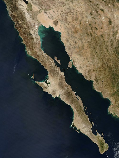
Baja California peninsula
Videos
The Baja California peninsula is a peninsula in northwestern Mexico. It separates the Gulf of California from the Pacific Ocean. The peninsula extends from Mexicali, Baja California, in the north to Cabo San Lucas, Baja California Sur, in the south.

Isla Partida, which is part of the San Lorenzo Marine Archipelago National Park

Port of Cabo San Lucas

Baja California as seen in April 1984, from the bay of a Space Shuttle (STS-41-C)